History happens. All stories, especially the difficult ones, need to be heard. Award winning author, a public historian, professional genealogist, and International speaker. Member of the Missouri Speakers Bureau and the National Underground Railroad Network to Freedom.
News of the Portage des Sioux treaties sent a message to residents of eastern states; it was now safe to emigrate and homestead in the Missouri Territory. From 1816 to 1820 settlers “camelike an avalanche” wrote missionary John Mason Peck. “It seemed as though Kentucky and Tennessee were breaking up and moving to the Far West.” The treaties also had political ramifications. Missouri filed for statehood in 1820 and William Clark failed in his election bid to become the new state’s first governor. Voters viewed him as being “too soft” on the Indians at Portage des Sioux. Jefferson’s plan of coercion through commerce had worked, though not exactly as he envisioned it. The treaty of Portage des Sioux reaffirmed the process of depriving the Osage of their land and it opened the door for a flood of settlers who rapidly filled the old Osage domain and clamored for more. At the beginning of 1808 the Osage dominated nearly 1/8th of the Louisiana Territory but in just 17 years, they were left with a reservation only 50 miles wide and 150 miles long in southern Kansas. The Treaty of Portage des Sioux which meant peace to the United States only added to the change and turmoil being experienced by the Osage Nation.
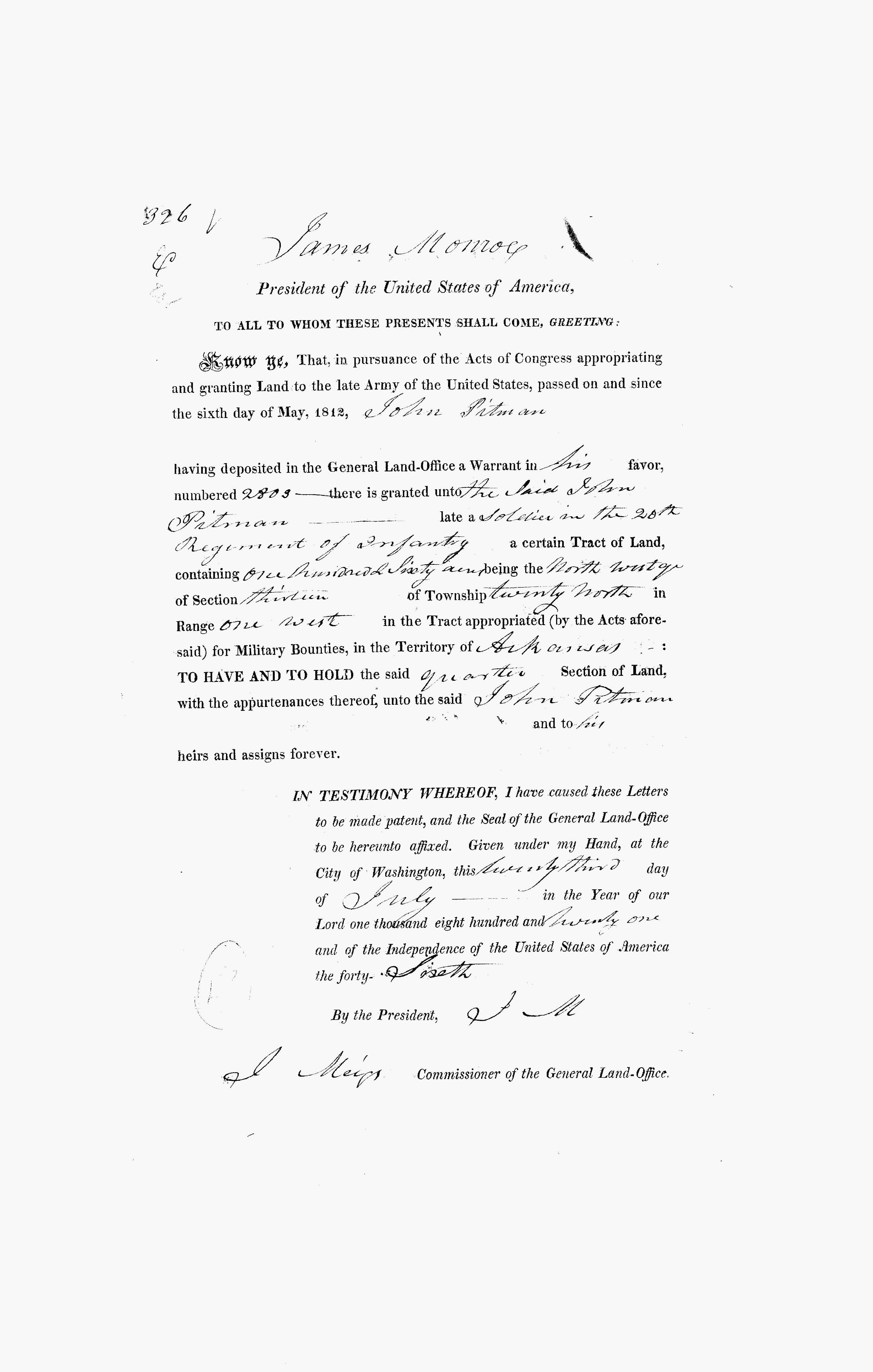
In 1816, John Pitman (1753-1839) and his neighbors would file a Petition, asking the Government to assign a surveyor to lay out a road to the most western edge of U.S. settlement at that time, called the Booneslick. That road would become today’s Boone’s Lick Road. In 1816, roads were named by where they were headed! As this old Buffalo trace, turned into a trail, it was because the population was growing. Veterans of the Revolutionary War, like Pitman, had been awarded Land Grants for their service. Pitman had moved to Missouri by 1816, bringing many of his family and his relatives with him. His brother Thomas Pitman (1750-1825) had settled at Howell’s Prairie, near the Missouri River.
Pitman’s Land Warrant was issued for land in the Arkansas Territory in 1821, but he had already moved his family to Missouri by that time. He sold that land warrant to a relative, using it to enlarge his amount of property here in St. Charles County. But in 1816, he was one of a growing number of St. Charles County residents that realized that the Territory was growing, and that good roads were important. And just like James Morrison on St. Charles’ Main Street, who owned the Bryan and Rose Salt lick at the other end of the Boone’s Lick Road, Pitman wanted to make sure that his land would be on “the big road” as it was often referred to at that time.
In 1818, U.S. Land Sales Offices had opened an begun selling land using the Public Land Survey System of a Section Range and Township, which Thomas Jefferson had encountered in France. When the U.S. purchased the Louisiana Territory from France in 1804, it didn’t come with any records of who owned what land already. Besides sending out the explorers Lewis and Clark, surveyors were needed to lay out these grids. With the War of 1812, that process would be interrupted. After the treaties, work would begin anew by surveyors. However, the U.S Land Office was also involved at the same time, in identifying who already owned what land. Early settlers like Daniel Boone, Warren Cottle and Jacob Zumwalt had already purchased land prior to 1804. These early land grants from the Spanish were called into question and they had to prove to the new government that they truly owned the property. There was also a lot of land speculation and those that tried to claim land that they didn’t actually owned. And there were those who didn’t own land, but had simply “squatted” on a parcel calling it theirs.
This was a difficult time, as we were just a Territory, and with little representation in D.C., and thoughts of Statehood were beginning. The demographics were changing as well, as the fur traders were giving way to those coming from the states of Virginia, Kentucky, and Tennessee buying up huge swaths of cheap land and bringing their cheap labor force, the enslaved, with them.
Land Warrant for John Pitman for his service in the Revolutionary War.
RESOURCES
For More about Missouri’s Land Sales and where to obtain records see the Missouri Secretary of State Archives website:
Follow links within our blogs and they will take you to previous posts that have more information. Or you can use the Search function below to search categories, tags, or previous posts.
Written by Michael Dickey – Former Site Director, Arrow Rock State Historic Site, Missouri Department of Natural Resources for the Program: April 25, 2015 Conflicted Perspectives Symposium, St. Charles County College and the Peace and Friendship Commemoration on September 15, 2015.
President James Madison appointed William Clark, Illinois Territorial Governor Ninian Edwards and U.S. Indian Agent Auguste Chouteau as Indian Peace Commissioners and they were convened from May 11 through September 28. They were appropriated $20,000 in trade goods to use as presents for the Indians.[19]
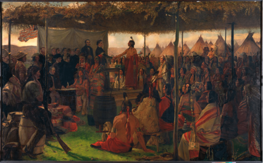
They invited about 19 western tribes (some were actually bands of tribes) to meet and council at Portage des Sioux. This location was convenient to the tribes on the Missouri, upper Mississippi and Illinois Rivers, and it was far enough from St. Louis and St. Charles so as not to impact the daily activity of the citizenry. Fort Belle Fontaine was only a few miles away and its 275 troops were deployed to the treaty grounds. In early July about 2,000 Indians began gathering at the site. Leaders the pro-British faction of the Sac & Fox did not show up. Leaders of a dozen tribes signed the treaty but others such as the Menominee and Winnebago did not until the following year. Even though the Osage had not fought against the United States they were compelled to affirm their loyalty and re-affirm the treaty of 1808. Eleven chiefs of the Big Osage, one Arkansas Osage chief, eleven Little Osage chiefs and one chief of the Missourias attached to the Little Osage signed the peace treaty on September 12, 1815 which followed a short, simple template:
A treaty of peace and friendship, made and concluded between William Clark, Ninian Edwards, and Auguste Chouteau, Commissioners Plenipotentiary of the United States of America…of the one part; and the undersigned King, Chiefs, and Warriors, of the Great and Little Osage Tribes or Nations…of the other part.
THE parties being desirous of re-establishing peace and friendship between the United States and the said tribes or nations, and of being placed in all things, and in every respect, on the same footing upon which they stood before the war, have agreed to the following articles:
ARTICLE 1. Every injury, or act of hostility, by one or either of the contracting parties against the other, shall be mutually forgiven and forgot.
ARTICLE 2. There shall be perpetual peace and friendship between all the citizens of the United States of America and all the individuals composing the said Osage tribes or nations.
ARTICLE 3. The contracting parties, in the sincerity of mutual friendship recognize, re-establish, and confirm, all and every treaty, contract, and agreement, heretofore concluded between the United States and the said Osage tribes or nations.[20]
At first glance, the wording of the treaty seems harmless enough. No land cessions were required and annuities were not withheld as punishment for any damages attributed to individual Osages during the war. However, the Osages did not regain “the same footing upon which they stood before the war.” Fort Osage reopened that fall, but they did not relocate there. The war had changed the climate of the nation. News of the Portage des Sioux treaties sent a message to residents of eastern states; it was now safe to emigrate and homestead in the Missouri Territory. From 1816 to 1820 settlers “camelike an avalanche” wrote missionary John Mason Peck. “It seemed as though Kentucky and Tennessee were breaking up and moving to the Far West.”[21] The treaties also had political ramifications. Missouri filed for statehood in 1820 and William Clark failed in his election bid to become the new state’s first governor. Voters viewed him as being “too soft” on the Indians at Portage des Sioux.[22] Missourians it seems, were not willing to “forgive and forget” as the treaty had stipulated. The Shawnee, Delaware, Kickapoo, Peoria and Cherokees were assigned to reservations abutting the Osage boundary and they frequently hunted on the Osage side of the line. Pressured by the growing settlements of whites and dispossessed eastern tribes, some Big and Little Osage as early as 1808 began joining their Arkansas kinsmen or relocating to southeast Kansas. After 1815 the departures accelerated. The last group of Big Osage remaining in Missouri abandoned their village in the summer of 1822.[23] On June 2 of 1825, the Osage signed a treaty at St. Louis, by which they ceded the remainder of their territory in Missouri, Arkansas, Oklahoma and much of Kansas[24]
Jefferson’s plan of coercion through commerce had worked, though not exactly as he envisioned it. The treaty of Portage des Sioux reaffirmed the process of depriving the Osage of their land and it opened the door for a flood of settlers who rapidly filled the old Osage domain and clamored for more. At the beginning of 1808 the Osage dominated nearly 1/8th of the Louisiana Territory but in just 17 years, they were left with a reservation only 50 miles wide and 150 miles long in southern Kansas. The Treaty of Portage des Sioux which meant peace to the United States only added to the change and turmoil being experienced by the Osage Nation.
Endnotes
[19] March, David. The History of Missouri Vol. I. Lewis Historical Publishing Co. New York 1967, p. 303
[21] Babcock, Rufus, ed. Forty Years of Pioneer Life Memoir of John Mason Peck D.D. Carbondale and Edwardsville: Southern Illinois University Press, 1965 p. 146
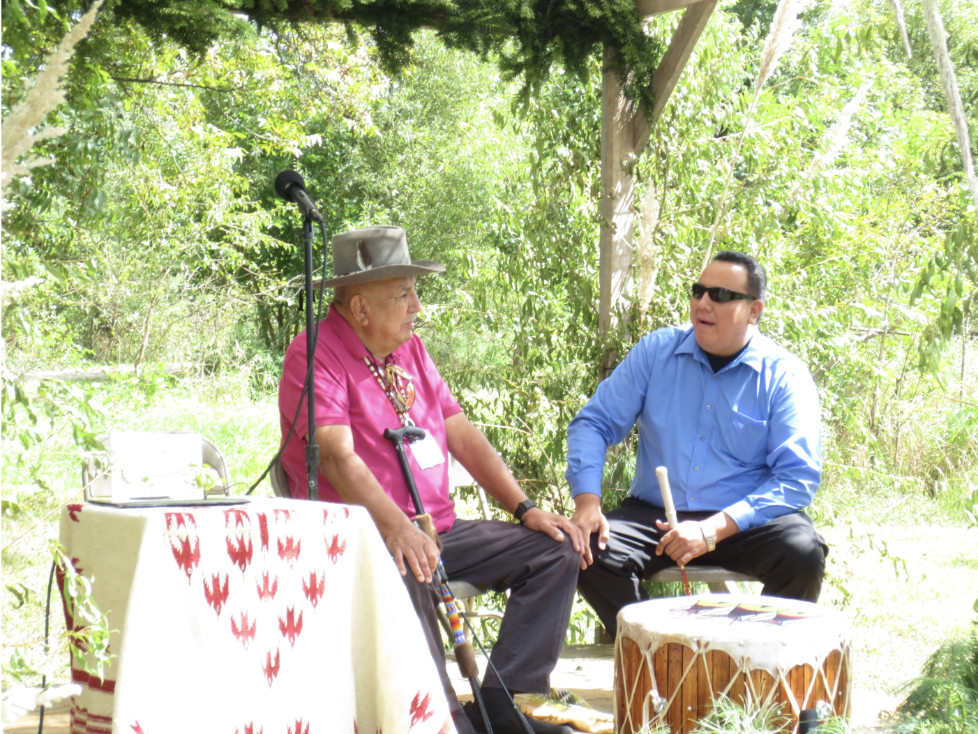
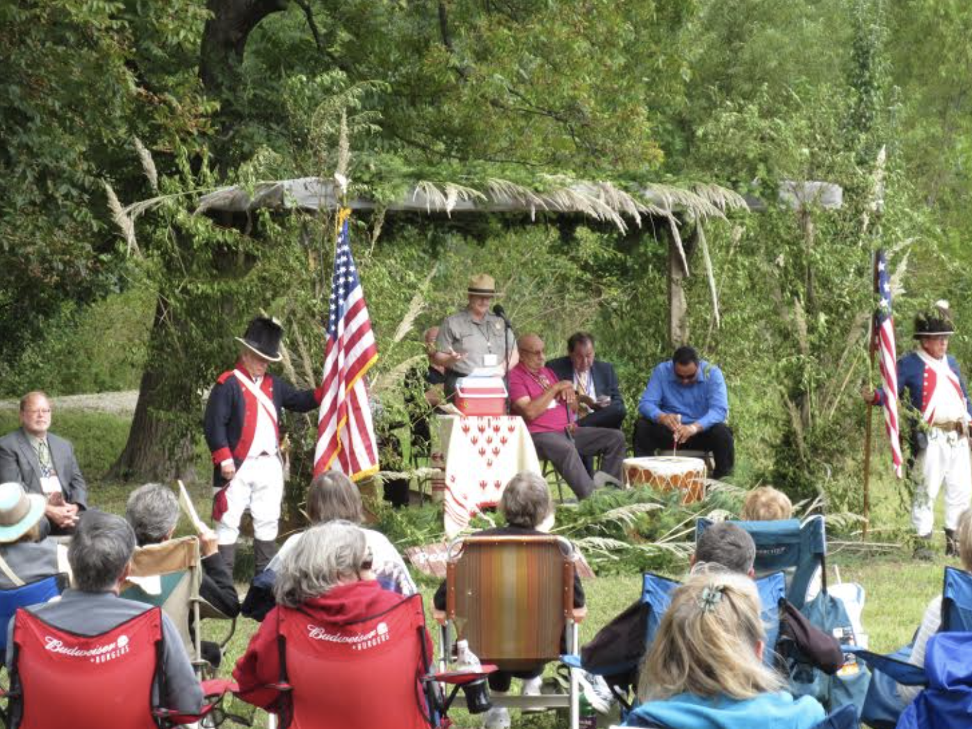
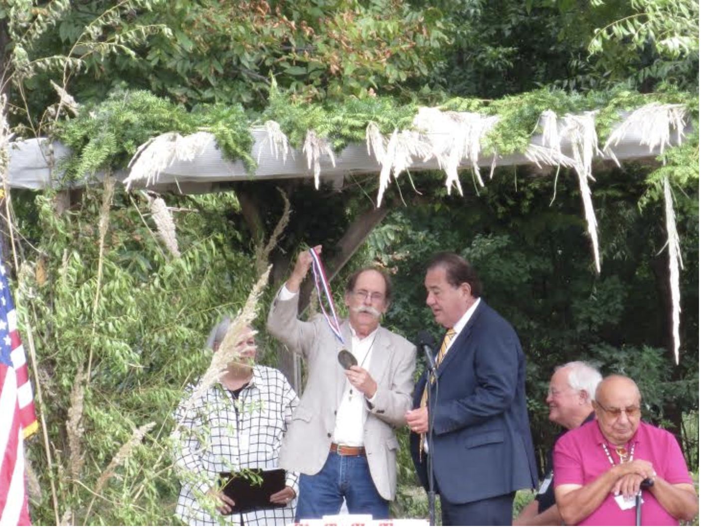
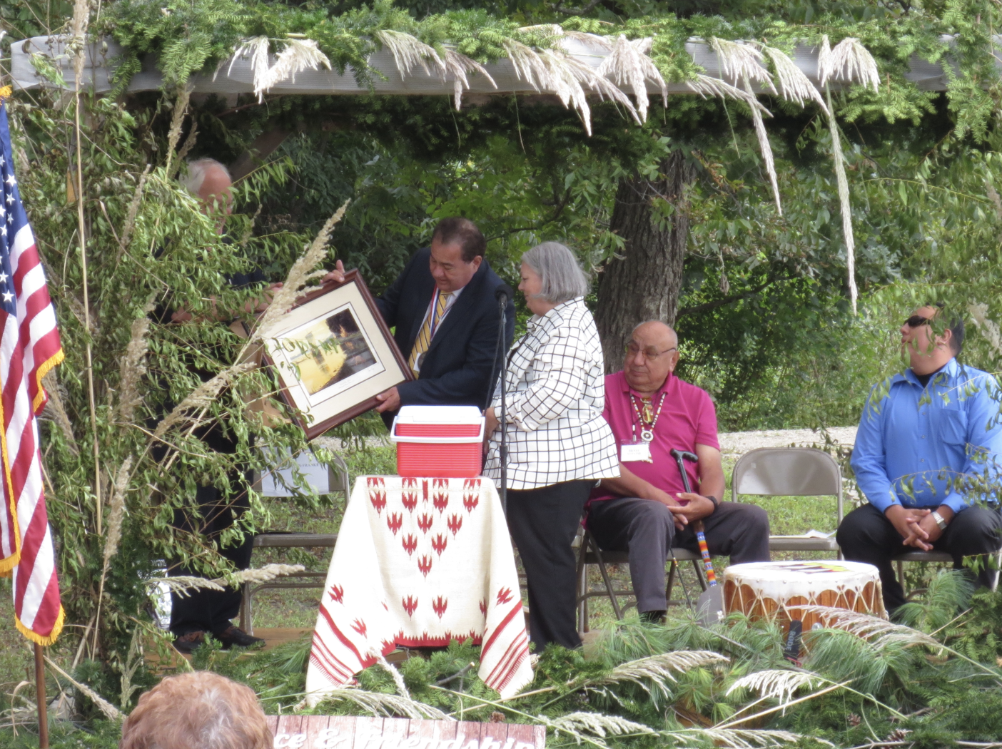
On September 15, 2015, the Commemoration of the Peace and Friendship Treaties took place at the same location as the original signing, Portage des Sioux in St. Charles County. Present were St Charles County Executive Steve Ehlmann, Osage Nation’s Chief Standing Bear, and William Clark’s descendant Bud Clark.
Drum of the Osage NationSeptember 15, 2015Dorris Keeven-Franke, Bud Clark, Chief Standing BearL-R Steve Ehlmann, Chief Standing Bear, Dorris Keeven-Franke
By Michael Dickey – Former Site Director, Arrow Rock State Historic Site, Missouri Department of Natural Resources for a Program: April 25, 2015 Conflicted Perspectives Symposium, St. Charles County College
The War Department in 1808 instituted the factory system to implement Jefferson’s vision. Factories were government fur trading posts that competed directly with private traders in an effort to pacify and control Indians. A military garrison was assigned to protect each factory. Meriwether Lewis proposed that the factory for the Osage be located on the Missouri River as travel on the Osage River was often limited due to low water conditions.[9] In August of 1808 a keelboat under the command of Captain Eli B. Clemson of the 1st U.S. Infantry set out up the Missouri River from Fort Belle Fontaine near St. Louis, followed a short time later by William Clark and Nathan Boone’s overland march of mounted dragoons from St. Charles.[10] The troops rendezvoused at the “Fire Prairie” several miles east of present–day Independence Missouri. There they began construction of Fort Osage, sometimes identified as Fort Clark.
Clark sent Boone and an interpreter out to bring the Osages in to council. Clark employed a carrot-and-stick strategy, threatening war on the Osage but promising that all would be forgiven and they would have their own very trading post if they became American friends. Clark also promised them protection from their enemies.
What pleased most was the idea I suggested that it was better that they should be on the lands of the U.S. where they Could Hunt without the fear of other Indians attacking…than being in continual dread of all the eastern Tribes whom they knew wished to destroy them & possess their Country.[11]
The Osage accepted Clark’s proposal and signed a treaty on September 14. Clark informed Secretary of War Henry Dearborn of the price they paid and what they got in return:
near 50,000 Square Miles of excellent Country – for which I have promised the Osage protection under the guns of the Fort at Fire prairie, to keep a Store at that place to trade with them, to furnish them with a Blacksmith, a Mill, Plows, to build them two houses of logs and to pay for the Horses and property they have taken from the Citizens of the U. States.”[12]
Later a group of 75 Osages arrived in St. Louis returning some stolen horses. They said the treaty was invalid because they had not been present at the signing. They also said that White Hair was a “government chief” who had no authority to make binding agreements for the tribe. Thus, the treaty of 1808 exacerbated existing political dissension in the tribe. The Osages had dealt with the French, British and Spanish for over 100 years on their own terms, sometimes playing them against each other to their own advantage. The French were gone, the Spanish in New Mexico had nothing to trade and the British were too distant to easily trade with. So the Osage could really only deal with the United States and were not able to do so from a position of political unity.
Governor Lewis revised the treaty and Pierre Chouteau was dispatched to Fort Osage to persuade the Osages to sign it. Most of the Big and Little Osage had relocated to the fort. Chouteau had to distribute more gifts and promise an early dispersal of the annuity payments to get them to sign. In the original treaty, a line was drawn straight south from Fort Osage to the Arkansas River and everything east of that boundary to the Mississippi River was ceded. The revised treaty required that they cede an additional 20 million acres of land north of the Missouri River, territory that was also claimed by the Ioway and Sac & Fox nations. However, the government did not consult with those nations about the cession.
The Big Osage became displeased with their new residence and returned to their old towns on the Osage River in 1810. In 1811, war clouds gathered on the frontier as the Shawnee chief Tecumseh built a confederacy of Indian tribes and the British were perceived as inciting the Indians to make war on the United States. The Osage refused Tecumseh’s overtures to join as many tribes in the confederacy were their hereditary enemies. Plus, they weren’t willing to jeopardize the trade at Fort Osage. The British however were reaching out to western tribes to trade in an effort solidify Indian unity. The Osage as U.S. clients and the Ioway as British clients became engaged in a proxy war, receiving tacit support from their sponsors in their raids against each other. After the United States declared war on Great Britain on June 18, 1812, the Little Osage chiefs promised George C. Sibley the fort’s factor (trader), “never to desert their American father as long as he was faithful to them.”[13]
In May of 1813 Frederick Bates, acting Governor of Missouri Territory sought volunteers to defend the Missouri frontier from the pro-British Sac and Fox nation on the Rock River of Illinois. Pierre Chouteau secured 275 first-line Osage warriors for the task. When Governor Benjamin Howard returned from Kentucky he canceled the planned attack, which angered Chouteau and the Osages. Howard and territorial delegate Edward Hempstead distrusted and feared any group of armed Indians roaming the countryside, even though they were allies. Hempstead feared the Osage would change sides at the first opportunity and attack the Missouri settlements. [14]
Fort Osage was closed in June of 1813 as being useless to the defense of the frontier. The U.S. still needed to maintain Osage loyalty so Sibley relocated the factory to the Arrow Rock bluff that October. Gray Bird of the Big Osage liked the Arrow Rock location “on account of the Settlements of Americans near it which I think afford us more security when we come to trade.”[15] Gray Bird obviously saw the Boonslick settlement as a buffer between them and their enemies, the Sac & Fox, Potawatomi and Ioway. However, Big Soldier of the Little Osage disagreed with the move:
I was lately on a visit to the Great American Chief. He told me that Ft. Clark should be made stronger than ever, that he would plant an iron post there that could not be pulled up and that would never decay. I fear he has forgotten that promise and instead of planting an iron post intends to let the old wooden one rot. The Trading House is not for nothing. We have given our Sons for it and I tell you plainly I think the President has done very wrong to remove it at all…[16]
The Osage leaders clearly had a higher degree of sophistication and understanding of events going on around them than they are usually given credit for. However dependence on American trade and political disunity in the tribe made it ever more difficult for them to control those events. Despite the Little Osage objections, trade continued at Arrow Rock until April of 1814 when the post was abandoned due to troubling events. Sac & Fox raids in the Missouri valley began increasing. Osage leaders met in council with a faction of the Sac & Fox who been relocated to the Missouri River by Clark the previous September. A Sac chief named Quashquame raised a British Union Jack over the council house, alarming factor John Johnson. [17] Osages robbed trappers on the Gasconade River and killed some hunters on the White River. Some Little Osages traveled to Prairie du Chien, Wisconsin the base of British operations in the Mississippi valley where they received presents. Despite these incidents, the Osage nation did not commit to the British side although Clark on August 14 reported that the British were “making great exertions to gain over the Osages…”[18] Sibley’s operation at Arrow Rock had helped maintain Osage loyalty at a critical juncture as did the influence of Auguste and Pierre Chouteau, who were married into the Big Osage tribe.
Great Britain and the United States signed a peace accord on December 24, 1814 in Ghent, Belgium. Congress ratified the treaty on February 28, 1815 officially ending the War of 1812. However, no provisions were made for the Indian nations involved and peace had to be negotiated separately with each tribe. President James Madison appointed William Clark, Illinois Territorial Governor Ninian Edwards and U.S. Indian Agent Auguste Chouteau as Indian Peace Commissioners and they were convened from May 11 through September 28. They were appropriated $20,000 in trade goods to use as presents for the Indians.[19]
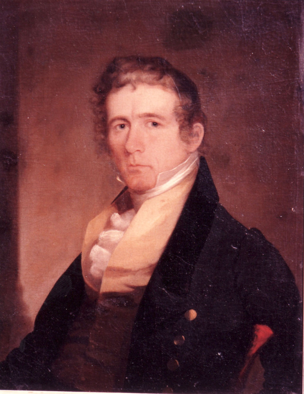
George Sibley 1782-1863
Endnotes
[9] Clarence E. Carter, Ed., The Territorial Papers of the United States, vol. 14, Louisiana and Missouri Territory 1806-1814 (Washington, D.C.: U.S. Government Printing Office, 1934-1962) p. 196


You must be logged in to post a comment.