ST. CHARLES COUNTY HISTORY

By Dorris Keeven-Franke

  • Dardenne Prairie

    By 1821, Missouri had become a State, and St. Charles County had established “Dardenne” as a Township. As settlers established themselves along the Boone’s Lick Road, there were no “official” towns, but your Post Office was your address. Mail was sent there, and you visited the Postmaster to pay for and retrieve your mail. If not picked up, then your name was listed in the local newspaper letting you know that you need to make a trip to “town” which was usually the mill or General Store as well. Many towns were first established by what the name of the Post Office – quite often his name – or the Railroad Station. Railroads did not begin until 1850s, and the Station Master was automatically the designated Postmaster as well. The word Dardenne is said to be French in origin and given to both the prairie and the creek, but there is no translation for its meaning. Some say a man by that name first lived there, but that too is lost in history. When Census takers would visit, up until 1980 they simply listed the Township as there was not an actual town incorporated by that name until 1983 or a City until 2001. Today it is one of the fastest growing areas in our county, having a population of 13,803 in 2023.

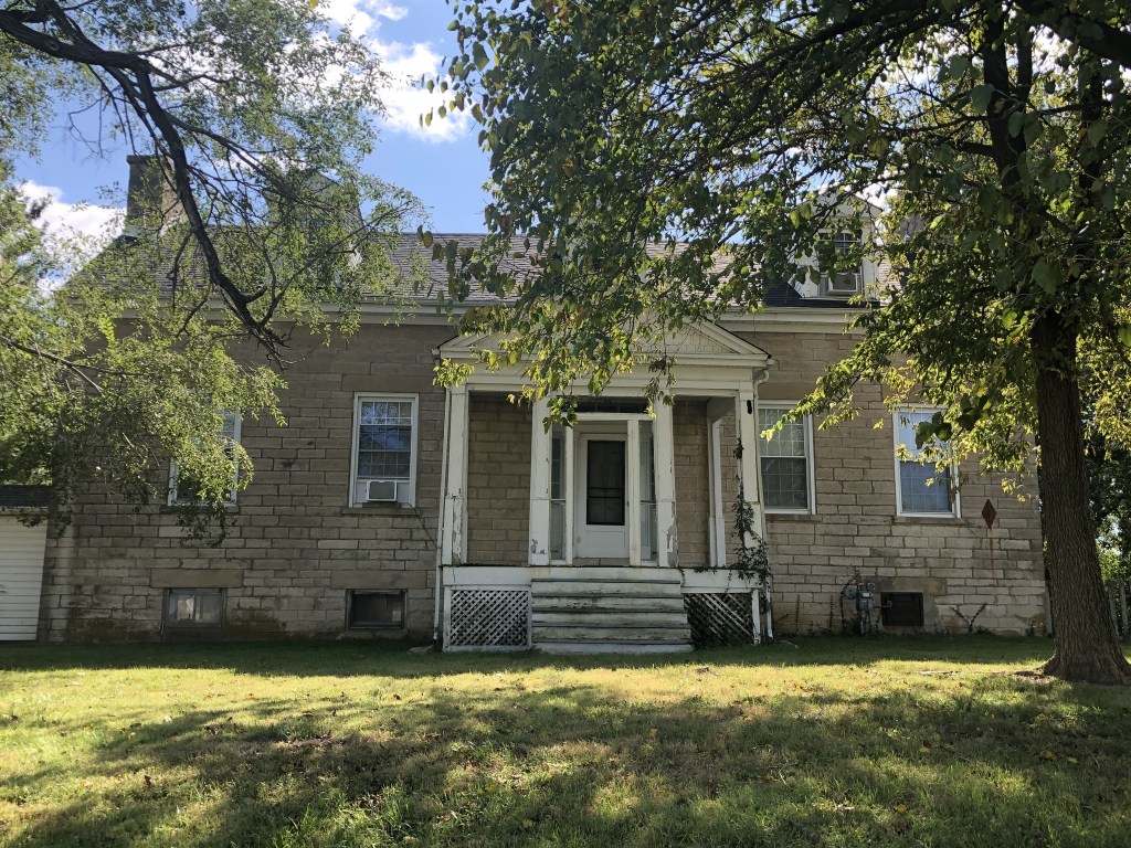
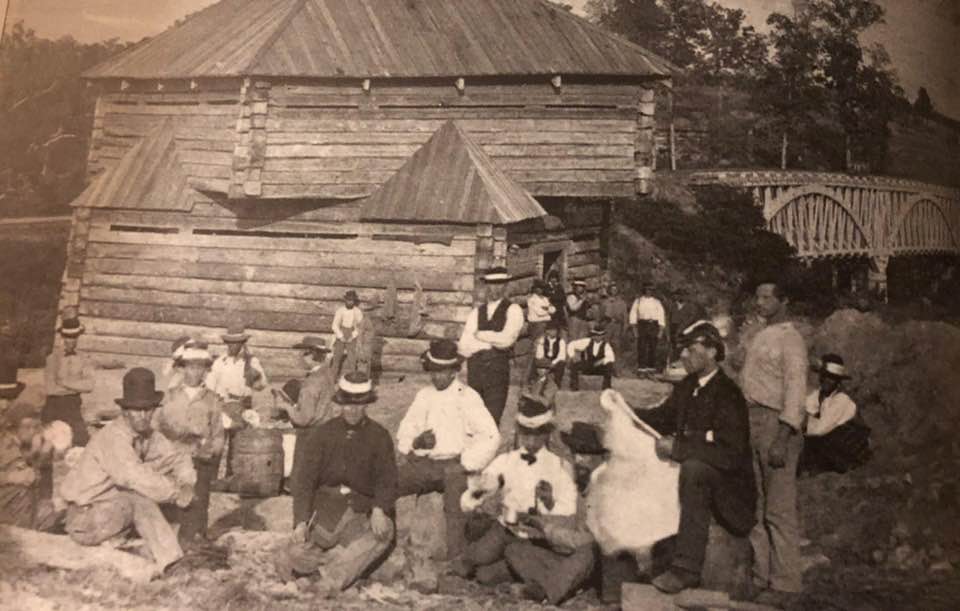
    Further west along the Boone’s Lick Road, past Alexander’s or Captain Campbell’s house, we would have found the mill of John Gill, who came from Kentucky to Missouri in 1811. He originally worked as a carpenter, in St. Louis, before returning to Kentucky and marrying there. He returned to Missouri and established a home, tavern and a large Grist Mill on the Boone’s Lick Road by 1822. Soon had established two large farms, which he managed with his sons and enslaved. At the outbreak of the Civil War, he gave each of his sons an enslaved man. As the only mill in the area, he was quite prosperous, and popular. *[1]

    Gill House and the Mill’s Millstones were located on the south side of Highway N, 0.6 miles west of Highway K. The mill stones were first purchased from the Dickherber family for marking the Boone’s Lick Road in 1913. At some point the stones were removed and stored at the Howell school. Then Mr. and Mrs. N.H. Loeffler purchased them, and on Septemer 24, 1959, and they were placed on the property and dedicated. Then in about 2012, during the Highway 364 road construction they were once again removed. They were the only mill stones used by the DAR along the entire route. The DAR marker for the Gill Mill is no longer found on the Boone’s Lick Road.

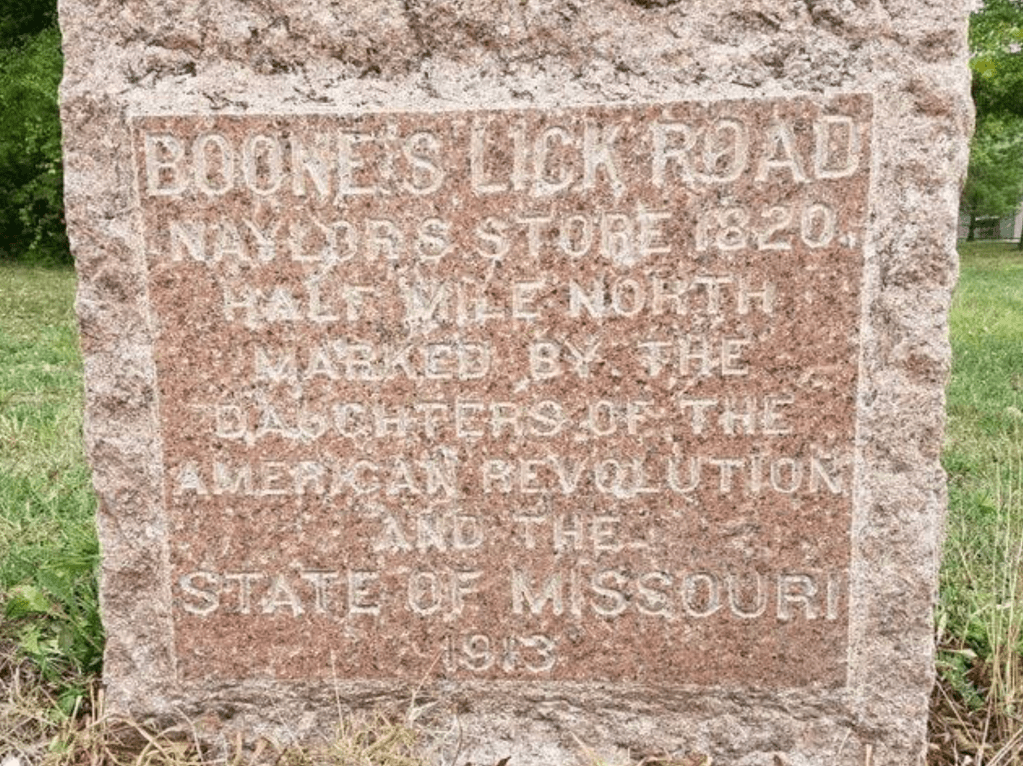
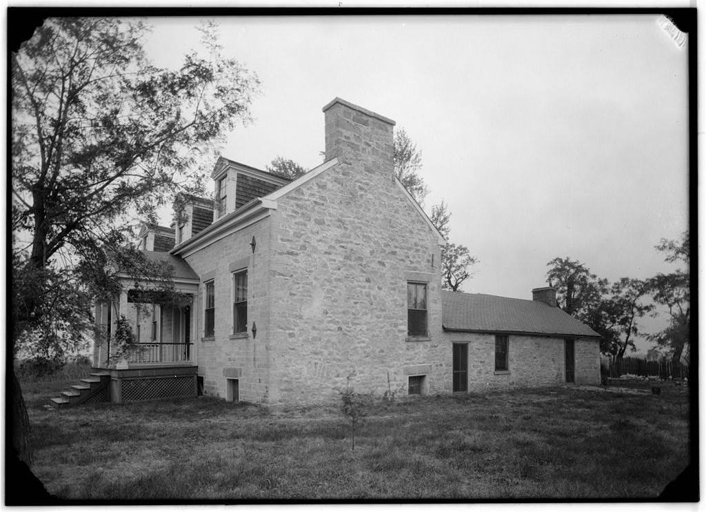
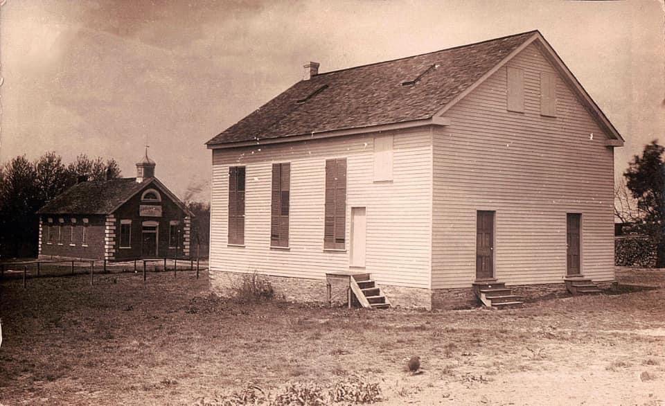
    Naylor Store. [7767 Highway N, O’Fallon, MO 63368, USA no longer standing]

    Just past Gill’s mill was the house of John Naylor, where the Dardenne Presbyterian Church first met in 1819. It soon became a Stagecoach and Postal stop, in his Mercantile.  Today it is the location of the City of Dardenne Prairie. The road originally curved off to the north to the store, before returning to Hwy N, up until the 1860s. The Dardenne Presbyterian Church’s first church building was first located on the south side of Dardenne Creek (in what is today’s Weldon Spring Government Reserve) but was burned during the Civil War. The beautiful new stone Church that was built after the Civil War can still be seen today as Hwy N, mixes with and crosses Interstate 364.  

    Naylor’s Store, on the Dardenne Prairie, was a stage stop in the 1820’s. John Naylor was an influential citizen in the area who helped to found the town of Dardenne. He and his wife helped start the Dardenne Presbyterian Church in 1818. The marker is located on the north side of Highway N, 3.2 miles west of Highways K and N intersection.
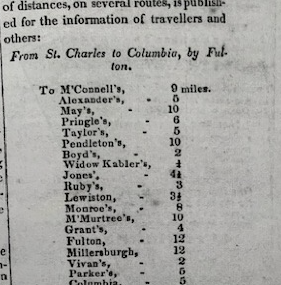
    “John Melish published the route and distances from St. Charles to Franklin in his The Traveller’s Directory Through the United States[i]: . . . in 1822. In this publication, Melish listed hundreds of routes between various cities and towns in the United States, including the road from St. Charles to Franklin. While this work was published in 1822, analysis shows that the effective date was probably 1820. Melish describes the route from St. Charles to Franklin thus: Beginning at St. Charles; 12 miles to Dardenne; 8 miles to Pond Fort; … His total mileage from St. Charles to Franklin is 151. Another great contemporary description of the alpha route comes from Lewis Beck’s 1823 Gazetteer which listed the stage route from St. Louis to Fort Osage. Peters concludes that the effective date of this route is 1821 or 1822, just a year or two later than the Melish data.  With Beck, we begin at St. Charles; then 9 miles to Coonts; 12 miles to Pond Fort;”

    Postal records shows that the route included Naylor’s Store from 1827-1840 and 1841-1868. This is the same location of Campbell’s 1873 Atlas of New Missouri for Dalhoff Post Office, on land purchased by John Naylor in Section 2, of Township 46, Range Two East.


    NOTES


    [i] Melish, John. The Traveller’s Directory Through the United States: . . . John Melish: Philadelphia, 1822. 3 Peters, “Path of Land-Rush Traffic Across Boone and Callaway Counties,” Genealogical Society of Central Missouri Reporter Quarterly, vol. 13, no. 2 (Summer, 1994): 39. 4

    Subscribe to the St. Charles County History Blog by Dorris Keeven-Franke -its free.

    For more about the Boone’s Lick Road – see https://booneslickroad.org/

  • Captain Campbell’s Ice House

    In October of 1829, four families from Rockbridge County Virginia, would come to settle on Dardenne Prairie with over two dozen enslaved people. They had left in August, and would be led by a young attorney named William Campbell (1805-1849) whose journal stated

    In his journal, he tells the story

    Archer Alexander’s descendants through Wesley Alexander – Photo by Dorris Keeven-Franke

    William Campbell’s cousin, James H. Alexander (1789-1835), purchases land in St. Charles County, near today’s intersection of Hwy K and Hwy N – which is the Boone’s Lick Road. He chose this location on purpose because of the road, and it being a major thouroughfare. His enslaved are put to work following the instructions of professional stone masons that have come from Ireland. When the house is complete, James Alexander applies to be postmaster and establishes his house as a stagecoach stop on the Boone’s Lick Road!

    Missouri Intelligencer and Boone’s Lick Advertiser, July 18, 1835

    However, as fate would have it, Cholera is sweeping the countryside, and on the 4th of September, 1835 James Alexander dies leaving four children, ages 13, 11, 9 and seven years old behind. They are sent back to Virginia to live with relatives who will be their Guardians. Alexander’s will states that his plantation and his enslaved are not to be sold, and to be leased out and all the profits used for the benefits of his children.

    Union Fort at Peruque Creek with Home Guards

    Sources: The Campbell Journal from the Rockbridge Historical Society, and the Washington and Lee University in Lexington, Virginia.

    Probate files from the Missouri State Archives

    SUBSCRIBE TO THE FREE BLOG STCHARLESCOUNTYHISTORY.ORG BY DORRIS KEEVEN-FRANKE AND RECEIVE A DAILY DOSE OF HISTORY

  • Pitman’s

    On Cottleville’s Chestnut Street sits a large two-and-one-half story frame building that once served its’ Methodist Episcopal South congregation. By 1810, John Pitman, a veteran of the Revolutionary War had come to Missouri from Kentucky, settling just to the south of the Cottle family. Portions of his huge estate would provide two additions to the town of Cottleville. John Pitman was owner of a large amount of enslaved property. He had been born in what was Bedford County Virginia in 1757. In 1776, Kentucky would become a County of Virginia, and eventually a state in 1792. By 1800, we find Pitman paying taxes on that property in Kentucky. However, many early Missouri settlers were like Pitman, and had received payment for their service in the Continental Congress during the Revolutionary War in the form of a Land Warrant, in the newly acquired Louisiana Territory. In February of 1805, John married Magdelene Irvine, and their son David Kyle Pitman was born that December.

    John Pitman (1753-1839) was the son of Thomas Pitman, who had come to the Missouri Territory by 1816, with several of his relatives. Some would settle as far west as what became Montgomery County (later Warren County) and some south of him along the Missouri River, near Howell’s Island. He purchased the earlier land grant of Hoffman, and began building what would become the largest plantations in St. Charles County and on the Boone’s Lick Road.

    The hostilities with the Native Americans had ended with the Peace and Friendship Treaties at nearby Portage des Sioux in September of 1815. And by 1816, John Pitman and his neighbors would ask the Missouri Territorial Government to establish a road to the Boone’s Lick settlement where the Bryan and Morrison saltworks was, near Franklin in Howard County. 

    Territory of Missouri  )

    County of St. Charles )

    Circuit Court  )

                            ) 1816

    April Term)

    John Pitman – filed a petition signed by twelve householders & upwards  – of the County of St. Charles, praying that a road maybe laid from from (sic) the Town of St. Charles, In the direction to Boones lick Settlement, until it strikes the line of Howard County.

                Where upon the Court appont John Gibson, Hugh McDermid, James Kennedy, Samuel Lewis & Joseph Yeardley, House holders of said County as commissioners to view & mark out said Road – The nearest & most practicable route – and to the Greatest ease & convenience to the inhabitants and as little as may be to the prejudice of individuals and make return there of  – to the Court at the next Term. According to the State in Such case made and provided.

    County of St. Charles vis Circuit Court July Term 1816. John Gibson, Hugh McDermid, James Kennedy, Samuel Lewis & Joseph Yeardly, being appointed commissioners, at the last Term of this court to view and mark out a road from the Town of Saint Charles with direction to Boones lick Settlements until it strike the line of Howard Countyand that return should be made to thy Term of the Court, It appearing to the Court that notice has been served on said commissioners – They ordered that the said Commisioners view and mark out a road is aforesaid and make return there of – to the next Term of they Court, And that Notice be given then respectively, by the Sheriff of thy Order.

                                                                                        A True Copy, attest.

                                                                                        Wm. Christy Clk.Ct., Cit of St. Charles[i]

    Pitmans Addition to Cottleville

    The Methodist religion had come to Missouri with the preachings of John Clark in 1816. According to the Methodist Archives at Central Methodist University in Fayette “In 1844 when the Methodist Episcopal Church separated into the MEC and the MEC, South, Missouri officially went South. Both churches operated in Missouri, many times side-by-side in the same town“. By 1854, John Pitman’s son David, and his son Richard would join with others to build a frame church building at the cost of $1,600. Other founding members were William C. Ellis, S. R. Watts, and James T. Sanford.They would start out with 20 members.[ii]

    Southern Methodist Church with Public School in back

    When John Pitman passed away, his youngest son David Kyle Pitman (1805-1891) and his grandson Richard Hickman Pitman (1830-1893) would inherit his home and much of his enslaved property. The Pitman home was built by the enslaved on the west side of Cottleville along the Boone’s Lick Road, with the family cemetery on the opposite side of the home. On July 3rd, 1856, David Kyle Pitman would record his plat of an addition to the town of Cottleville.

    David Kyle Pitman’s property stretched from Cottleville, up to James Alexander’s further west on the Boone’s Lick Road. David Pitman was one of St. Charles County’s largest enslavers in 1860 with over 35 people living in homes behind his home on the Boone’s Lick Road. By that time, David’s son Richard had married and also lived on the Pitman farm, and had ten more enslaved people of his own. John Pitman’s son David Pitman had gifted Archer Alexander (1806-1880) to his son Richard Hickman Pitman in 1859During the Civil War in 1863, his son Richard Pitman was a Confederate sympathizer and involved in treasonous activity, and because of this his enslaved man named Archer Alexander would be given his freedom.[iii]

    IT WAS 12 MILES FROM ST. CHARLES TO PITTMANS (COTTLEVILLE) BY STAGECOACH IN THE LATE 1830s AND A FULL DAY’S JOURNEY. Today you can leave Berthold Park on Main Street and go south to the Boone’s Lick Road where you make a right turn and proceed west for one mile. At First Capitol (Hwy 94) you proceed west (left) on Hwy 94 to the Mid Rivers Exit, go west to Hwy N, where you make a left turn. You stay on Hwy N – which is the Boone’s Lick Road, as you pass Cottleville, to Pitman’s. This takes less than one hour in 2025.


    [i] U.S. Circuit Court, Territory of Missouri, County of St. Charles, Book A, Box 15, File 38, April 1816

    [ii] Dorris Keeven-Franke, Cottleville Legacy  https://cottleville.org/

    [iii] Dorris Keeven-Franke, The True Story of Archer Alexander, https://archeralexander.blog/

    SUBSCRIBE TO STCHARLESCOUNTYHISTORY.ORG (FREE) AND RECEIVE DAILY EMAILS BY DORRIS KEEVEN-FRANKE