ST. CHARLES COUNTY HISTORY

By Dorris Keeven-Franke

  • ST. CHARLES PREPARES FOR WAR

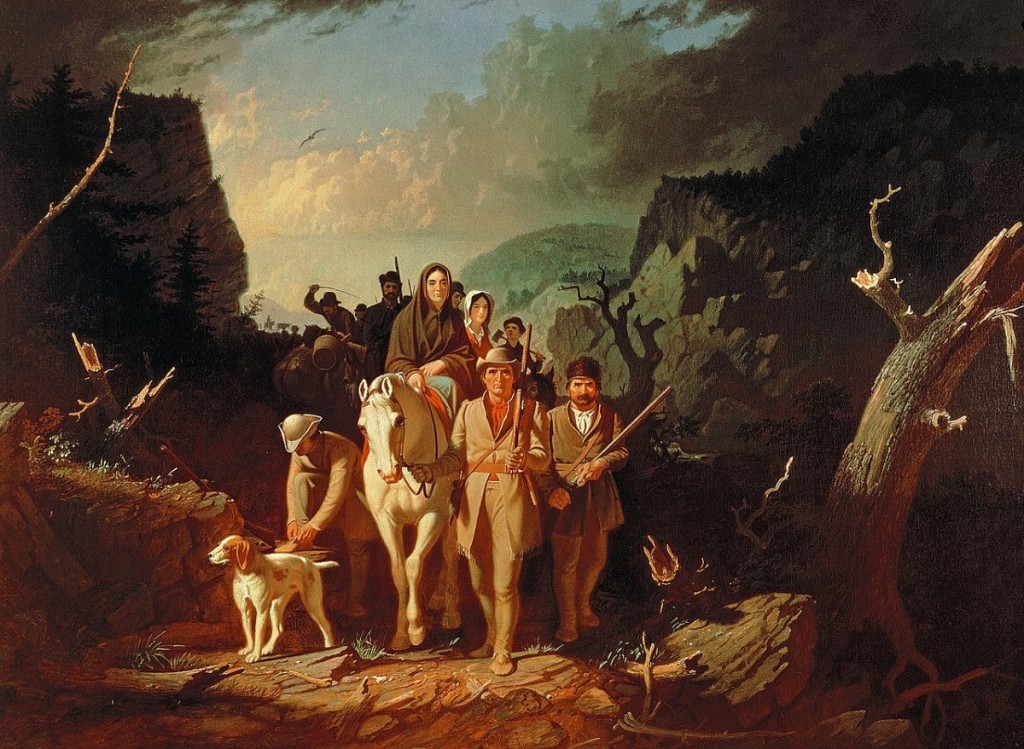
    George Gatty had settled west of Dardenne Creek, (near the Intersection of Mexico and Jungerman Roads) where he built a home that he quickly turned into a fort to protect his family and neighbors. His neighbor, William Becknell, would first join Daniel Morgan Boone’s company – the U.S. Mounted Rangers. Later, Daniel Morgan’s nephew James Callaway took command of them.  Becknell would join Capt.Callaway in Major Zachary Taylor’s campaign on the Sauk Indians, against the British, at the battle of Credit Island. Later Becknell would take command of Fort Clemson (a fort across from today’s Hermann Missouri) built by the Missouri Rangers on their way home from building Fort Osage. Becknell is considered the father of the Sante Fe Trail.

    Other settlements were soon “forting up,” such as the home of Isaac Van Bibber, an adopted son of Daniel and Rebecca Boone. The farm of John Pitman, which he’d purchased from George Huffman, and included land previously purchased from the Cottle family, near today’s Cottleville was forted up. Capt. James White settled his family on land west of the Mississippi, east of Peruque Creek, south of the Quivre River, along the Salt River trail, and established White’s Fort. Tiny settlements ranged across the entire Territory. Settlements from Femme Osage to La Charrette to Cote Sans Dessein (near today’s Jefferson City) dotted the Missouri riverbank, and would soon become local “forts”.

    The attacks increased. A newspaper report read:

    The family of Mr. Neal was killed in the district of St. Charles on the bank of the Mississippi by a party of unknown Indians; it was believed that the mischief was done by a party of Illinois … I saw the bodies, nine in number, principally females. “  Immediately after… Governor Howard sent orders to Col. Kibby, who commanded the St. Charles Militia to call out the portion of the men he had held in reserve, to march at a moments notice.”  These troops were waiting for just such a moment.

    On the 3rd of March in1812, Governor Howard acting on his own authority ordered  a company of mounted riflemen raised, for 3 months, all from the District of St. Charles to be put under the command of Capt. Nathan Boone. Then he sought authorization for his actions from the President Madison. In May, word came “that a Federal Commission has come for Nathan Boone, as Captain, for a company of Rangers to be raised for 12 months.” Many of those finishing their 3 months of service eagerly rejoined for another 12. George Huffman’s son, Peter, served in Nathan Boone’s Militia, which officially was called the St.Charles Mountain Men. They earned 75c a day when serving on foot, and $1 when mounted. Boone’s log book refers to them as “Minute men.”

    Back east, John Clopton, Congressman from Virginia stated:

    “The outrages in impressing American seamen exceed all manner of description. Indeed the whole system of aggression now is such that the real question between Great Britain and the U.S. has ceased to be a question merely relating to commerce… it is now clearly, positively, and directly a question of our Independence.”

  • ST. CHARLES TERRITORY IN 1808

     In 1808 General William Clark, asked for volunteers to accompany him and the Militia, under the command of Eli B. Clemson, to establish a fort and factory, Fort Osage, or Clark as referred to by some. They made 21 miles their first day, and camped near a chain of three small ponds, where Pond Fort would later be built.  In September they arrived at what would become the most western point of Military occupation by the U.S. Government and within the Territory of Saint Charles at that time. The site had been chosen by Lewis and Clark years before. Young George Sibley was appointed factor there, and the government hoped to further friendly Indian relations. (The route was what later became the Boone’s Lick Road.)

    There General William Clark began to negotiate a Treaty with the Osage, which would cede nearly 200 square miles of land between the Missouri and Arkansas River to the United States. Soon it was renegotiated, and on November 10th a Treaty negotiated by Auguste Choteau added “all claims to land north of the Missouri River” another 20 million acres, for an overall total of 50 million acres. Clark and Choteau thought with this Treaty would put an end to all of our Indian problems.

    But much more would be needed to co-exist with the Native Americans. KaKaGiChe, a Sauk warrior had killed a trader at Portage des Sioux, Antoine Le Page. Two Iowa braves, White Cloud and Mera Naute killed Joseph Thibault and Joseph Marechel. In November, Governor Lewis gave Orders for 370 men to organize, arm and equip for actual service, to be the militia of the Territory of Louisiana. Each officer of that detachment was ordered to furnish himself with a sword, uniform coat and hat; non-commissioned officers were to furnish themselves with a good rifle, tomahawk, scalping knife, horn and pouch, 24 rounds of ammunition, a blanket and a knapsack. All of this created a false sense of peace, while the threat of attack was just a half day’s ride from St. Charles. 

  • Bonhomme

    Tuesday, May 22, 1804 Journal entry of William Clark

    a Cloudy morning    Delay one hour for 4 french men who got liberty to return to arrange Some business they had forgotten in Town, at 6 oClock we proceeded on, passed Several Small farms on the bank, and a large creek on the Lbd. Side Called Bonom  [Bonhomme-A Good Man- French]   a Camp of Kickapoos on the St. Side    Those Indians told me Several days ago that they would Come on & hunt and by the time I got to their Camp they would have Some Provisions for us, we Camped in a Bend 〈under〉 at the Mo: of a Small creek, Soon after we came too the Indians arrived with 4 Deer as a Present, for which we gave them two qts. of whiskey—

    Course & Distance th 22d May

    S 60° W.  3ms. to a pt. Lbd Side
    S 43° W.  4ms. to a pt. on Stbd. Side
    West  3 ½ms. to a pt. on Stbd Sd. psd Bonon
    S 75° W.  7 ½ms. to a pt. in Bend to Stbd Side at the mo. of Osage
    Womans R
    18

    This Day we passed Several Islands, and Some high lands on the Starboard Side, Verry hard water.

    HOWELL’S FERRY

    What was called Bonhomme in Clark’s journal is today the Wildwood/Chesterfield Bottoms, originally the site of towns called Bellefontaine, Gumbo and Centaur. Also, on the south side of the river is the plantation of Frederick Bates (1777-1825) Missouri’s Second Governor. He would use the Ferry to cross the Missouri River, which is the location of the Interstate 40/64 Bridge/Daniel Boone Bridge. On the north side of the river lay the plantation of Thomas Howell. Frederick Bates was Governor when St. Charles was Missouri’s First State Capitol, and died while in office.

    Howell’s Ferry can be first found in records in 1804, and the journals of Captains Meriwether Lewis [1774-1809] and William Clark [1770-1838] as they embarked with their Corps of Engineers and enslaved man York. As the Company began their westward journey on May 22, 1804, several journals refer to their passing on what is called Bonhomme Creek on the south side of the Missouri River.[i] This was their first stop as they began their journey south of the village of St. Charles. This was also near the early Spanish settlement known as St. Andre, where the Spanish Commandant James Mackay oversaw the Spanish District up until 1804.  Thomas Howell [1783-1869] was the son of a Francis Howell [1762-1834] who

    “had emigrated to what is now the State of Missouri in 1797. He first settled thirty miles west of St. Louis, in (now) St. Louis county, where he lived three years, and then removed to (now) St. Charles county, and settled on what has since been known as Howell’s Prairie”[ii].

    He had married Susannah Callaway [1791-1876] who was a sister of Capt. James Callaway [1783-1815], a grandson of Daniel Boone. Captain Callaway’s wife was Nancy Howell, a sister of Thomas.[iii] The Howells were one of many families that settled in St. Charles County at that time, following the migration of Daniel Boone’s family from Kentucky. Each of these families owned a large amount of those enslaved as well. In 1860, Thomas Hawel [sic] maintained a plantation that housed 20 enslaved individuals. Four of these men were between the ages of 20 and 35 years old.[iv] 

    The Hawls [sic] Howell’s Ferry Crossing was an often used route of the Underground Railroad, a network used by freedom seekers, during the Civil War. Today, the African American community known as Westland is here.

    NOTES


    [i] Journals of the Lewis and Clark Expedition https://lewisandclarkjournals.unl.edu/item/lc.jrn.1804-05-22

    [ii] Wildwood Historical Society Files retrieved June 2025.

    [iii] Ancestry, Family Histories of Boone, Howell and Callaway families.

    [iv] 1860 U.S. Federal Census Slave Schedules, National Archives Records Administration (Ancestry) for Missouri/St. Charles/Dardenne Filmstrip image 4.


    Bonhomme Presbyterian Church

    This is the location of one of the oldest Presbyterian churches in the St. Louis area. The Reverend Salmon Giddings founded the Bonhomme Presbyterian Church in October 1816. It was the second Presbyterian church he founded in the Missouri territory. In 1841, the congregation built a stone church on Conway Road. The second church he established was in St. Charles.

    General Zebulon Pike departed St. Charles Main Street from the Morrison Trading Post in 1806.