The entire United States is about to celebrate our Nation’s 250th Anniversary. And we are part of that history. The earliest settlement north of the Missouri River and west of the Mississippi River, was a tiny village that became known as Saint Charles. Founded on the banks of the Missouri River, amongst the Osage, was Louis Blanchette’s fur trading post in 1769. While he was a French-Canadian fur trader, under Spanish rule, others soon arrived. Before being acquired in the Louisiana Purchase, the great trailblazer Daniel Boone, a Revolutionary War veteran himself arrived with a lot of friends and followers. With Boone came thousands from the eastern states of Virginia, Kentucky and Tennessee with their enslaved. By the time Lewis and Clark passed through with their Corps of Discovery, there were over 100 families living there along our historic Main Street already. Everything since 1769, is part of our “history”. Let’s celebrate!
ST. CHARLES COUNTY HISTORY
By Dorris Keeven-Franke
-
-

Campbell is still waiting for the heavy wagons to catch up to him. The household goods will be loaded on a flat bottomed Keelboat to be shipped up river. The whole caravan can then move faster.
The Journey continues… This is the journal of William Campbell, leading four families, Alexander, McCluer, Wilson and Icenhower from Lexington, in Rockbridge County, Virginia to Dardenne Prairie, in Saint Charles County Missouri. It includes at least 25 enslaved people, including the enslaved Archer Alexander, who today is found on Washington, D.C.’s Emancipation Monument. The journal is located in the Leyburn Library, Special Collections and Archives, located at the Washington and Lee University, in Lexington, Virginia. They had departed Lexington on August 20, 1829… Campbell has spent the past five days in Charleston, (West) Virginia waiting on the wagons that are loaded with household goods to catch up to him in Charleston.

To continue to follow the journal of William Campbell, his next entry is September 5th. You can follow him here at this link…https://archeralexander.blog/2023/09/05/5-september/ where the journal picks up again.
Written in 1829, this is the journal of William M. Campbell. This is also the story of Archer Alexander, an enslaved man born in Lexington, Virginia, who was taken to Missouri in 1829. There are 38 entries in Campbell’s journal, which begins on August 20, 1829 that you can read and follow the story of Archer Alexander. Campbell’s journal is located in the Archives at Washington and Lee University in Lexington, Virginia and is being shared here so that we may hear all the voices, including those whose voices were not shared originally. The photos were taken by me when visiting Virginia for research and then following the pathway that Campbell shares in his journal. Please keep in mind the context of the time in which this journal was written. Feel free to share your comments directly on this blog or join in on the discussion in the St. Charles County History Facebook Group. You may sign up for email alerts of the daily blog posts below.
-

There is no entry by Campbell on August 30th
The confluence of the Kanawha and Elk Rivers made Charleston a great location to stop and rest. Apparently William Campbell had ridden way ahead in his buggy. Campbell had left Lexington on the 20th of the August and traveled approximately 210 miles. Campbell had also made this journey before, and most probably Robert Cummins, had as well, as he had invested in property in Missouri before statehood. Cummings was most likely staying with the slower wagons. Twenty-four year old Campbell, who had studied law at Washington and Lee University makes friends easily.
The confluence of the rivers would allow them to ship their furniture, and household goods on ahead, thereby allowing them to travel easier and faster. The boat, called a keelboat, is essentially a large flat bottom boat used for these purposes. Not designed for passengers, it was more like a barge. Perhaps Cummings was then assigned the task of staying with the goods, that were being shipped on ahead. This was a common practice, whether coming from the north down the Ohio River from ports like Baltimore, or from the southern regions. This would allow for much easier travel. Sunday was a day of rest, and most likely the Alexanders, McClures and Icenhower would have visited the Presbyterian church in the city.
Written in 1829, this is the journal of William M. Campbell. This is also the story of Archer Alexander, an enslaved man born in Lexington, Virginia, who was taken to Missouri in 1829. There are 38 entries in Campbell’s journal, which begins on August 20, 1829 that you can read and follow the story of Archer Alexander. Campbell’s journal is located in the Archives at Washington and Lee University in Lexington, Virginia and is being shared here so that we may hear all the voices, including those whose voices were not shared originally. The photos were taken by me when visiting Virginia for research and then following the pathway that Campbell shares in his journal. Please keep in mind the context of the time in which this journal was written. Feel free to share your comments directly on this blog or join in on the discussion in the St. Charles County History Facebook Group. You may sign up for email alerts of the daily blog posts below.
Photo by Dorris Keeven-Franke 2019
Lloyd’s official map of the state of Virginia from actual surveys by order of the Executive 1828 & 1859 from the Library of Congress
-

29 August , 1829 – We waited patiently for the arrival of our wagons. In the meantime I became acquainted with a number of the citizens, with whom I was well pleased.
Written in 1829, this is the journal of William M. Campbell. This is also the story of Archer Alexander, an enslaved man born in Lexington, Virginia, who was taken to Missouri in 1829. There are 38 entries in Campbell’s journal, which begins on August 20, 1829 that you can read and follow the story of Archer Alexander. Campbell’s journal is located in the Archives at Washington and Lee University in Lexington, Virginia and is being shared here so that we may hear all the voices, including those whose voices were not shared originally. The photos were taken by me when visiting Virginia for research and then following the pathway that Campbell shares in his journal. Please keep in mind the context of the time in which this journal was written. Feel free to share your comments directly on this blog or join in on the discussion in the St. Charles County History Facebook Group. You may sign up for email alerts of the daily blog posts below.
Library of Congress
-

Strayed about town without any acquaintance and all the feeling of a stranger in a strange place.
Written in 1829, this is the journal of William M. Campbell. This is also the story of Archer Alexander, an enslaved man born in Lexington, Virginia, who was taken to Missouri in 1829. There are 38 entries in Campbell’s journal, which begins on August 20, 1829 that you can read and follow the story of Archer Alexander. Campbell’s journal is located in the Archives at Washington and Lee University in Lexington, Virginia and is being shared here so that we may hear all the voices, including those whose voices were not shared originally. The photos were taken by me when visiting Virginia for research and then following the pathway that Campbell shares in his journal. Please keep in mind the context of the time in which this journal was written. Feel free to share your comments directly on this blog or join in on the discussion in the St. Charles County History Facebook Group. You may sign up for email alerts of the daily blog posts below.
-
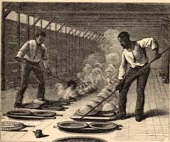
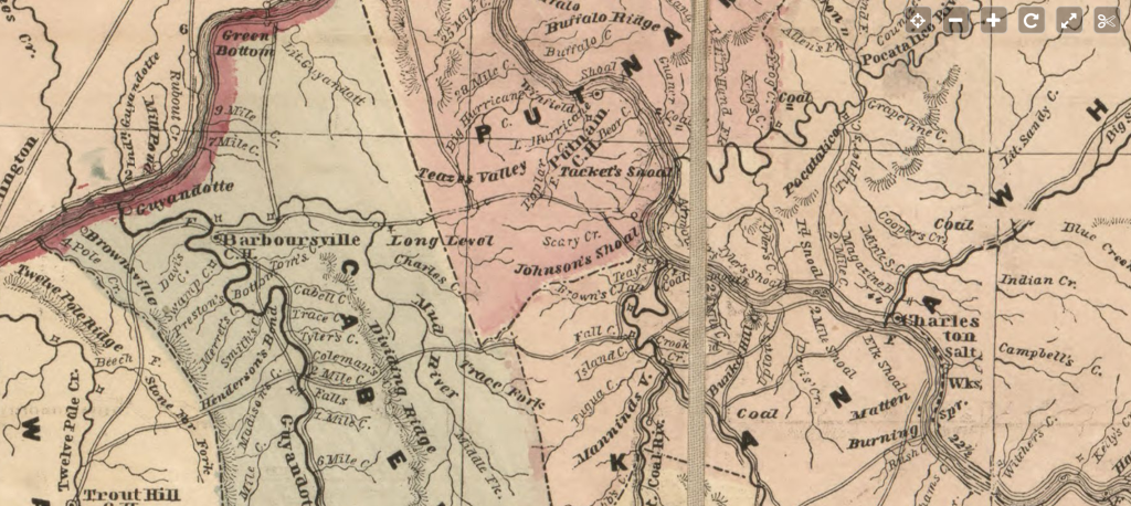
27 August 1829 – Traveled twelve miles to Stockton’s for breakfast, excellent fare. The turnpike ends eight miles from Ganly [Gauley]. A new contract had just been taken by Trimble and Thompson to continue to Charleston, 30 miles at the rate of $1595 per mile, bridges included. Very cheap road. The sixty miles between Charleston and Sandy will be let out on the first of October. We this day passed through the rich narrow bottoms of Kanawha, a great part of which is covered with a heavy crop of corn. Ten miles of the valley are called “the Licks” from their being covered with salt works. There are sixty furnaces which manufacture 2,000,000 bushels of salt annually.* The manufacturing of salt would be much more extensive if it were not entirely monopolized by a company. It will someday be a place of much more importance. The buildings about the salt works are miserable shells and hovels, temporary and unsubstantial. We passed the Burning Springs and came to Charleston about night. Charleston is a town about as large as Lexington, Virginia. It is built on a bottom along the Kanawha River. One street is laid off along the margin of the river, scarcely leaving room for a row of houses between the street and the river; here all the business is done. The other street has but few houses on it. The beauty of the town is very much diminished by the row of houses on the river bank. The houses are principally of wood, some brick.
Written in 1829, this is the journal of William M. Campbell. This is also the story of Archer Alexander, an enslaved man born in Lexington, Virginia, who was taken to Missouri in 1829. There are 38 entries in Campbell’s journal, which begins on August 20, 1829 that you can read and follow the story of Archer Alexander. Campbell’s journal is located in the Archives at Washington and Lee University in Lexington, Virginia and is being shared here so that we may hear all the voices, including those whose voices were not shared originally. The photos were taken by me when visiting Virginia for research and then following the pathway that Campbell shares in his journal. Please keep in mind the context of the time in which this journal was written. Feel free to share your comments directly on this blog or join in on the discussion in the St. Charles County History Facebook Group. You may sign up for email alerts of the daily blog posts below.
*The Kanawha salt furnaces were labor intensive. The salt makers employed many slaves, making Kanawha County an exception to the fact that Western Virginia had relatively few slaves. By 1850, there were as many as 1,500 slaves at the salt works, owned by the salt barons or leased from other owners. See https://www.wvgazettemail.com/life/historian-shines-light-on-regions-forgotten-history-of-slaves-owners/article_a5dcfb35-fd5f-50c7-9b06-51f456cde046.html
-

Rain – drove on, came to New River, passed along its stupendous cliffs, by a magnificent road, crossed Goly* Bridge, toll $1. This is an open bridge lately erected by B and S. It is built on piers at the same place the Arched Bridge formerly stood. It is an handsome bridge. Two miles below the bridge we passed the great falls of Kenewha*, a great natural curiousity, an admirable site for water works. A great quantity of timber is sawed here and several hundred large flat boats are built here for the purpose of taking salt down the Ohio. Staid all night at Huddleston’s; fared very well. Had a good deal of conversation with the citizens of Ohio, Mississippi and Indiana, who were traveling and had called to stay all night.
Written in 1829, this is the journal of William M. Campbell. This is also the story of Archer Alexander, an enslaved man born in Lexington, Virginia, who was taken to Missouri in 1829. There are 38 entries in Campbell’s journal, which begins on August 20, 1829 that you can read and follow the story of Archer Alexander. Campbell’s journal is located in the Archives at Washington and Lee University in Lexington, Virginia and is being shared here so that we may hear all the voices, including those whose voices were not shared originally. The photos were taken by me when visiting Virginia for research and then following the pathway that Campbell shares in his journal. Please keep in mind the context of the time in which this journal was written. Feel free to share your comments directly on this blog or join in on the discussion in the St. Charles County History Facebook Group. You may sign up for email alerts of the daily blog posts below.

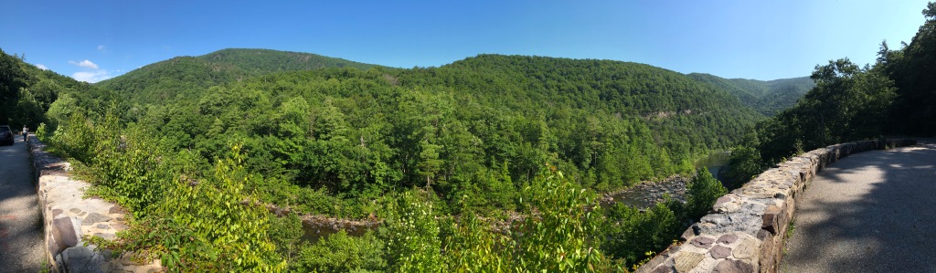
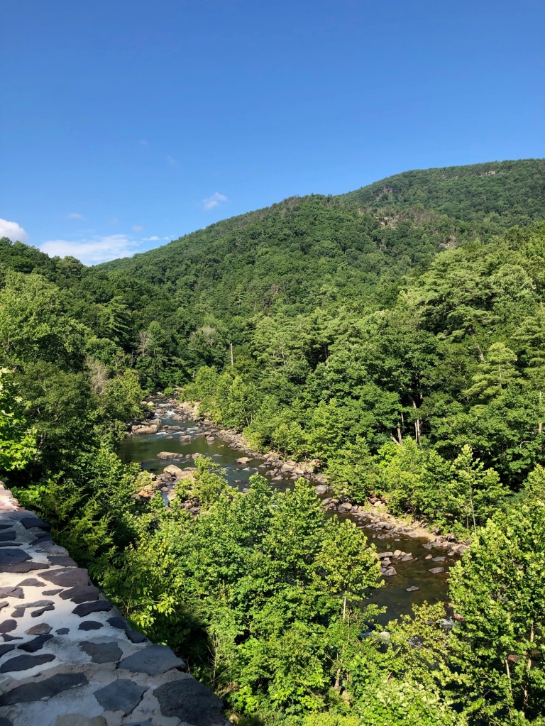
This is one of the most beautiful sights in West Virginia. The wood mills that once made flatboats for travel down the Ohio River are today’s paper mills. The lumber industry fuels the economy. Traveling the side roads such as Route 60, the Midland Trail and a National Scenic Byway one sees so much more history and beauty. Photo by Dorris Keeven-Franke.
-
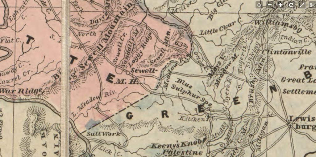
We entered on a very mountainous region crossed Meadow Mountain, Big and Little Sewell and numerous other ridges, for which the inhabitants say thay cannot afford names. All along these, numerous houses have been built for the purpose fo keeping entertainment. Many of them good houses. Houses are still being built for that purpose and much more land is clearing out where formerly there were no settlements. Staid all night at Tyrees fared well.
Written in 1829, this is the journal of William M. Campbell. This is also the story of Archer Alexander, an enslaved man born in Lexington, Virginia, who was taken to Missouri in 1829. There are 38 entries in Campbell’s journal, which begins on August 20, 1829 that you can read and follow the story of Archer Alexander. Campbell’s journal is located in the Archives at Washington and Lee University in Lexington, Virginia and is being shared here so that we may hear all the voices, including those whose voices were not shared originally. The photos were taken by me when visiting Virginia for research and then following the pathway that Campbell shares in his journal. Please keep in mind the context of the time in which this journal was written. Feel free to share your comments directly on this blog or join in on the discussion in the St. Charles County History Facebook Group. You may sign up for email alerts of the daily blog posts below.
From Lexington, Virginia to Lewisburg, today’s West Virginia our travelers have come seventy-five miles through the Appalachian Mountains. First crossing the Blue Ridge Mountains, they have climbed into the Shenandoah valley at the altitude of 2,080 feet. The ages of the members of the caravan range from three-month-old Sallie Campbell McCluer born in May, and Mr. Icenhower’s father-in-law who is over ninety-years old. When they crossed Sewell Mountain they had climbed to 3,212 feet. Anna Icenhower and another member of the enslaved community were several months pregnant.
https://hdl.loc.gov/loc.gmd/g3800.fi000077http://hdl.loc.gov/loc.gmd/g3880.rr003100 Library of Congress Maps like the one above were quite useful to the traveler in 1829. Nothing like the Google Maps (see below) we use today. They had no GPS coordinates to insert into an app either. In 1829 roads are dirt, and your mode of transportation determined your speed. A man on a horse could travel much faster than a wagon full of household goods, or one of the enslaved walking alongside. Inns were stopping points that were usually the right distance for a days journey from the last innkeeper. Perhaps Campbell has put up with William Tyree and Innkeeper in today’s Anstead, Fayette County, West Virginia.
About this map from the Library of Congress
Lloyd’s official map of the state of Virginia from actual surveys by order of the Executive 1828 & 1859.Summary Indicates drainage, state and county boundaries, roads, distances, place names, mills, factories, “places remarkable for military incidents,” and the railroad network.Contributor Names: Lloyd, James T.Fillmore, Millard, 1800-1874, collector. Created / PublishedNew York, 1861.Subject Headings- Virginia–Maps- United States–VirginiaNotes- LC Civil War Maps (2nd ed.), 450- LC Railroad maps, 310- Description derived from published bibliography.- Available also through the Library of Congress Web site as a raster image.- VaultMedium1 col. map 30 x 48 cm.Call Number/Physical LocationG3880 1861 .L41 RepositoryLibrary of Congress Geography and Map Division Washington, D.C. 20540-4650 USA Digital Id https://hdl.loc.gov/loc.gmd/g3800.fi000077http://hdl.loc.gov/loc.gmd/g3880.rr003100
-

Staid in Lewisburg until evening. It was a quarterly court and a day of great resort in Lewisburg. Started in the evening and came to Pierce’s [Pierie’s] ten miles over the Muddy Creek Mountain. Fared well.
Written in 1829, this is the journal of William M. Campbell. This is also the story of Archer Alexander, an enslaved man born in Lexington, Virginia, who was taken to Missouri in 1829. There are 38 entries in Campbell’s journal, which begins on August 20, 1829 that you can read and follow the story of Archer Alexander. Campbell’s journal is located in the Archives at Washington and Lee University in Lexington, Virginia and is being shared here so that we may hear all the voices, including those whose voices were not shared originally. The photos were taken by me when visiting Virginia for research and then following the pathway that Campbell shares in his journal. Please keep in mind the context of the time in which this journal was written. Feel free to share your comments directly on this blog or join in on the discussion in the St. Charles County History Facebook Group. You may sign up for email alerts of the daily blog posts below.
Lewisburg Courthouse where Campbell spent the day.
-

Came to Callahan’s for breakfast. A fine Tavern stand. Finely kept by the owner who is much a gentleman. We now commenced traveling on the turnpike. The road is very excellent considering the mountainous regions through which it passes – crosses the Alleghany. Passed the White Sulpher Springs where there were two hundred visitors. This is the most valuable mineral water in the world and would be frequented by double the present number of visitors if there were good roads to it and it was owned by an active and energetic man. Crossed Greenbrier River by the finest bridge in Virginia Toll 93-3/4 cents and came to Louisburg in the evening. Met many acquaintances with some of whom we staid.
For the full story see: https://archeralexander.blog/2023/08/23/entry-4-from-virginia-to-missouri/
Written in 1829, this is the journal of William M. Campbell. This is also the story of Archer Alexander, an enslaved man born in Lexington, Virginia, who was taken to Missouri in 1829. There are 38 entries in Campbell’s journal, which begins on August 20, 1829 that you can read and follow the story of Archer Alexander. In Campbell’s journal is located in the Archives at Washington and Lee University in Lexington, Virginia and is being shared here so that we may hear all the voices, including those whose voices were not shared originally. The photos were taken by me when visiting Virginia for research and then following the pathway that Campbell shares in his journal. Please keep in mind the context of the time in which this journal was written. Feel free to share your comments directly on this blog or join in on the discussion in the St. Charles County History Facebook Group. You may sign up for email alerts of the daily blog posts below.
[Photograph] Retrieved from the Library of Congress, https///www.loc.gov/item/2006679024/.jpg -
Made an early start, crossed the Warm Spring Mountain, lately improved by turn piking. Passed the Warm Springs where there were forty visitors and Hot Springs, where there were sixty. Were detained on the road by the oversetting and breaking of a South Carolina Sulky. We met in a narow place and he capsized and we had to help him refit before he could proceed; crossed Jackson’s River and the steep Morris Hill and came to the Shoomates [Shumates] at dark. He was an officious, sensible, kind and talkative landlord. This road is crowded with travelers passing to and from the springs. Our horses came.
PHOTOS BY DORRIS KEEVEN-FRANKE
Written in 1829, this is the journal of William M. Campbell. This is also the story of Archer Alexander, an enslaved man born in Lexington, Virginia, who was taken to Missouri in 1829. There are 38 entries in Campbell’s journal, which begins on August 20, 1829 that you can read and follow the story of Archer Alexander.Campbell’s journal is located in the Archives at Washington and Lee University in Lexington, Virginia and is being shared here so that we may hear all the voices, including those whose voices were not shared originally. The photos were taken by myself when visiting Virginia for research, and then following the pathway that Campbell shares in his journal. Please keep in mind the context of the time in which this journal was written. Feel free to share your comments directly on this blog or on Archer Alexander’s Facebook page. You may sign up for alerts of the blog posts below.
-

Took a final leave of all my fathers family and turned our faces toward the West. We found the roads very bad and of course traveled slowly. Crossed the North Mountain and at noon ate a harty meal of bread, beef and cheese at a spring on the side of Mill Mountain. Fed at Williams and started for Warm Springs about 3 o’clock. We had not proceeded more than two hundred yards before we broke a singletree and were detained until almost night to have a new one made. Then drove four miles to Stewards. Fared well on a plenty of plain substantial food.
And so begins the journal of William M. Campbell from Lexington, Virginia to Dardenne Township in St. Charles County Missouri. Begun in August of 1829, the group of over fifty travelers would have twenty-five enslaved individuals, including Archer Alexander, between three families, the Alexanders, McClures, and Wilsons . Enslaved there were six boys under the age of ten, three young males between ten and twenty-three, two young men between twenty-four and thirty-six, and one older man between thirty-six and fifty-four. Also there were four little girls under the age of ten, seven young women of child-bearing age between ten and twenty-three, two older women still of child bearing age between twenty-four and thirty-six, and one older woman also between the age of thirty-six and fifty-four. Among these was Archer’s newborn son Wesley, and his mother, the black nurse for the McClure’s newborn baby Sally McClure.
This journal of a journey from Lexington, in Rockbridge County in Virginia to St. Charles County Missouri was written between August through October, 1829, includes the enslaved Archer Alexander. Written by William M. Campbell (1805-1849) the son of Samuel LeGrand Campbell (1765-1840) , the second President of Washington and Lee University in Lexington, Virginia and his wife Agnes Reid Alexander (1772-1846). It can be found in the Leyburn Library, Special Collections and Archives, located at the Washington and Lee University, in Lexington, Virginia. A very special thanks goes to Lisa S. McCown, Senior Assistant and all of the staff there. . This journal is presented here with the spellings as presented by the writer in 1829. All photos by Dorris Keeven-Franke.
Written in 1829, this is the journal of William M. Campbell. This is also the story of Archer Alexander, an enslaved man born in Lexington, Virginia, who was taken to Missouri in 1829. There are 38 entries in Campbell’s journal, which begins on August 20, 1829 that you can read and follow the story of Archer Alexander.Campbell’s journal is located in the Archives at Washington and Lee University in Lexington, Virginia and is being shared here so that we may hear all the voices, including those whose voices were not shared originally. Please keep in mind the context of the time in which this journal was written.
SUBSCRIBE TO STCHARLESCOUNTYHISTORY.ORG FOR FREE DAILY EMAIL WITH STORIES ABOUT ST CHARLES’ HISTORY
FOR MORE ABOUT ARCHER ALEXANDER SEE https://archeralexander.blog/
-

First Entry – The Journey begins 8.20.29
I started from Lexington, Virginia on a journey to the state of Missouri. My own object in going to that remote section of the Union was to seek a place where I might obtain an honest livelihood by the practice of law. I travel in company with four families containing about fifty individuals, white and black. The first family is that of Dr. McCluer, his wife (my sister) and five children from six months to thirteen years old and fourteen negro servants. Two young men, McNutt and Cummings, and myself form a part of the traveling family of Dr. McCluer. Dr. McCluer leaves a lucrative practice and proposes settling himself in St. Charles County Missouri on a fine farm which he has purchased about 36 miles from St. Louis. The second family is that of James H. Alexander, who married a sister of Dr. McCluer, with five children and seven negro slaves. Intends farming in Missouri. Third family, James Wilson, a young man who is to be married this night to a pretty young girl and start off in four days to live one thousand miles from her parents. He has four or five negroes. Fourth family, Jacob Icenhoward, an honest, poor, industrious Dutchman with several children and a very aged father in law whom he is taking at great trouble to Missouri, to keep him from becoming a county charge. He has labored his life time here and made nothing more than a subsistence and has determined to go to a country where the substantial comforts of life are more abundant.
Our caravan when assembled will consist of four wagons, two carryalls, one Barouche and several horses, cows.and fifty people. Two of Dr. McCluer’s children are in Charleston, Kenahwa, with their Uncle Calhoun. Our caravan will not start until the 25th of August. But I, with my sister and nurse will proceed forthwith in the Barouche to Charleston, Kenawha, where we will await the arrival of the caravan. This evening we left Lexington, our native town; possibly never to see it again.
I bid adieu to numerous friends and acquaintances, all of whom professes to wish me well. Many of them sincerely, some of them from the bottom of their hearts, some deceitfully and others with indifference. I parted from many whom I respected and esteem highly. I left a numerous tribe of relatives and many old friends. Many requested me to write to them and give them an account of the country and numbers intimated a hope of coming to Missouri in a few years. We came three miles to the residence of my aged father and mother with whom we stay all night, perhaps for the last time. Tomorrow morning we will start in our barouche for Warm Springs.
More of this story can be found on my blog post https://archeralexander.blog/2021/08/20/from-virginia-to-missouri/
SUBSCRIBE TO STCHARLESCOUNTYHISTORY.ORG AND GET A FREE EMAIL WITH A STORY EVERY DAY IN YOUR INBOX…
-

By the end of the 1820s, St. Charles County’s population had grown to 4,320 white Americans living here, primarily from the states of Virginia, Kentucky and Tennessee. They had brought their enslaved with them, amounting to a total of 476 males, and 475 females for a total of 951 African-Americans, approximately 18% of the total population. There were also twenty seven free blacks living in the county. Its 470 Square miles encompassed forests, creeks, rivers, and prairie land. The principal crops were tobacco and hemp, which required large enslaved labor forces. But a huge wave of new settlers were on their way. In the next decade, the population would nearly double. Things were about to change…
On August 20, 1829, a group of three families, the Alexanders, the McCluers, and the Wilsons, would be joined by a large family named Icenhaur, would depart from Rockbridge County, in the Shenandoah Valley. Their cousin William Campbell, would keep a journal of that trek to Missouri, giving accounts of where they stopped, and what kinds of inns and innkeepers they would encounter. In reading this account and following their journey, we learn what such a journey is like for families coming here to St. Charles County. There are over fifty people in this caravan, half of them are white, and half of them are black. One of them, is an enslaved man named Archer Alexander, with his wife Louisa, and a son named Wesley.
-
Ever wonder why so many Saint Charles families trace their ancestry back to Germany? Some would say one visitor who arrived in 1824 might just be the reason. He would spend three years here visiting with Nathan Boone, Jacob Zumwalt, and others, observing the life of those who had already uprooted their families and headed west. They had a reason to head to this new territory….
In 1829, Gottfried Duden published at his own expense 1500 copies of a small book titled Report on a Journey to the Western States of North America in Elberfeld Germany. In 1909, eighty years after Duden’s Report was published, A.B. Faust described Duden with, “His skillful pen mingled fact and fiction, interwove experience and imagination, pictured the freedom of the forest and of democratic institutions in contrast with the social restrictions and political embarrassments of Europe. Many thousands of Germans pondered over this book and enthused over its sympathetic glow. Innumerable resolutions were made to cross the ocean and build for the present and succeeding generations happy homes on the far-famed Missouri.”
In 1919, ninety years following Duden’s Report, Duden’s first biographer William G. Bek begins with, “Duden was the first German who gave his countrymen a fairly comprehensive, and reasonably accurate, first-hand account of conditions as they obtained in the eastern part of the new state of Missouri.”
In Mack Walker’s Germany and the Emigration 1816-1885 we find, “Duden’s enthusiastic book . . . fits its time with a gratifying neatness; for it first appeared in 1829, just as the Auswanderung to America was beginning to revive. But it not only met a need and suited an atmosphere it helped appreciably to create them. Duden’s descriptions of American landscapes and American resources were vivid, even lyrical. He found American economic, political, and social conditions better than those of the Fatherland, and American intellectual and moral conditions just as good. The color, timing, and literary qualities of Duden’s report made it unquestionably the most popular and influential description of the United States to appear during the first half of the century. It was an important factor in the enthusiasm for America among educated Germans in the thirties; it served for decades as a point of departure for hundreds of essays, articles, and books, and innumerable thousands of conversations; it was a landmark in the life and memory of many an Auswanderer.”
Nearly one hundred twenty-five years following Duden’s Report, Charles van Ravenswaay in his epic The Arts and Architecture of German Settlements in Missouri: A Survey of a Vanishing Culture tells us, “This timely work . . . greatly stimulated immigration to the United States and caused thousands to make Missouri their destination . . . For more than a generation Duden’s writings formed the leitmotif of German settlement in Missouri, with the interpretation of his comments provoking endless discussion among those who came here. Many immigrants continued to revere his memory as the father of the German migration, and even those who blamed him for their misfortunes seem to have had a grudging respect for that kindly, guileless man.”
Born in 1789 in the small town of Remscheid, Duden was the son of a wealthy apothecary and his second wife. When Duden was six years old his father died, leaving a widow and five children, and Duden the middle child with two older brothers, and two younger sisters. When one of the older brothers died, Duden was only nine, more thought was certainly placed on whether he would follow in the family’s apothecary business. Instead his chosen career became law. And as an impressionable, wealthy and highly educated young man, he would suddenly find himself seated behind the law bench in Dusseldorf, listening to the horrid tales of woe, from a world he was certainly not familiar with. His military service, done without pay, raised his awareness further, about the conditions and the problems his country was facing. His generation’s students at the Universities were pushing to change these problems. Others, such as Frederick Ludwig Jahn, with the Turner movement, spoke out about the need for a need for a united Germany, with strong minds and bodies. With the foresight to see, that if the struggles his fellow countrymen faced, could not be changed, perhaps a fresh start in that young country in North America should be made. Duden was not the first, nor was he the only German author to consider authoring an “emigration book” as hundreds were being published by this time. But did they know what they were talking about? Most authors had never even been there, and those that claimed to, Duden would soon discover really had not. Inspired by the tales of pioneers such as Daniel Boone, Duden began to look closer at the new territories opening in the far west.
Using an agent, in 1819, Duden purchased property in the U.S. Land Office. It lay near the Fifth Principal Meridian, in what had been Saint Charles County, but was then Montgomery County, and today is Warren County, the village of Dutzow. He developed a plan, which would be thwarted when a chosen companion died in South America. Soon he would have another, Ludwig Eversmann, and he, and his cook Gertrude Obladen, would join him in the young State of Missouri, where he purchased even more land.
For three years, Duden would write about his time in the Western States, compiling notes about everything from his neighbors to the conditions of the U.S. Government. Thorough, he covered the issues of slavery, the American Indians, and farming, from a nearby hillside on Jacob Haun’s farm. Farming, was only by observation, as that was what he had brought Eversmann for. He roamed the countryside and went duck hunting with Nathan Boone. When he readied for his return to Germany, the locals asked why he was going back to conditions he considered so bad, and he stated that Eversmann would stay and take care of his farm, but Duden’s mission was to publish a book. A book in which he would compare, like no other at that time, Germany to North America. He would report, in a matter of fact manner, how a farmer could purchase land, raise a family, and worship freely in the church of his choice. He was free to raise all the crops he wanted on his land, and kill all of the meat his family could eat, that his labor allowed. He was free to marry, cut whatever wood he needed for his house and his fire, and vote to decide on his leaders. He was free. Here one was free to do all of these things, while in Germany most were not. With no military draft, no inheritance laws, and no high taxes, this would sound like a virtual Schlafferenlande – a Garden of Eden.
When Duden’s A Report on a Journey to the Western States of North America hit the bookstores in 1829, it was an instant hit! It literally flew off the bookstores’ shelves, going straight to the top of the bookseller list, and had everybody talking, all without the help of today’s blogs, tweets and Facebook. Included in the back was Duden’s advice to the farmer, and suddenly everybody wanted to be a “farmer”! Soon thousands would leave German ports such as Bremen, and arrive at Baltimore or New Orleans, declaring them self a farmer. For the first decade, Duden’s advice to travel through Baltimore and in groups, for safety, was usually heeded.
First only a small trickle, with the little so called Berlin Society, funded by Baron von Bock, establishing Dutzow, named after his estate in Germany. Soon to be followed by a ships filled with Germans from Osnabruck and then Soligen, hundreds more soon filled the Missouri River valley. Emigration Societies in Germany and Switzerland republished Duden’s book, with second, third and fourth editions soon to follow. Emigration Societies here in the U.S. were formed, in Philadelphia, which purchased land and sold shares, creating Missouri towns like Hermann.
The impetus was on, and when charismatic leaders such as Paul Follen, and Friedrich Muench, with their Giessen Emigration Society, gave a call for a large group to emigrate in mass, the response was huge! Their impossible goal to create a German Republic in the United States as they originally planned may have failed, but the idea of a State where Germany’s cultural heritage could live on, definitely did not. Thousands wanted to be part of Muench and Follenius’ movement, and seek their freedom and fortunes in the New World.
Not only to be restricted to the wealthy, freedom for religious faiths would soon find inspiration in Duden’s book, with leaders like Martin Stephans, who corresponded with Duden. And finally, in the end, not to be restrained by class or religion, entire villages would be emptied, as letters home or chain migration picked up the baton passed on to them. Soon Duden’s book, would be replaced somewhat, by even more personal, first hand accounts written by his followers. These letters, written by relatives to family members still in Germany, and shared after church on Sunday, in the wine garden, or during drills at the Turnverein, kept the waves of emigrants coming. With stories of how they ate more meat in a day or week, than their relatives did in a month. Or, how with a little hard work, they could purchase land, to raise large families. And how best of all, they were free, free to speak their own mind, to be part of the electoral process and to worship where they chose.
While I could go on, and would love to continue, about the achievements of these early emigrants and their bold moves which brought us to today.Gottfried Duden died on October 29, 1856. And while he never returned to Missouri, he did keep his own dream alive, with ownership of his small Missouri farm with the cows on it. Today, one can still purchase books on the subject of emigration, in both Germany and the U.S. and find Gottfried Duden included. Duden’s personal ambition to help his fellow countrymen was fulfilled with his Report. While criticized for his romantic descriptions, immigrants could not deny that “while all things were not exactly as Duden described, in some ways they were even better.” His Report, inspired great leaders, and gave rise to thousands, to chose to emigrate to the land where “the sun of freedom shines” forever. This legacy lives on today, in the hundreds of thousands of immigrants, and their descendants, in the United States.
Today, we can still find evidence of those early emigrants in our architecture, customs and traditions. Our history books cite their roles in the Civil War, and in the industry found in their businesses. We celebrate our holidays with Christmas trees and cookies. We toast our successes with wine. Our love of parties and celebrations, of commemorating each moment, cannot be quashed by blue laws. We educate our children starting with Kindegarten, and teach the importance of schooling, freely, and for all. Today still, our traditions keep the dreams, the culture, and the faith of those first bold moves alive.
SUBSCRIBE AND GET FREE DAILY EMAILS OF STCHARLESCOUNTYHISTORY
-

Edward Bates was born in 1793, in Goochland County, Virginia. In 1814, he would follow his brother Frederick, who had been appointed by President Thomas Jefferson as Secretary of the Louisiana Territory. Edward studied law under Rufus Easton, the Territory’s Chief Clerk, and then serving on the Supreme Court, he would receive his bar degree in 1816. In 1820, he would serve in the State Convention , after being one opposed to the restriction of slavery. In 1822, he would serve Missouri in the House of Representatives, located in the village of St. Charles.
Edward Bates’ brother Fredrick Bates would serve as Missouri’s second Governor, where he would die while he was in office in 1825. The first State Capitol would move from St. Charles to Jefferson City in November of 1826. Edward Bates would establish his home on the Boone’s Lick Road (Today’s Highway N) in Dardenne Prairie in 1829, naming his huge plantation of 500 acres Walnut Grove. There he built a 22-room mansion, the largest in St. Charles County and name it Chenaux. The huge home was flanked by two large twin Chimneys. (The home is no longer standing.)
In 1844, Edward Bates would serve as the pro-bono attorney for Lucy Berry, later known as Lucy Delaney, author of the 1892 slave narrative “From the Darkness cometh the Light”. Her case, which Bates won, served as the inspiration for the freedom suit of Harriet and Dred Scott. “Despite his efforts on behalf of freepersons like Lucy, Bates had reservations against exerting greater pressure on slavery itself. Personally, his actions regarding enslaved people were in line with his contemporaries who exhibited no personal qualms with treating Black people unequally. At times, Bates hired out his enslaved servants to his neighbors. At others, he profited from their sale.” [i]
During the Civil War, Edward Bates would serve in President Abraham Lincoln’s Cabinet as the United States Attorney General from 1861until 1865. When Edward Bates retired and returned to Missouri, his son Joshua Barton Bates was living at the family’s estate in Dardenne Prairie and raising his family. President Lincoln had appointed Barton Bates as a Missouri Supreme Court Judge in 1862.
From the Twin Chimneys Elementary which was built in 1993: Most of the Winghaven Development is located on what was the Bates’ property. Even now, if you superimpose the 1800’s property map over present day satellite images, they are still eerily similar. The part of the Twin Chimneys subdivision, Little Oaks, is where the original residence, Cheneaux stood. In our Twin Chimneys Elementary community, there are still signs of Judge Bates and his family. Many streets in the adjacent subdivision are named after the Bates family. Bates road of course, Onward Way for the Judge’s oldest son, Thornhill was the name of the residence owned by an uncle, and Watson’s Parish was named after the Reverend Thomas Watson of Dardenne Church.
Endnote
[i] Neels, Mark A, Lincoln’s Conservative Advisor, Southern Illinois Press, 2024
SUBSCRIBE AND RECEIVE A FREE DAILY DOSE OF ST. CHARLES COUNTY HISTORY IN YOUR EMAIL
-

News of the Portage des Sioux treaties sent a message to residents of eastern states; it was now safe to emigrate and homestead in the Missouri Territory. From 1816 to 1820 settlers “came like an avalanche” wrote missionary John Mason Peck. “It seemed as though Kentucky and Tennessee were breaking up and moving to the Far West.” The treaties also had political ramifications. Missouri filed for statehood in 1820 and William Clark failed in his election bid to become the new state’s first governor. Voters viewed him as being “too soft” on the Indians at Portage des Sioux. Jefferson’s plan of coercion through commerce had worked, though not exactly as he envisioned it. The treaty of Portage des Sioux reaffirmed the process of depriving the Osage of their land and it opened the door for a flood of settlers who rapidly filled the old Osage domain and clamored for more. At the beginning of 1808 the Osage dominated nearly 1/8th of the Louisiana Territory but in just 17 years, they were left with a reservation only 50 miles wide and 150 miles long in southern Kansas. The Treaty of Portage des Sioux which meant peace to the United States only added to the change and turmoil being experienced by the Osage Nation.
In 1816, John Pitman (1753-1839) and his neighbors would file a Petition, asking the Government to assign a surveyor to lay out a road to the most western edge of U.S. settlement at that time, called the Booneslick. That road would become today’s Boone’s Lick Road. In 1816, roads were named by where they were headed! As this old Buffalo trace, turned into a trail, it was because the population was growing. Veterans of the Revolutionary War, like Pitman, had been awarded Land Grants for their service. Pitman had moved to Missouri by 1816, bringing many of his family and his relatives with him. His brother Thomas Pitman (1750-1825) had settled at Howell’s Prairie, near the Missouri River.
Pitman’s Land Warrant was issued for land in the Arkansas Territory in 1821, but he had already moved his family to Missouri by that time. He sold that land warrant to a relative, using it to enlarge his amount of property here in St. Charles County. But in 1816, he was one of a growing number of St. Charles County residents that realized that the Territory was growing, and that good roads were important. And just like James Morrison on St. Charles’ Main Street, who owned the Bryan and Rose Salt lick at the other end of the Boone’s Lick Road, Pitman wanted to make sure that his land would be on “the big road” as it was often referred to at that time.
In 1818, U.S. Land Sales Offices had opened an begun selling land using the Public Land Survey System of a Section Range and Township, which Thomas Jefferson had encountered in France. When the U.S. purchased the Louisiana Territory from France in 1804, it didn’t come with any records of who owned what land already. Besides sending out the explorers Lewis and Clark, surveyors were needed to lay out these grids. With the War of 1812, that process would be interrupted. After the treaties, work would begin anew by surveyors. However, the U.S Land Office was also involved at the same time, in identifying who already owned what land. Early settlers like Daniel Boone, Warren Cottle and Jacob Zumwalt had already purchased land prior to 1804. These early land grants from the Spanish were called into question and they had to prove to the new government that they truly owned the property. There was also a lot of land speculation and those that tried to claim land that they didn’t actually owned. And there were those who didn’t own land, but had simply “squatted” on a parcel calling it theirs.
This was a difficult time, as we were just a Territory, and with little representation in D.C., and thoughts of Statehood were beginning. The demographics were changing as well, as the fur traders were giving way to those coming from the states of Virginia, Kentucky, and Tennessee buying up huge swaths of cheap land and bringing their cheap labor force, the enslaved, with them.

Land Warrant for John Pitman for his service in the Revolutionary War. RESOURCES
For More about Missouri’s Land Sales and where to obtain records see the Missouri Secretary of State Archives website:
Follow links within our blogs and they will take you to previous posts that have more information. Or you can use the Search function below to search categories, tags, or previous posts.
-
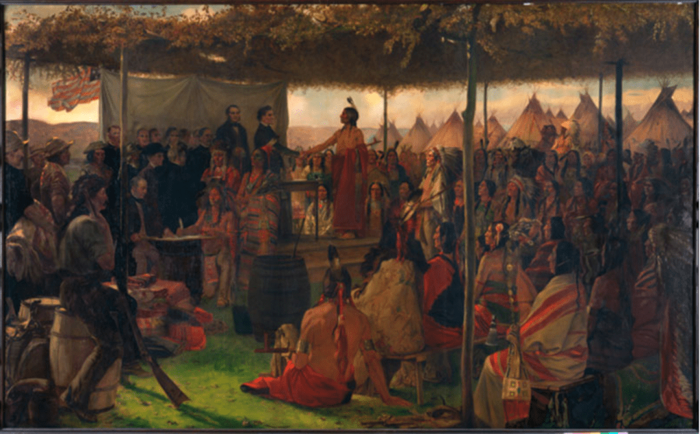
Written by Michael Dickey – Former Site Director, Arrow Rock State Historic Site, Missouri Department of Natural Resources for the Program: April 25, 2015 Conflicted Perspectives Symposium, St. Charles County College and the Peace and Friendship Commemoration on September 15, 2015.
President James Madison appointed William Clark, Illinois Territorial Governor Ninian Edwards and U.S. Indian Agent Auguste Chouteau as Indian Peace Commissioners and they were convened from May 11 through September 28. They were appropriated $20,000 in trade goods to use as presents for the Indians.[19]
They invited about 19 western tribes (some were actually bands of tribes) to meet and council at Portage des Sioux. This location was convenient to the tribes on the Missouri, upper Mississippi and Illinois Rivers, and it was far enough from St. Louis and St. Charles so as not to impact the daily activity of the citizenry. Fort Belle Fontaine was only a few miles away and its 275 troops were deployed to the treaty grounds. In early July about 2,000 Indians began gathering at the site. Leaders the pro-British faction of the Sac & Fox did not show up. Leaders of a dozen tribes signed the treaty but others such as the Menominee and Winnebago did not until the following year. Even though the Osage had not fought against the United States they were compelled to affirm their loyalty and re-affirm the treaty of 1808. Eleven chiefs of the Big Osage, one Arkansas Osage chief, eleven Little Osage chiefs and one chief of the Missourias attached to the Little Osage signed the peace treaty on September 12, 1815 which followed a short, simple template:
A treaty of peace and friendship, made and concluded between William Clark, Ninian Edwards, and Auguste Chouteau, Commissioners Plenipotentiary of the United States of America…of the one part; and the undersigned King, Chiefs, and Warriors, of the Great and Little Osage Tribes or Nations…of the other part.
THE parties being desirous of re-establishing peace and friendship between the United States and the said tribes or nations, and of being placed in all things, and in every respect, on the same footing upon which they stood before the war, have agreed to the following articles:
ARTICLE 1. Every injury, or act of hostility, by one or either of the contracting parties against the other, shall be mutually forgiven and forgot.
ARTICLE 2. There shall be perpetual peace and friendship between all the citizens of the United States of America and all the individuals composing the said Osage tribes or nations.
ARTICLE 3. The contracting parties, in the sincerity of mutual friendship recognize, re-establish, and confirm, all and every treaty, contract, and agreement, heretofore concluded between the United States and the said Osage tribes or nations.[20]
At first glance, the wording of the treaty seems harmless enough. No land cessions were required and annuities were not withheld as punishment for any damages attributed to individual Osages during the war. However, the Osages did not regain “the same footing upon which they stood before the war.” Fort Osage reopened that fall, but they did not relocate there. The war had changed the climate of the nation. News of the Portage des Sioux treaties sent a message to residents of eastern states; it was now safe to emigrate and homestead in the Missouri Territory. From 1816 to 1820 settlers “came like an avalanche” wrote missionary John Mason Peck. “It seemed as though Kentucky and Tennessee were breaking up and moving to the Far West.”[21] The treaties also had political ramifications. Missouri filed for statehood in 1820 and William Clark failed in his election bid to become the new state’s first governor. Voters viewed him as being “too soft” on the Indians at Portage des Sioux.[22] Missourians it seems, were not willing to “forgive and forget” as the treaty had stipulated. The Shawnee, Delaware, Kickapoo, Peoria and Cherokees were assigned to reservations abutting the Osage boundary and they frequently hunted on the Osage side of the line. Pressured by the growing settlements of whites and dispossessed eastern tribes, some Big and Little Osage as early as 1808 began joining their Arkansas kinsmen or relocating to southeast Kansas. After 1815 the departures accelerated. The last group of Big Osage remaining in Missouri abandoned their village in the summer of 1822.[23] On June 2 of 1825, the Osage signed a treaty at St. Louis, by which they ceded the remainder of their territory in Missouri, Arkansas, Oklahoma and much of Kansas[24]
Jefferson’s plan of coercion through commerce had worked, though not exactly as he envisioned it. The treaty of Portage des Sioux reaffirmed the process of depriving the Osage of their land and it opened the door for a flood of settlers who rapidly filled the old Osage domain and clamored for more. At the beginning of 1808 the Osage dominated nearly 1/8th of the Louisiana Territory but in just 17 years, they were left with a reservation only 50 miles wide and 150 miles long in southern Kansas. The Treaty of Portage des Sioux which meant peace to the United States only added to the change and turmoil being experienced by the Osage Nation.
Endnotes
[19] March, David. The History of Missouri Vol. I. Lewis Historical Publishing Co. New York 1967, p. 303
[20] Kappler, Charles J. Indian Affairs Laws and Treaties Vol. II Washington, Government Printing Office, 1904. Treaty With the Osage 1815 http://digital.library.okstate.edu/kappler/Vol2/treaties/osa0119.htm
[21] Babcock, Rufus, ed. Forty Years of Pioneer Life Memoir of John Mason Peck D.D. Carbondale and Edwardsville: Southern Illinois University Press, 1965 p. 146
[22] March, p. 305
[23] Burns, p. 50
[24] Kappler, Treaty With the Osage 1825 http://digital.library.okstate.edu/kappler/Vol2/treaties/osa0217.htm
On September 15, 2015, the Commemoration of the Peace and Friendship Treaties took place at the same location as the original signing, Portage des Sioux in St. Charles County. Present were St Charles County Executive Steve Ehlmann, Osage Nation’s Chief Standing Bear, and William Clark’s descendant Bud Clark.
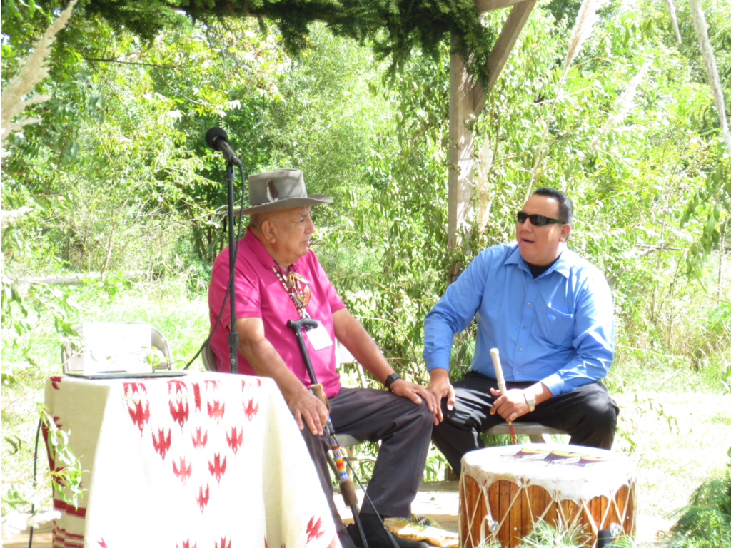
Drum of the Osage Nation 
September 15, 2015 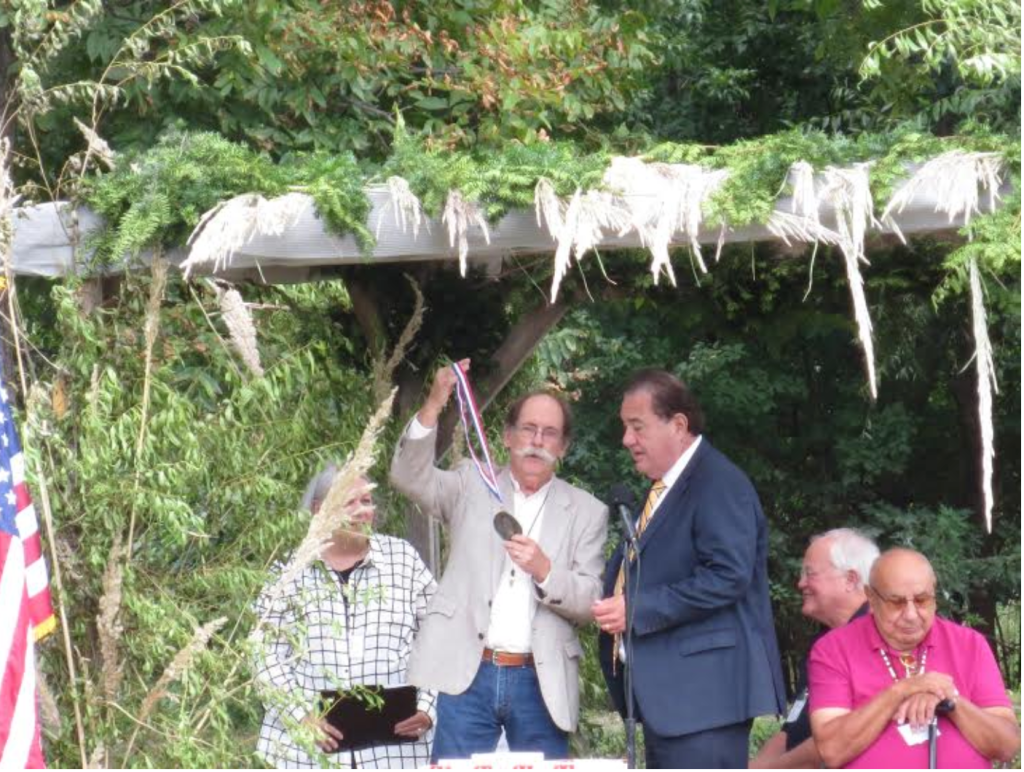
Dorris Keeven-Franke, Bud Clark, Chief Standing Bear 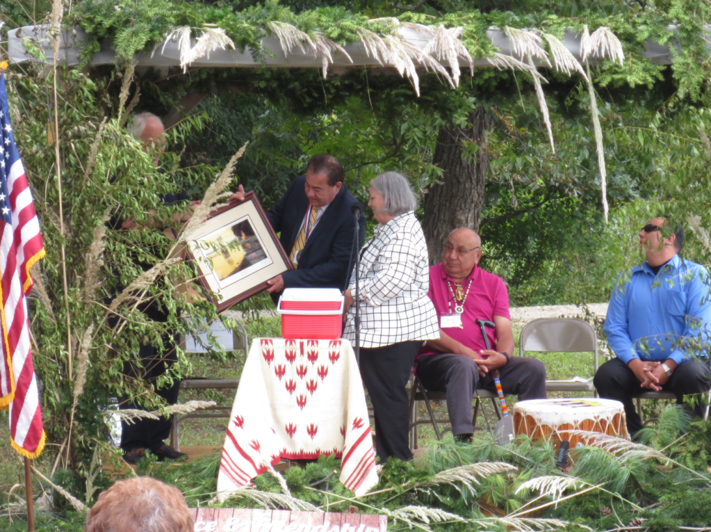
L-R Steve Ehlmann, Chief Standing Bear, Dorris Keeven-Franke By Dorris Keeven-Franke
-

By Michael Dickey – Former Site Director, Arrow Rock State Historic Site, Missouri Department of Natural Resources for a Program: April 25, 2015 Conflicted Perspectives Symposium, St. Charles County College
The War Department in 1808 instituted the factory system to implement Jefferson’s vision. Factories were government fur trading posts that competed directly with private traders in an effort to pacify and control Indians. A military garrison was assigned to protect each factory. Meriwether Lewis proposed that the factory for the Osage be located on the Missouri River as travel on the Osage River was often limited due to low water conditions.[9] In August of 1808 a keelboat under the command of Captain Eli B. Clemson of the 1st U.S. Infantry set out up the Missouri River from Fort Belle Fontaine near St. Louis, followed a short time later by William Clark and Nathan Boone’s overland march of mounted dragoons from St. Charles.[10] The troops rendezvoused at the “Fire Prairie” several miles east of present–day Independence Missouri. There they began construction of Fort Osage, sometimes identified as Fort Clark.
Clark sent Boone and an interpreter out to bring the Osages in to council. Clark employed a carrot-and-stick strategy, threatening war on the Osage but promising that all would be forgiven and they would have their own very trading post if they became American friends. Clark also promised them protection from their enemies.
What pleased most was the idea I suggested that it was better that they should be on the lands of the U.S. where they Could Hunt without the fear of other Indians attacking…than being in continual dread of all the eastern Tribes whom they knew wished to destroy them & possess their Country.[11]
The Osage accepted Clark’s proposal and signed a treaty on September 14. Clark informed Secretary of War Henry Dearborn of the price they paid and what they got in return:
near 50,000 Square Miles of excellent Country – for which I have promised the Osage protection under the guns of the Fort at Fire prairie, to keep a Store at that place to trade with them, to furnish them with a Blacksmith, a Mill, Plows, to build them two houses of logs and to pay for the Horses and property they have taken from the Citizens of the U. States.” [12]
Later a group of 75 Osages arrived in St. Louis returning some stolen horses. They said the treaty was invalid because they had not been present at the signing. They also said that White Hair was a “government chief” who had no authority to make binding agreements for the tribe. Thus, the treaty of 1808 exacerbated existing political dissension in the tribe. The Osages had dealt with the French, British and Spanish for over 100 years on their own terms, sometimes playing them against each other to their own advantage. The French were gone, the Spanish in New Mexico had nothing to trade and the British were too distant to easily trade with. So the Osage could really only deal with the United States and were not able to do so from a position of political unity.
Governor Lewis revised the treaty and Pierre Chouteau was dispatched to Fort Osage to persuade the Osages to sign it. Most of the Big and Little Osage had relocated to the fort. Chouteau had to distribute more gifts and promise an early dispersal of the annuity payments to get them to sign. In the original treaty, a line was drawn straight south from Fort Osage to the Arkansas River and everything east of that boundary to the Mississippi River was ceded. The revised treaty required that they cede an additional 20 million acres of land north of the Missouri River, territory that was also claimed by the Ioway and Sac & Fox nations. However, the government did not consult with those nations about the cession.
The Big Osage became displeased with their new residence and returned to their old towns on the Osage River in 1810. In 1811, war clouds gathered on the frontier as the Shawnee chief Tecumseh built a confederacy of Indian tribes and the British were perceived as inciting the Indians to make war on the United States. The Osage refused Tecumseh’s overtures to join as many tribes in the confederacy were their hereditary enemies. Plus, they weren’t willing to jeopardize the trade at Fort Osage. The British however were reaching out to western tribes to trade in an effort solidify Indian unity. The Osage as U.S. clients and the Ioway as British clients became engaged in a proxy war, receiving tacit support from their sponsors in their raids against each other. After the United States declared war on Great Britain on June 18, 1812, the Little Osage chiefs promised George C. Sibley the fort’s factor (trader), “never to desert their American father as long as he was faithful to them.”[13]
In May of 1813 Frederick Bates, acting Governor of Missouri Territory sought volunteers to defend the Missouri frontier from the pro-British Sac and Fox nation on the Rock River of Illinois. Pierre Chouteau secured 275 first-line Osage warriors for the task. When Governor Benjamin Howard returned from Kentucky he canceled the planned attack, which angered Chouteau and the Osages. Howard and territorial delegate Edward Hempstead distrusted and feared any group of armed Indians roaming the countryside, even though they were allies. Hempstead feared the Osage would change sides at the first opportunity and attack the Missouri settlements. [14]
Fort Osage was closed in June of 1813 as being useless to the defense of the frontier. The U.S. still needed to maintain Osage loyalty so Sibley relocated the factory to the Arrow Rock bluff that October. Gray Bird of the Big Osage liked the Arrow Rock location “on account of the Settlements of Americans near it which I think afford us more security when we come to trade.”[15] Gray Bird obviously saw the Boonslick settlement as a buffer between them and their enemies, the Sac & Fox, Potawatomi and Ioway. However, Big Soldier of the Little Osage disagreed with the move:
I was lately on a visit to the Great American Chief. He told me that Ft. Clark should be made stronger than ever, that he would plant an iron post there that could not be pulled up and that would never decay. I fear he has forgotten that promise and instead of planting an iron post intends to let the old wooden one rot. The Trading House is not for nothing. We have given our Sons for it and I tell you plainly I think the President has done very wrong to remove it at all…[16]
The Osage leaders clearly had a higher degree of sophistication and understanding of events going on around them than they are usually given credit for. However dependence on American trade and political disunity in the tribe made it ever more difficult for them to control those events. Despite the Little Osage objections, trade continued at Arrow Rock until April of 1814 when the post was abandoned due to troubling events. Sac & Fox raids in the Missouri valley began increasing. Osage leaders met in council with a faction of the Sac & Fox who been relocated to the Missouri River by Clark the previous September. A Sac chief named Quashquame raised a British Union Jack over the council house, alarming factor John Johnson. [17] Osages robbed trappers on the Gasconade River and killed some hunters on the White River. Some Little Osages traveled to Prairie du Chien, Wisconsin the base of British operations in the Mississippi valley where they received presents. Despite these incidents, the Osage nation did not commit to the British side although Clark on August 14 reported that the British were “making great exertions to gain over the Osages…”[18] Sibley’s operation at Arrow Rock had helped maintain Osage loyalty at a critical juncture as did the influence of Auguste and Pierre Chouteau, who were married into the Big Osage tribe.
Great Britain and the United States signed a peace accord on December 24, 1814 in Ghent, Belgium. Congress ratified the treaty on February 28, 1815 officially ending the War of 1812. However, no provisions were made for the Indian nations involved and peace had to be negotiated separately with each tribe. President James Madison appointed William Clark, Illinois Territorial Governor Ninian Edwards and U.S. Indian Agent Auguste Chouteau as Indian Peace Commissioners and they were convened from May 11 through September 28. They were appropriated $20,000 in trade goods to use as presents for the Indians.[19]

George Sibley 1782-1863 Endnotes
[9] Clarence E. Carter, Ed., The Territorial Papers of the United States, vol. 14, Louisiana and Missouri Territory 1806-1814 (Washington, D.C.: U.S. Government Printing Office, 1934-1962) p. 196
[10] Ibid p. 209-210
[11] Clark to Dearborn Sept. 23, 1808 Indian Claims Commission 733 Docket No. 105 The Osage Nation of Indians, 1962 p. 858 http://digital.library.okstate.edu/icc/v11/iccv11bp812.pdf
[12] Carter, p. 225
[13] James, Edwin. An Account of an Expedition to the Rocky Mountains in the Years 1819 and 1820. H.C. Cary, Philadelphia, Vol II 1823, p. 248
[14] Carter, p. 673-676
[15] Ibid p. 714
[16] Ibid p. 714
[17] Gregg, Kate. War of 1812 on the Missouri Frontier. Missouri Historical Review, Vol. 32: 122 – 123
[18] Carter, p. 787
[19] March, David. The History of Missouri Vol. I. Lewis Historical Publishing Co. New York 1967, p. 303
-

By Michael Dickey – Former Site Director, Arrow Rock State Historic Site, Missouri Department of Natural Resources from a Program: April 25, 2015 Conflicted Perspectives Symposium, St. Charles County College
In 1803, the 6,000 strong Osage Nation was the largest, most powerful Native American nation immediately west of the Mississippi River. Adding to that image of power, Osage men averaged over six feet in height, some even reaching seven feet, such as Chief Black Dog painted by western artist George Catlin in 1834. In contrast, the average height of a white American male was only 5 ft. 8 in., strengthening “the idea of their being giants.”[1] The Osage were divided into three bands; the Big Osage on the Osage River, the Little Osage on the Missouri River until about 1795 but now on the Osage River, and the Arkansas Osage on the Verdigris River in northeast Oklahoma. The Osage dominated the region from northern Missouri to the Red River and from the Mississippi valley to the western plains of Kansas and Oklahoma: about 1/8 of the Louisiana Territory.[2]
They aggressively defended their territory against all intruders, Indian and white alike. The Osage could bring all of their 1,250 veteran warriors to bear on a single target in a “grand war movement” a feat that few Indian nations in North America could accomplish.[3] In contrast, the United States had only about 250 soldiers available on the western frontier. Following a meeting with Osage leaders in 1805 President Thomas Jefferson wrote, “…in their quarter, we are miserably weak.”[4] The Osage delegation also visited Boston early in 1806 where Chief Tatschaga delivered a testimonial before the Massachusetts State Senate on how the Osage saw themselves in relation to the United States: “Our complexions differ from yours, but our hearts are the same color, and you ought to love us for we are the original and true Americans.“[5]
By 1808, the Osage became restive as displaced eastern tribes and whites increasingly encroached on their territory. Pawhuska or White Hair the so-called “principal chief” or “grand chief” of the Big Osage was pro-American. The position of the chiefs (actually called headmen) was hereditary; if they lived up to the task for a bad chief could be deposed simply by his people ignoring him. But the real political and spiritual power of the tribe lay with the Non-hon-zhin ga or Little Old Men, a select group of elders imbued with sacred knowledge and tribal history. Chiefs followed the leading and advice of the Little Old Men. European traders and officials interfered with this traditional tribal government by giving gifts and medals to individuals they believed would influence the tribe on their behalf. Pawhuska was not a hereditary chief. St. Louis fur traders Pierre and Auguste Chouteau as representatives of the Spanish government had awarded him medals around 1795. This may have helped further a political schism that was already causing some Big Osage to break away and form the Arkansas Band. [6]
Dissidents to Pawhuska’s leadership harassed American settlers by stealing their horses and killing their cattle. Meriwether Lewis, now the Governor of Louisiana Territory ordered the cessation of all trade with the Osages and invited the Shawnee, Delaware, Kickapoo, Ioway and Miami and Potawatomi to wage war on them.[7] Those tribes did not require much goading because they desired to possess the Osage country which was still rich in wild game, while the wildlife resources in their own territories were rapidly becoming depleted.
Jefferson wrote Lewis that military force should be a last resort, so the attack was called off. “Commerce is the great engine by which we are to coerce them & not war”[8] he told Lewis. Jefferson’s strategy was to create Osage dependence on American commercial trade, thereby creating indebtedness within tribes that they would pay off by ceding land. Reducing their hunting territory in this manner, he believed, would force them to become farmers out of necessity and they would be gradually assimilated into American agrarian society a process taking 50 or more years. He was encouraged by the progress he saw then occurring with southeastern tribes such as the Lower Creeks and Cherokees. But Jefferson failed to understand just how rapidly the frontier would advance and how resistant to cultural change the Osage would be. Furthermore, Missouri frontiersmen did not share Jefferson’s ideals about assimilating the Osages into American society.
Endnotes
- [1] Bradbury, John. Travels in the Interior of America in the Years 1809, 1810, and 1811. London: Sherwood, Neely and Jones, 1819 p. 11
- [2] Burns, Louis A History of the Osage People University of Alabama Press, Tuscaloosa AL 2004, pp. 27-37
- [3] Osage elder Jim Red Corn cited in “The Osages at Home in the Center of the Earth – Wa sha she U ke Hun ka U kon scah” an exhibit held in conjunction with Osage Tribal Museum at Arrow Rock State Historic Site, 2004-2005.
- [4] Ambrose, Stephen. Undaunted Courage: Meriwether Lewis, Thomas Jefferson, and the Opening of the American West Simon and Schuster, 1996, p. 342
- [5] The Smithsonian Journal of History, John C. Ewers, Chiefs of the Missouri and Mississippi Vol. I, 1966 p. 22
- [6] Burns, pp. 129-131
- [7] Lewis to Dearborn July 1, 1808 Indian Claims Commission 733 Docket No. 105 The Osage Nation of Indians, 1962 p. 858 http://digital.library.okstate.edu/icc/v11/iccv11bp812.pdf
- [8] Jefferson to Lewis August 21, 1808. The Writings of Thomas Jefferson. Published by the Thomas Jefferson Memorial Association Washington, D.C. 1904 p. 142

From the Gilchrist Museum: Title(s): Chief White Hair, Pawhuska, Oklahoma, Creator(s): Unidentified (Author),Culture: Native American, Osage,Date: 1850 – 1900,Classification: Photographs, Object Type: Photographic Print, Accession No: 4326.4129, Previous Number(s): 72949, Department: , Archive Collection: , Oklahoma Native American Photographs Collection.
-
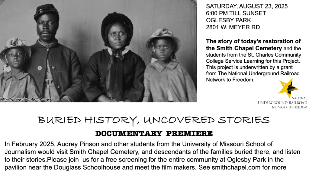
The Smith Chapel Cemetery in Foristell, Missouri is listed on the National Underground Railroad Network to Freedom. It is one of over 800 sites across this country that document stories like theirs. The program is a catalyst for innovation, partnerships, and scholarship connecting the legacy of the Underground Railroad across boundaries and generations. The program consists of sites, programs, and facilities with a verifiable connection to the Underground Railroad. There are currently Network to Freedom locations in 40 states, plus Washington D.C., the U.S. Virgin Islands and Canada.
Established in 1871, Smith Chapel Cemetery is an African American burying ground established by nine formerly enslaved individuals in St. Charles County Missouri. At least three men were freedom seekers, and members of the Smith Chapel African Methodist Episcopal Church associated with this graveyard. The cemetery is final resting place for Smith Ball (1833-1912), Benjamin Oglesby (1825-1901), and Martin Boyd (1826-1912) who each took steps toward freedom and joined the United States Colored Troops, despite the risks involved for themselves and their families. Living in a border state, these families were caught between the conflict of both Union Troops and Confederate guerilla soldiers. Under Martial law, many Missourians strongly opposed the formation of Colored Troops, only allowing those enslaved to serve as substitutes in their place and to fill County quotas. These freedom seekers, like many others, escaped slavery by the underground railroad, enlisting without permission. Slave Patrols, who kept constant watch of the roads for those attempting freedom, would either return those seeking their freedom to their former enslaver or enforce methods of punishment, which could include death. After the war, these men returned to their families to join others in creating this community.
For 2025, the Smith Chapel Cemetery was awarded a grant by the Network to Freedom to hire a professional cemetery preservationist, Jerry Prouhet, to restore the headstones in the cemetery. It also gave funds for four informational signs to be placed in the cemetery, one at the front that identifies the property, one at the site of the Douglass Schoolhouse (now recreated in Oglesby Park) and one at the Cemetery that will list all of the names of the people buried in the cemetery. The grant also includes for the students at the St. Charles Community College, taking American History 101 Service Learning to actively get involved with the research for the signs, restoring the cemetery, recording Oral Histories, working with their Professor Grace Wade Moser and historian Dorris Keeven-Franke.
In February of 2025, Audrey Pinson and other students from the University of Missouri Columbia – School of Journalism, contacted those working on this project and began work on a documentary about the Smith Chapel Cemetery. The public is invited to the Premiere showing of this documentary on August 23, 2025 at 6:00pm where the film makers, members of the project, descendants of those buried at the cemetery, and students will be available to talk about this wonderful project. Everyone is invited, open to the public, please bring a lawnchair!
FOR MORE INFORMATION ABOUT THE SMITH CHAPEL CEMETERY SEE ITS WEBSITE SMITHCHAPELCEMETERY.COM
-
Here on the frontier in 1815, Daniel Boone’s grandson James Callaway (1783-1815), had taken command of Nathan Boone’s company of Rangers at Fort Clemson on Loutre Island (Located at today’s southwestern Warren County border across from Hermann, MO). They were about to mount another campaign, so Callaway had sent many of his men home to prepare, when the alarm came that Sauk and Fox had stolen several horses. Callaway gathered his men still at the Fort and took out in pursuit westward. They followed their trail up the dry fork of the Loutre, and discovered an abandoned Indian camp, with just their horses and a few Indian women there. They retrieved their horses, and turned towards home, with some believing that to return the same way would take them into a trap. It did. As they forded a creek, they were fired upon and Capt. James Callaway was shot. He and five other lives were lost that day.
In May of 1815, atrocities against the settlers continued, despite the events in the East. One of the worst happened when a band attacked the Ramsey family (near Marthasville, Warren County), murdering and scalping the entire family, except a two year old and an infant. The final battle here came on May 24, 1815 with the Battle of the Sinkhole, when Black Hawk and a band of Sauk attacked Fort Howard.(near Old Monroe, in Lincoln County MO) north of the Cuivre River. An ambush on a group of Rangers led to a prolonged siege in which seven of our Rangers were killed.
Finally, word reached the frontier about the end of the war that had happened five months before. President James Madison called for a Treaty to be made with the Indians, and selected Portage des Sioux for the location on September 15, 1815. He appointed Gov. Wm Clark, Illinois Gov. Ninian Edwards, and Col. Auguste Choteau to handle the affair. With the U.S. showing their strength with Col. John Miller and his Third Infantry, and almost the entire force under Gen. Daniel Bissell stationed at Ft. Bellefontaine in place, the drums began to roll. The tribes began arriving July 1st and negotiations lasted for months, with Black Hawk never signing. But the War of 1812, our Indian War, was finally over.
-

War was official on June 18, 1812, and some would call it the “Second American Revolution,” here it would simply be our “The Indian War.” Callaway’s Rangers included settlers from Howell’s Prairie, Pond Fort, Femme Osage and the Boone Settlement. Companies were raised by James Musick at Black Walnut, Robert Spencer at Dardenne, John Weldon of Dardenne Prairie, Benjamin Howell out on Howell’s Prairie, and Christopher Clark in Troy.
Governor Howard, advised those settlers with Benjamin Cooper out near Boone’s Lick, to move in closer to the main settlements where they could be afforded some “smallest measure of protection.” Col. Cooper replied:
“We have made our homes here and all we have is here, and it would ruin us to leave now. We be all good Americans, not a Tory or one of his pups among us, and we have 200 men and boys that will fight to the last and have 100 women and girls that will take their places with [them]. Makes a good force. So we can defend the settlement. With God’s help we do so.” And so they did.
Closer to St. Charles the settlers gathered at Griffith’s farm, Johnson’s farm, Portage des Sioux, Royal Domaine, Wood’s Fort, Clark’s, the Peruque settlement, Price’s farmstead, Baldridge’s farmstead, Zumwalt’s Fort, Kountz’s Fort, and waited. Where ever they could, settlers created forts out of their homesteads or erected house forts. Where there were several families, cabins were erected and stockades connected them, with wells dug, protecting their livestock as well.
Further west on the frontier was Journey’s near Warrenton, Kennedy’s near Wright City, Quick’s Fort and Talbott’s Fort were near McKittrick (now Warren County) and Isaac Best’s and McDermott’s were near Big Spring, and Jacob Groom’s near Readsville (today’s Montgomery County) . North, in today’s Lincoln County, was Buffalo Fort near Louisiana, Stout’s Fort near Auburn, Clarksville had a stockade, Fort Independence, and Fort Mason was near today’s Hannibal.
In August, Winnebagos, Ioways, and Ottos joined nearly 100 Sauk Indians with the British above Fort Mason, and stole horses. A company of Rangers and Cavalry commanded by Capt. Alexander McNair were at Fort Mason at the time. With troops commanded by Col. Nathan Boone,together they pursued the thieves that had made their way to an island on the Mississippi near Portage des Sioux, and were about 200 yards out. When Boone and McNair caught up with them, they fled to the Island’s interior. The troop’s horses were too fatigued to swim, but McNair and his Rangers swam over and recaptured the stolen horses, after they had marched 60 miles that day.
In September, 100 Sioux attacked a settler and his wife, stole their horses and cow, which they slaughtered. Captains Musick and Price pursued the attackers in their canoes. There were said to be at least 70 of them. They recaptured the stolen beef. Then in October, the Van Burkleo family was attacked near Black Walnut. A member of the Militia, Van Burkleo would later serve as an interpreter at the Treaty at Portage des Sioux when the War ended.
Those years were filled with danger, and the settlers were constantly being attacked. Men were torn between serving in the Militia and protecting their families. Pleas were made to the Federal government, who the settlers did not believe were doing enough to protect them. Its location made Saint Charles a passageway for all the Indian nations to the north, who had hunted this area for years prior to the arrival of the white man. Settlement was so scattered that communications were difficult. Just as we were the last to know of the beginning of the War, news of the Treaty ending it, at Ghent on Dec. 24, 1814, was just as slow. Too slow, to prevent the horrible incidents that occurred next.
-
Settlement was sparse, and in clusters. Attacks by the Sauk, Fox, Potowatomis and Iowa increased. They stole horses from the settlers and murdered four members of Stephen Cole’s party when they set out to retrieve them. St. Charles was incorporated in 1809, and by1810 the population of the Territory would reach 20,845 with just over 3,500 residing in our District.
In 1812, those living in the St. Charles Territory, did not know that our young United States had just officially gone to war for the very first time. Without today’s internet, blogs and tweets, they were totally unaware that the House had hotly debated the issue, behind closed doors, ending with the closest vote for war in our Nation’s entire history. For most of the United States, this war would be over the issues of trade embargoes and the forced service of over 10,000 of our men into the British Navy. But for those living here on the frontier, it was “The Indian War”, which had started years before. The British used the Indian tribes, inciting them to slaughter, because of our expansionist activities. Britain was involved in a fierce struggle with Napoleon in Europe. Our pride would not allow us to ignore these threats to our national honor, that most viewed as a continuation of our War for Independence.
Here, the war actually began with Jefferson’s purchase of the Louisiana Territory in 1804. Quite a deal had been cut because France needed the money. Saint Charles territory stretched northwest of the Missouri River to uncharted lands. After the Corps departed that May, a trickle of settlement began. We were far outnumbered then by the Indian tribes. The Territory contained nearly the entire domain of the Sauk and Fox. We lived in constant fear of attack.
When Sauk and Fox killed several settlers north of Saint Charles, they turned over one of the warriors involved in the incident, with a petition for pardon to Governor Harrison. The result was a Treaty, in 1804, that read,
“As long as the lands that are now ceded to the U.S. remain their property, the Indians belonging to the said tribes shall enjoy the privilege of hunting on them.” Some even questioned whether the U.S. had the right to Treaty, the paper was so freshly inked. The treaty did NOT sit well with the settlers.
In June of 1805, the Federal government established Fort Bellefontaine, the first American fort west of the Mississippi River. A young man named George Sibley served as the factor’s assistant. John Johnson from Tennessee, an avowed Indian hater, settled his family east of Portage des Sioux, about fifteen miles from Saint Charles. The settlement was growing with families like Boone, Howell and Cooper, mixing with the earlier French and Spanish. Benjamin Cooper, a friend of Daniel Boone would settle first at Hancock’s Bottom, today’s Dutzow, but soon move westward within two miles of Boone’s salt lick, or today’s Arrow Rock. This was all the Territory of Saint Charles and we made the Indians mad with all this settlement. Acting Governor Dr. Joseph Browne gave out Military appointments in 1806 for the District of Saint Charles Militia that created 6 companies.
-
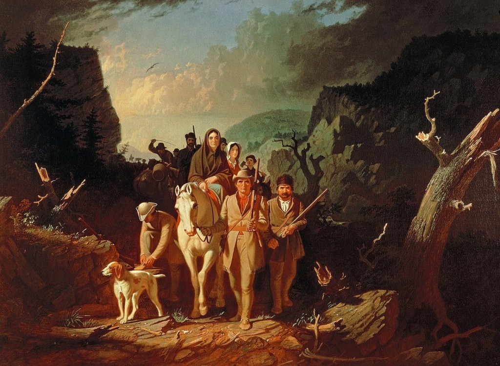
George Gatty had settled west of Dardenne Creek, (near the Intersection of Mexico and Jungerman Roads) where he built a home that he quickly turned into a fort to protect his family and neighbors. His neighbor, William Becknell, would first join Daniel Morgan Boone’s company – the U.S. Mounted Rangers. Later, Daniel Morgan’s nephew James Callaway took command of them. Becknell would join Capt.Callaway in Major Zachary Taylor’s campaign on the Sauk Indians, against the British, at the battle of Credit Island. Later Becknell would take command of Fort Clemson (a fort across from today’s Hermann Missouri) built by the Missouri Rangers on their way home from building Fort Osage. Becknell is considered the father of the Sante Fe Trail.
Other settlements were soon “forting up,” such as the home of Isaac Van Bibber, an adopted son of Daniel and Rebecca Boone. The farm of John Pitman, which he’d purchased from George Huffman, and included land previously purchased from the Cottle family, near today’s Cottleville was forted up. Capt. James White settled his family on land west of the Mississippi, east of Peruque Creek, south of the Quivre River, along the Salt River trail, and established White’s Fort. Tiny settlements ranged across the entire Territory. Settlements from Femme Osage to La Charrette to Cote Sans Dessein (near today’s Jefferson City) dotted the Missouri riverbank, and would soon become local “forts”.
The attacks increased. A newspaper report read:
“The family of Mr. Neal was killed in the district of St. Charles on the bank of the Mississippi by a party of unknown Indians; it was believed that the mischief was done by a party of Illinois … I saw the bodies, nine in number, principally females. “ Immediately after… Governor Howard sent orders to Col. Kibby, who commanded the St. Charles Militia to call out the portion of the men he had held in reserve, to march at a moments notice.” These troops were waiting for just such a moment.
On the 3rd of March in1812, Governor Howard acting on his own authority ordered a company of mounted riflemen raised, for 3 months, all from the District of St. Charles to be put under the command of Capt. Nathan Boone. Then he sought authorization for his actions from the President Madison. In May, word came “that a Federal Commission has come for Nathan Boone, as Captain, for a company of Rangers to be raised for 12 months.” Many of those finishing their 3 months of service eagerly rejoined for another 12. George Huffman’s son, Peter, served in Nathan Boone’s Militia, which officially was called the St.Charles Mountain Men. They earned 75c a day when serving on foot, and $1 when mounted. Boone’s log book refers to them as “Minute men.”
Back east, John Clopton, Congressman from Virginia stated:
“The outrages in impressing American seamen exceed all manner of description. Indeed the whole system of aggression now is such that the real question between Great Britain and the U.S. has ceased to be a question merely relating to commerce… it is now clearly, positively, and directly a question of our Independence.”
-
In 1808 General William Clark, asked for volunteers to accompany him and the Militia, under the command of Eli B. Clemson, to establish a fort and factory, Fort Osage, or Clark as referred to by some. They made 21 miles their first day, and camped near a chain of three small ponds, where Pond Fort would later be built. In September they arrived at what would become the most western point of Military occupation by the U.S. Government and within the Territory of Saint Charles at that time. The site had been chosen by Lewis and Clark years before. Young George Sibley was appointed factor there, and the government hoped to further friendly Indian relations. (The route was what later became the Boone’s Lick Road.)
There General William Clark began to negotiate a Treaty with the Osage, which would cede nearly 200 square miles of land between the Missouri and Arkansas River to the United States. Soon it was renegotiated, and on November 10th a Treaty negotiated by Auguste Choteau added “all claims to land north of the Missouri River” another 20 million acres, for an overall total of 50 million acres. Clark and Choteau thought with this Treaty would put an end to all of our Indian problems.
But much more would be needed to co-exist with the Native Americans. KaKaGiChe, a Sauk warrior had killed a trader at Portage des Sioux, Antoine Le Page. Two Iowa braves, White Cloud and Mera Naute killed Joseph Thibault and Joseph Marechel. In November, Governor Lewis gave Orders for 370 men to organize, arm and equip for actual service, to be the militia of the Territory of Louisiana. Each officer of that detachment was ordered to furnish himself with a sword, uniform coat and hat; non-commissioned officers were to furnish themselves with a good rifle, tomahawk, scalping knife, horn and pouch, 24 rounds of ammunition, a blanket and a knapsack. All of this created a false sense of peace, while the threat of attack was just a half day’s ride from St. Charles.
-
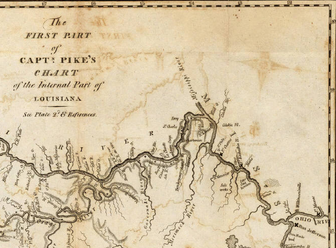
Tuesday, May 22, 1804 Journal entry of William Clark
a Cloudy morning Delay one hour for 4 french men who got liberty to return to arrange Some business they had forgotten in Town, at 6 oClock we proceeded on, passed Several Small farms on the bank, and a large creek on the Lbd. Side Called Bonom [Bonhomme-A Good Man- French] a Camp of Kickapoos on the St. Side Those Indians told me Several days ago that they would Come on & hunt and by the time I got to their Camp they would have Some Provisions for us, we Camped in a Bend 〈under〉 at the Mo: of a Small creek, Soon after we came too the Indians arrived with 4 Deer as a Present, for which we gave them two qts. of whiskey—
Course & Distance th 22d May
S 60° W. 3 ms. to a pt. Lbd Side S 43° W. 4 ms. to a pt. on Stbd. Side West 3 ½ ms. to a pt. on Stbd Sd. psd Bonon S 75° W. 7 ½ ms. to a pt. in Bend to Stbd Side at the mo. of Osage
Womans R18 This Day we passed Several Islands, and Some high lands on the Starboard Side, Verry hard water.
HOWELL’S FERRY
What was called Bonhomme in Clark’s journal is today the Wildwood/Chesterfield Bottoms, originally the site of towns called Bellefontaine, Gumbo and Centaur. Also, on the south side of the river is the plantation of Frederick Bates (1777-1825) Missouri’s Second Governor. He would use the Ferry to cross the Missouri River, which is the location of the Interstate 40/64 Bridge/Daniel Boone Bridge. On the north side of the river lay the plantation of Thomas Howell. Frederick Bates was Governor when St. Charles was Missouri’s First State Capitol, and died while in office.
Howell’s Ferry can be first found in records in 1804, and the journals of Captains Meriwether Lewis [1774-1809] and William Clark [1770-1838] as they embarked with their Corps of Engineers and enslaved man York. As the Company began their westward journey on May 22, 1804, several journals refer to their passing on what is called Bonhomme Creek on the south side of the Missouri River.[i] This was their first stop as they began their journey south of the village of St. Charles. This was also near the early Spanish settlement known as St. Andre, where the Spanish Commandant James Mackay oversaw the Spanish District up until 1804. Thomas Howell [1783-1869] was the son of a Francis Howell [1762-1834] who
“had emigrated to what is now the State of Missouri in 1797. He first settled thirty miles west of St. Louis, in (now) St. Louis county, where he lived three years, and then removed to (now) St. Charles county, and settled on what has since been known as Howell’s Prairie”[ii].
He had married Susannah Callaway [1791-1876] who was a sister of Capt. James Callaway [1783-1815], a grandson of Daniel Boone. Captain Callaway’s wife was Nancy Howell, a sister of Thomas.[iii] The Howells were one of many families that settled in St. Charles County at that time, following the migration of Daniel Boone’s family from Kentucky. Each of these families owned a large amount of those enslaved as well. In 1860, Thomas Hawel [sic] maintained a plantation that housed 20 enslaved individuals. Four of these men were between the ages of 20 and 35 years old.[iv]
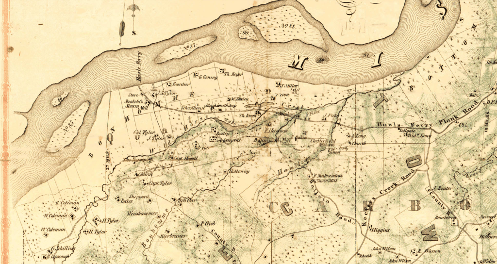
The Hawls [sic] Howell’s Ferry Crossing was an often used route of the Underground Railroad, a network used by freedom seekers, during the Civil War. Today, the African American community known as Westland is here.
NOTES
[i] Journals of the Lewis and Clark Expedition https://lewisandclarkjournals.unl.edu/item/lc.jrn.1804-05-22
[ii] Wildwood Historical Society Files retrieved June 2025.
[iii] Ancestry, Family Histories of Boone, Howell and Callaway families.
[iv] 1860 U.S. Federal Census Slave Schedules, National Archives Records Administration (Ancestry) for Missouri/St. Charles/Dardenne Filmstrip image 4.
This is the location of one of the oldest Presbyterian churches in the St. Louis area. The Reverend Salmon Giddings founded the Bonhomme Presbyterian Church in October 1816. It was the second Presbyterian church he founded in the Missouri territory. In 1841, the congregation built a stone church on Conway Road. The second church he established was in St. Charles.
General Zebulon Pike departed St. Charles Main Street from the Morrison Trading Post in 1806.
-

Monday 21st May 1804. Some rainy. we took on board Some more provision bread &c. about 4oClock P.M we Set out from this place. fired our bow peace and gave three cheers, and proceeded on in good heart, about __miles and Camped on the North Side. 2 frenchman went back to the village. two of our men Stayed at St. Charles in order to come on with the horses
Monday May 21st This morning we had some Rain, part of this day was employed in taking in Provisions &ca.— about 4oClock P.M. we took our departure from Saint Charles, a number of the Inhabitants had assembled to see us set off we fired our Swivel, from the Bow of our boat; and gave them three Cheers, which they returned; we then proceeded up the River about 3 Miles, and came to, on the North side of said River where we encamped. We sent two of our hands back to Saint Charles , in Order to bring on two of our Men, that were left with horses at that place. We found the current of the River very rapid, the Banks steep, & the bottom very miry. The course of the River running due West from its mouth this place. The country lying level, and very fertile.—
This is a journal entry (above) of Joseph Whitehouse (1775-?) served as a Private in the Lewis and Clark expedition, and is the author of one of the journals kept. He was a “skin dresser” which was a tailor, and made most of the clothing that the men wore on the expedition.
A portion of the map Lewis and Clark used (below) when they departed St. Charles on Monday, May 21, 1804. It was originally drawn in 1798 by Nicolas de Finiels and added to by James Mackay, James Evans, William Henry Harrison, Meriwether Lewis and William Clark.
Map is from the Library of Congress Geography and Map Division Washington, D.C. 20540-4650 USA dcu (URL http://hdl.loc.gov/loc.gmd/g4127m.ct000583 Library of Congress Control Number 2002621122
One of the members of the Lewis and Clark Expedition was an enslaved man named York (c 1770-c1815) who served as a manservant for William Clark for the entire expedition and afterwards. He also contributed to the expedition as a scout, hunter and negotiator with the Native Americans they encountered.
-
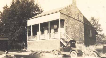
May 20, 1804 “The clouds continued to follow each other in rapaid succession, insomuch that there was but little prospect of it’s ceasing to rain this evening; as I had determined to reach St. Charles this evening and knowing that there was now no time to be lost I set forward in the rain, most of the gentlemen continued with me, we arrived at half after six and joined Capt Clark, found the party in good health and sperits. suped this evening with Charles Tayong a Spanish Ensign & late Commandant of St. Charles at an early hour I retired to rest on board the barge— St. Charles is situated on the North bank of the Missouri 21 Miles above it’s junction with the Mississippi, and about the same distance N. W. from St. Louis; it is bisected by one principal street about a mile in length runing nearly parrallel with the river, the plain on which it stands—is narrow tho’ sufficiently elivated to secure it against the annual inundations of the river, which usually happen in the month of June, and in the rear it is terminated by a range of small hills, hence the appellation of petit Cote, a name by which this vilage is better known to the French inhabitants of the Illinois than that of St. Charles. The Vilage contains a Chappel, one hundred dwelling houses, and about 450 inhabitants; their houses are generally small and but illy constructed; a great majority of the inhabitants are miserably pour, illiterate and when at home excessively lazy, tho’ they are polite hospitable and by no means deficient in point of natural genious, they live in a perfect state of harmony among each other; and plase as implicit confidence in the doctrines of their speritual pastor, the Roman Catholic priest, as they yeald passive obedience to the will of their temporal master the commandant. a small garden of vegetables is the usual extent of their cultivation, and this is commonly imposed on the old men and boys; the men in the vigor of life consider the cultivation of the earth a degrading occupation, and in order to gain the necessary subsistence for themselves and families, either undertake hunting voyages on their own account, or engaged themselves as hirelings to such persons as possess sufficient capital to extend their traffic to the natives of the interior parts of the country; on those voyages in either case, they are frequently absent from their families or homes the term of six twelve or eighteen months and alwas subjected to severe and incessant labour, exposed to the ferosity of the lawless savages, the vicissitudes of weather and climate, and dependant on chance or accident alone for food, raiment or relief in the event of malady. These people are principally the decendants of the Canadian French, and it is not an inconsiderable proportian of them that can boast a small dash of the pure blood of the aboriginees of America. On consulting with my friend Capt.C I found it necessary that we should pospone our departure untill 2 P M. the next day and accordingly gave orders to the party to hold themselves in readiness to depart at that hour.—
So writes Captain Meriwether Lewis in his journal entry for May 20, 1804. Definitely one of the earliest descriptions of St. Charles. Charles Tayong is actually Don Carlos Tayon, the former Commandant, that had been replaced by James Mackay. Describing our Main Street of about a mile long, that is actually the distance from Mackay’s home to its’ intersection with Jefferson St. This entry tells us that there are at least one hundred homes at that time, and a population of about 450 residents. There is a chapel, and a priest, which is today’s St. Charles Borromeo Catholic church . It is all elevated enough to keep it from flooding much, as the hillsides called petit Cote which means Little Hills in French, are what the area is generally known as. “These people are principally the decendants of the Canadian French, and it is not an inconsiderable proportian of them that can boast a small dash of the pure blood of the aboriginees of America” implies that a portion of the residents owned enslaved people. The journal entry is documentation, and a snapshot, of St. Charles in 1804, as we joined the United States as part of the Illinois Territory. The departure of Captains Lewis and Clark from St. Charles is one of the most important moments in our history.

The stone portion of the building is the home of James Mackay, Commandant of the Illinois Territory in 1804. It stood at 1017 South Main Street. “This is the site of the headquarters of James Mackay (sometimes referred to as Don Sanitiago Mackay) who was the Commandant for St. Charles from 1802-1804. The original building had been built of Burlington stone in 1797. When the Spanish appointed him to replace Carlos Tayon, his home was at today’s Chesterfield, across the Missouri River and west of St. Charles. A former explorer and fur trader, Mackay had led expeditions up the Missouri River creating the map that Lewis and Clark would later use for their famous 1804 expedition. In 1804, though aware of all the political negotiations of the time, for the Louisiana Purchase, Mackay would defy instructions by his Spanish government to block the expedition. Instead he met and conferred with its leaders. No doubt it was Mackay’s prescence that was one of the reasons that attracted the Corps to consider St. Charles their starting point.” [See Historic Main Street Tour https://storymaps.arcgis.com/stories/ef8dfd89425c46349ead22cd80213320]
-
Before we were St. Charles County Missouri, we were St. Charles County in the Missouri Territory. And before that we were Louisiana Territory. We were purchased as part of the Louisiana Purchase by Thomas Jefferson in 1804 from the French. But the French and Spanish had treatied and traded this land for years before that. And yes, before all of that, this was the home to thousands of Native Americans, many of which had previously lived further east. They had been forced west by the settlement in our original colonies, and then the “Far West” which Indiana and Illinois were once called. In other words, this land that we call St. Charles County now, has been home to many people and many cultures in these past 250 years.
In the 1760s, the French and Spanish had started sending explorers, in amongst the Native Americans. Soon French Canadians, who were having difficulties with the British, like we were, started looking for new locations to settle. People like Chouteau and Blanchette. Rivers were the pathways, used by both the Native Americans and the French and Spanish. While all of this was happening here though, America was being born. Based on the principles of Democracy, that we all fought hard for. And while we thought that those battles would never spill over into our territory, we were prepared and yet so happened the battle of San Carlos in St. Louis. By the late 1700s, Americans were looking for new territory to settle, and so came the first waves. Those that came had slaves. Many had come from Virginia, and Kentucky, which had just been carved out of the Commonwealth of Virginia. They were used to living under the Code Noir, the Black Code, which had dictated how they dealt with their property.
The Code Noir regulated the institution of slavery and the rights of all Black subjects–whether free or enslaved–within the French Empire. First issued as an edict under King Louis XIV in 1685, the Code Noir was enforced by French authorities in the Louisiana Territory as the nation expanded its landholdings in what would later become the United States. The Code Noir remained in effect after France ceded the Louisiana Territory to Spain in 1762 and remained on the books until the United States acquired these lands through the Louisiana Purchase of 1803-1804. Parts of the Code Noir would later show up in the Missouri State Constitution after statehood was acheived in 1821. [https://www.nps.gov/articles/000/transcription-of-the-code-noir-the-black-code.htm]
That is why when Missouri finally became a State in 1821, the issue of slavery was handled the exact same way it had been since 1685 under King Louis XIV. In looking back, that’s exactly where we started. And in 1821, it was very common for all of the property owners, to own enslaved property. And as property, they did not have names, they did not know things, as simple as their birthdate. We became a State that was built on the institution of slavery. The first settlers that settled St. Charles County, were people who built their homes with that labor. Whose meals were cooked, cattle were fed, and children were cared for by black people. They were there, and they have been invisible in our history, for way too long. Most of us didn’t learn it in school, and many of our children aren’t learning it today in our schools. We are removing it daily. Its’ time we acknowledge all history. Not just the good or bad, but the ugly as well. That’s how we learn from our mistakes. As Winston Churchill said
“The farther back you can look, the farther forward you are likely to see.”
History happens. I feel that as a writer, and a historian, its important to include all people and cultures. And, they should be honest and true, which takes research. Sometimes those are stories we don’t want to see or hear. What’s the old saying? The truth hurts. I like to compare “society” to a person. When a person is born, they are a blank slate. Their parents are their first teachers. One of the first words a toddler learns is no. And when they make a mistake, they learn the meaning of no, and they don’t repeat it hopefully. And when they reach school age, a whole new world opens open. And as they learn about that world, if they don’t learn about the mistakes, they won’t know how not to repeat them. I’m still learning, always searching for the truth, the whole story, and to know what really happened. And then I will share it as best I can. The stories shared here are my own.
If you would like to subscribe to this blog by Dorris Keeven-Franke about St. Charles County History, enter your email and you will get a free dose of history daily…
-
In 2023, a small one-acre plot of land called Smith Chapel Cemetery was recognized by the National Park Service’s Program, the NATIONAL UNDERGROUND RAILROAD NETWORK TO FREEDOM, due to the resilience and courage of three enslaved men who were seeking their freedom using the Underground Railroad. In the winter of 1864, at the height of the Civil War, they would flee their enslavers and join the Union Army’s U.S. Colored Troops.
In 2024, the Wesley Smith Church in Wright City was granted funds for a project funded by the National Park Service’s NATIONAL UNDERGROUND RAILROAD NETWORK TO FREEDOM for the Smith Chapel Cemetery Restoration, to enable them to hire a professional Cemetery Restorer named Jerry Prouhet and for historian and writer Dorris Keeven-Franke to work with Professor Grace Moser and her students at St. Charles Community College. The students are taking the Service Learning Class American History 101 and 102 and are helping to research the signs that will be erected to tell the story of Smith Chapel.
In February 2025, Journalism Students from the University of Missouri in Columbia became aware of the project, and wanted to learn more about the cemetery and its’ people. Join us on August 23, 2025, in Oglesby Park, 2801 W. Meyer Road, (St. Charles County Parks) in Foristell, from 6pm til Sunset as we premiere their documentary called BURIED HISTORY, UNCOVERED STORIES. The public is invited; this event is being held by those working on the cemetery, who want to share the story with everyone. The screening will be outdoors in the pavilion at the back of the Park near the Douglass Schoolhouse. Please bring lawnchairs. For more information, email stcharlescountyhistory@gmail.com
For more about Smith Chapel Cemetery, see smithchapelcemetery.com
To receive a free daily email with more St. Charles County Stories….

-
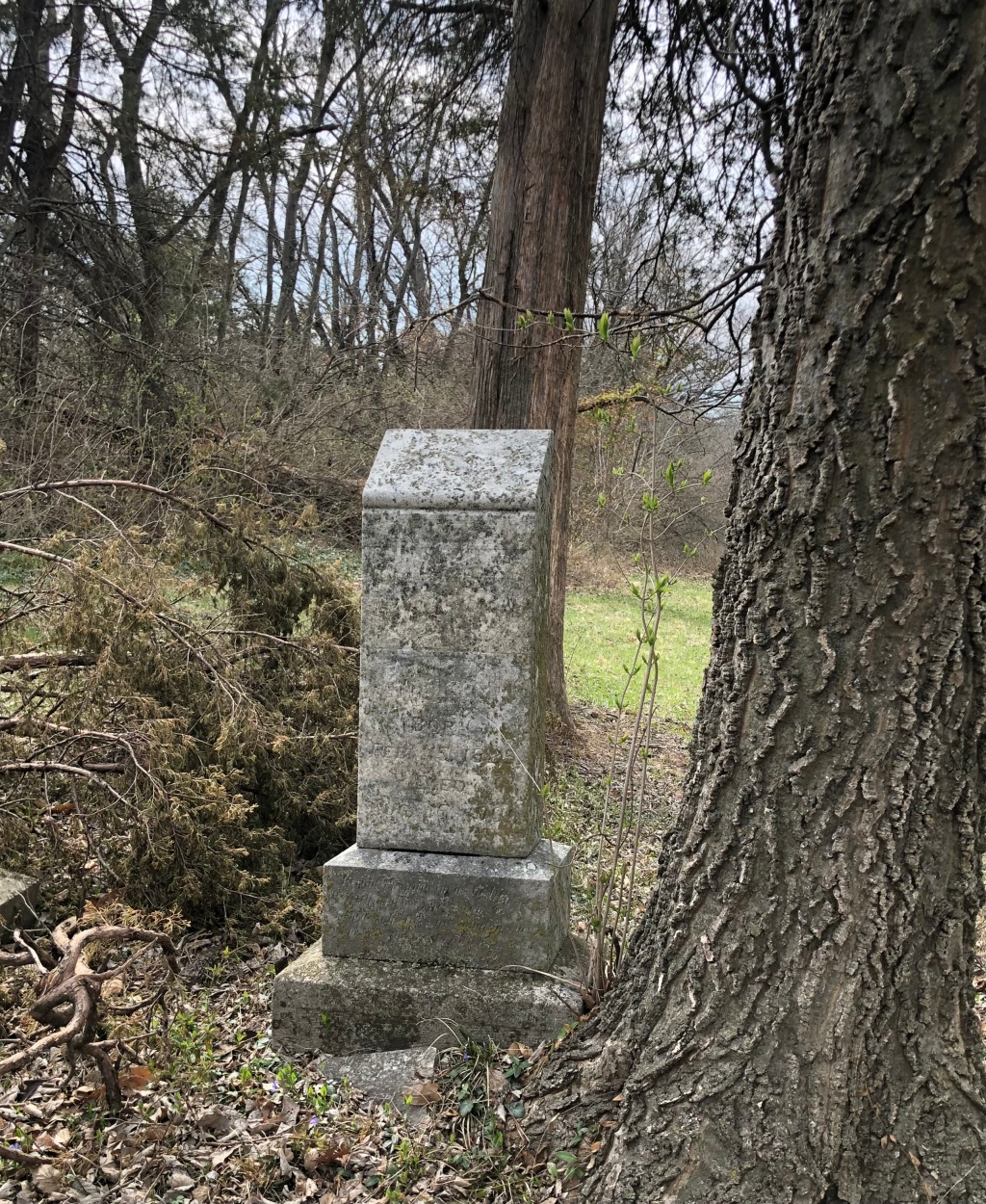
Many of St. Charles County’s enslaved men would resist enslavement and risk everything to enlist in the U.S. Colored Troops. Leaving families behind, they used the network to freedom known as the Underground Railroad to enlist in the U.S Colored Troops during the Civil War. One man named Benjamin Oglesby was born in Bedford, Virginia in about 1821 while his mother’s enslaver was Marshall Bird. Benjamin was brought to Missouri by Bird around 1830 and according to St. Charles County historian Ben Gall “settled in property that sits to the southeast of the park along Meyer Road, in Sections 18 and 19 of Township 47 Range 1 East. During this time, Oglesby lived among seven other enslaved people while working the 260-acre farm. On this farm, he worked to cultivate corn, wheat, and tobacco, the last of which was their primary crop, producing 7000 pounds in 1860 alone.“ He would jump the broom and take a wife named Martha Bird, who he called Patsy, and together they would have eight children, Dora, Mary, Samuel, Sarah, Sophia, Oska, Albert and Belle. On November 14, he and several other St. Charles County slaves had left their owners and enlisted in the U. S. Colored Troops at George Senden’s store on Main Street. Soon after Oglesby was formally mustered into Company D as a Private of the 56th Infantry of the Union’s U.S. Colored Troops, at the age of 43 at Benton Barracks. His enrollment card says he is “copper-skinned, had grey eyes and black hair and was 5 feet 8 inches tall. “
His Regiment, the 56th U.S. C.T. would see action in 1864 at Indian Bay on April 13, at Muffleton Lodge on June 29, they were in charge of operations in Arkansas July 1-31. They then saw action at Wallace’s Ferry and Big Creek on July 26, 1864. Their expeditions took them from Helena up the White River from August 29 till September 3. Another expedition would take them from Helena to Friar’s Point, Mississippi, on February 19-22, 1865. They then had post and garrison duty at Helena, Arkansas till February of 1865. After the war ended, they had duty at Helena and other points in Arkansas till September 1866. The entire regiment was finally completely mustered out on September 15, 1866. The Regiment lost four Officers and twenty-one enlisted men who were killed or mortally wounded and they lost two Officers and 647 Enlisted men by disease.” Oglesby’s Muster Card indicated he was honorably discharged on November 13, 1865, at Helena, Arkansas, and was still owed $66 of his $100 enlistment bounty.
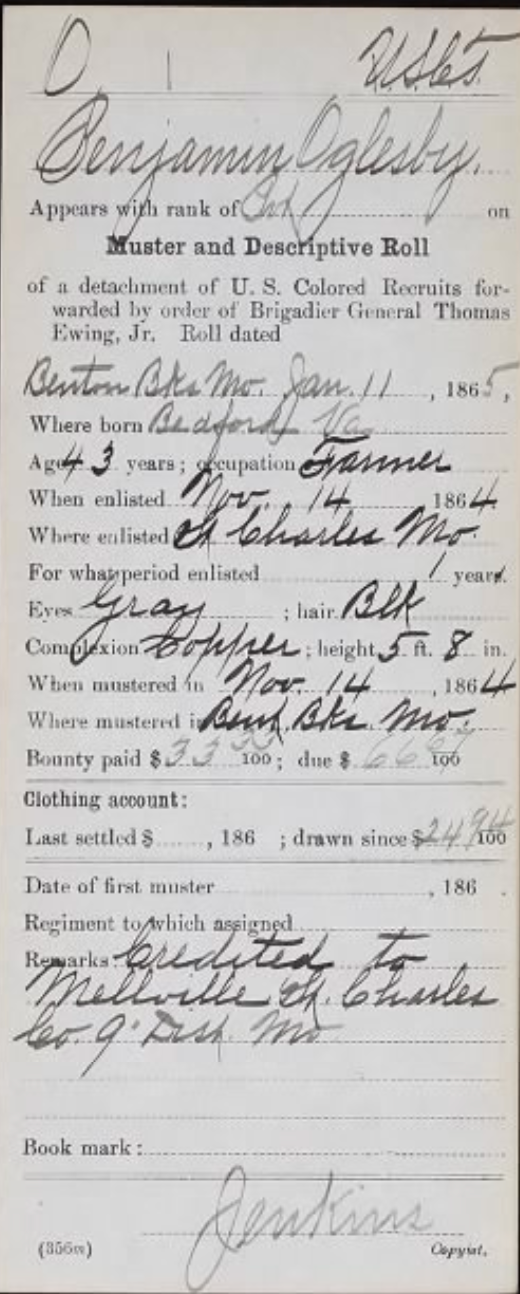
When he returned home, he and Patsy would rent a house and live south of Foristell, near Painter’s Store on the Boone’s Lick Road (Hwy N) where it crosses into Warren County (Hwy O today). Benjamin and Patsy would have four more children, Charles, Walter, Mount and Allie. According to Ben Gall “On March 2, 1871, Benjamin Oglesby purchased the property located along Meyer Road for $2000 from William Haggemann, who may have been a German immigrant. It appears that he acquired the funds for this land through a Deed of Trust, which they entered into with Henry Reinecke in March 1871. They paid off the property on March 14, 1877.
That September, on the 23rd, in 1871, Benjamin’s son-in-law Jackson Lockett, along with Austin Pringle (who was Smith Ball’s father in Law), Nathaniel Abington, Smith Ball, David Bird, Thomas McClean, Mark Robinson, Clayborn Richards, and Martin Boyd would become the Trustees for the Smith Chapel A.M.E. Church and Cemetery at Snow Hill. There the one-acre of land would have one-third dedicated to a black school, named Douglass after Frederick Douglass. The small one-room schoolhouse would be attended by area children until 1951 at least. The school has been moved to Ogelsby Park, where the Ogelsby family once lived, and a mile from the cemetery. The cemetery is less than a 1/4 mile north of Interstate 70 near Foristell.

Benjamin’s wife of over forty years, Patsy, would pass away on the 12th of August 1888 and be buried at Smith Chapel Cemetery at age 58 years old. The family would attend their church, teach their children, and bury their family all at Smith Chapel. Then on the 15th of August 1901, Benjamin Oglesby would join Patsy in the cemetery. There his stone reads Behold the pilgrim as he lies, With glory in his view, To heaven he lifts a longing view, And bids the world Adieu.

Smith Chapel Cemetery is on the National Underground Railroad Network to Freedom.
-

Several men, including Benjamin Oglesby, for whom St. Charles County Park Oglesby Park is named, served in the U.S. Colored Troops. Oglesby served in the 56th. There are still many families whose families served in the U.S. Colored Troops during the Civil War…
The War Department issued General Order #143 on May 22, 1863, to facilitate the recruitment of African-American soldiers to fight for the Union Army. The US. Congress passed the Second Confiscation Act in July 1862, which freed slaves whose owners were in rebellion against the United States, and the Militia Act empowered the President to use free blacks and former slaves from rebels states in any capacity in the army. President Lincoln was concerned that the four border states, of which Missouri was one. Lincoln opposed early efforts to recruit black soldiers, although he accepted the Army using them as paid workers. Lincoln issued his Emancipation Proclamation on September 22 announcing that all slaves in rebellious states that had seceded would be free as of January 1. Recruitment of colored regiments began in full force following the Proclamation in January 1863.
Approximately 175 regiments comprising more than 178,000 free blacks and freedmen served during the last two years of the war. Their service bolstered the Union war effort at a critical time. By the war’s end, the men of the USCT made up nearly one-tenth of all Union troops. The USCT suffered 2,751 combat casualties during the war, and 68,178 losses from all causes. Disease caused the most fatalities for all troops, both black and white. In the last year-and-a-half approximately 20% of all African Americans enrolled in the military lost their lives. Notably, their mortality rate was significantly higher than white soldiers.
Before the USCT was formed, several volunteer regiments were raised from free black men, in the South. The first engagement by African-American soldiers against Confederate forces during the Civil War was at the Battle of Island Mound in Bates County Missouri on October 28–29, 1862. African Americans, mostly escaped slaves, had been recruited into the 1st Kansas Colored Volunteers. They accompanied white troops to Missouri to break up Confederate guerrilla activities based at Hog Island near Butler, Missouri. Although outnumbered, the black soldiers fought valiantly, and the Union forces won the engagement. The conflict was reported by Harpers Weekly. There were 114,931 enslaved men, and 3,572 freedmen in Missouri, yet there were 8,344 men who enrolled.
After considerable foot-dragging, General John Schofield finally allowed the recruitment of Missouri slaves into the Union Army. The first regiment began to take in recruits in June 1863 and was finally organized in August. To sooth the political feelings of proslavery Unionists in the state and at the request of Missouri’s Provisional Governor, Hamilton Gamble, the new regiment was designated the 3d Arkansas Infantry, African Descent, even though its soldiers were Missourians. Schofield ordered that slaves who were accepted for the army be given a certificate declaring that they were forever free. To placate their owners – at least those who were loyal – the government would allow them to claim $300 per man who were successfully mustered into service. Schofield did not, however, initially permit recruiting officers to travel to the field for men. Rather, they were directed to set up offices in the towns. That meant that slaves who wished to join had to run away from their masters (or seek their consent). Contrary to standing orders, slave patrols were revived in some counties for the express purpose of preventing bondsmen from enlisting. Some slaveholders sought to evade recruiters by selling their slaves to persons in Kentucky until the practice was outlawed in March 1864.
On Jan. 7, 1864, the St. Charles Cosmos newspaper reported
“The Corps D’Africque, George H. Senden is making commendable progress in his task of enlisting American soldiers of Aftican descent to help fight the great battle against slavery. Notwithstanding the intense bitter and most intolerable cold of New Years, and the days that followed it, he has enlisted some thirty-two “swarthy sons of toil, who are willing to peril their lives for freedom, and the prospects are decidedly favorable for many more.
Owners, if they could prove their loyalty, received $300 for each slave enlisted. The men received $10 per month – $3 less than white troops – and their officers were allowed to withhold $3 a month for clothing, a charge not levied on white troops. At the time the blacks were enlisting, white troops who volunteered received bonuses of $302 to $402.
The regiment was redesignated as the 56th U.S. Colored Troop Infantry on March 11, 1864, as part of the general reorganization of black regiments in the Union Army. Its first commander was Col. Carl Bentzoni, a Prussian-born sergeant in the 1st U.S. Infantry of the Regular Army prior to his assignment to command black troops. The 56th USCT remained on post and garrison duty at Helena. A member of Company G was its First Sergeant, James Baldwin (also sometimes rendered Balldon). He claimed to have escaped from a slave owner named Joseph Montgomery. Montgomery was a Natchez merchant and the owner of 180 slaves. Baldwin made his way to Helena, and was apparently sent to St. Louis in 1863 by the General Benjamin Prentiss, then the commander in eastern Arkansas. He joined the Third Arkansas in the summer of 1863. (After the war, a William Dunning from Buchanan County (St. Joseph) said that Baldwin’s name was actually Willie or Willis and previously belonged to him.) Baldwin was evidently very intelligent and reliable, for he held the post as the top enlisted man in the company
Some of the masters and mistresses treated soldiers’ wives and children badly. For example, Private Andrew Hogshead received a letter from his wife Ann that read, “You do not know how bad I am treated. They are treating me worse and worse every day. Our child cries for you. Send me some money as soon as you can for me and my child are almost naked. My cloth is yet in the loom and there is no telling when it will be out. Do not send any of your letters to Hogsett [her owner] especially those having money in them as Hogsett will keep the money.” A Union officer reported that wives of Simon Williamson and Richard Beasley “have again been whipped by their Masters unmercifully.” Their owner tried to prevent them from going to the post office to pick up mail and if they did get mail, the master was “sure to whip them for it if he knows it.”Lieutenant William Argo wrote from Sedalia that the families of black soldiers were being driven from their masters’ homes. He was directed to send them to a contraband camp at Benton Barracks in St. Louis. In the first three months of 1864, the camp received 947 men, women and children; 330 left on their own; 234 were hired out to “loyal responsible persons”; 101 died; and 268 remained – 165 in the hospital.
In August 1863, about five hundred men under Major Moses Reed embarked on the steamboat Sam Gaty for Helena, Arkansas, a town that would be their duty station for the next three years. The rest of the regiment arrived in February 1864. Helena was captured by Union troops in 1862. Almost immediately, slaves began to flock there. After the issuance of the Emancipation Proclamation, literally thousands arrived. Conditions at Helena were atrocious. Former slaves sought shelter in abandoned buildings, barns, caves, discarded tent, brush shelters, and rude huts in an area called “Camp Ethiopia.” Helena’s commander was “at a loss to know what to do with them.” By the summer of 1864, there were 3,300 black civilians living in the town.
Helena Arkansas Helena, Arkansas had been captured by Union troops in 1862. -The 56th’s experience proved the city to be one of the unhealthiest spots on the Mississippi. Overall, in its three years there the regiment lost about 500 men to disease – typhoid, malaria, chronic diarrhea (probably dysentery), smallpox, measles, and cholera.For the most part the regiment performed mostly boring garrison duties. They maintained forts and guarded warehouses. A few hundred men were sent downriver to Island No. 63 to protect a woodyard that supplied fuel for steamboats. Conditions at Island No. 63 were no better than Helena, and several men died there of various diseases.
They would also see Action at Indian Bay April 13, 1864 Then at. Muffleton Lodge June 29. They were on Operations in Arkansas July 1-31. . On July 26, 1864, near Wallace’s Ferry in Arkansas, the unit (now re-designated as the 56th United States Colored Infantry Regiment), along with the 60th Colored Infantry regiments and Battery E of the 2nd U.S. Colored Artillery were attacked by a superior force of Confederate cavalry commanded by Col. Archibald S. Dobbins. Supported by about 150 men from the 15th Illinois Cavalry, the infantry regiments organized a fighting retreat and at a crucial moment in the battle made a counter charge into the enemy line. The unit was praised by the commander of Battery E in his after action report.
HDQRS. BATTY. E, SECOND U.S. COL. ARTY. (LIGHT), Helena, Ark., July 29, 1864.
SIR: I have the honor to report that on the evening of July 25, at 4.30 p.m., in company with Colonel Brooks, of the Fifty-sixth U.S. Colored Infantry, in command of detachments from the Fifty-sixth and Sixtieth U.S. Colored Infantry, with one section of Battery E, Second U.S. Colored Artillery (light), commanded by Capt. J. F. Lembke, we moved out on the Little Rock road with orders to guard the crossing at Big Creek, eighteen miles from this place….Colonel Brooks with part of the infantry crossed over to make a reconnaissance. In less than an hour he returned, reporting no enemy in that vicinity, and at once ordering the force left in the rear forward, and that breakfast be got and the teams watered and fed. Before the teams were all un-hitched it was rumored that the enemy was advancing upon our rear. I at once got the rifled gun into position about 200 yards from the creek and facing our left, and awaited their approach. The enemy were concealed in the thick timber and were within 150 yards of us before I opened on them, when they charged with a yell, but being well supported by Captain Brown, of the Sixtieth, with sixteen men, and Captain Patten, of the Fifty-sixth, with twenty-five men, and using canister rapidly and carefully, we repulsed them….
During the whole fight the colored men stood up to their duty like veterans, and it was owing to their strong arms and cool heads, backed by fearless daring, alone that I was able to get away either of my guns. They marched eighteen miles at once, fought five hours, against three to one, and were as eager at the end as at the beginning for the fight. Never did men, under such circumstances, show greater pluck or daring.
I am, very respectfully, your obedient servant,
H. T. CHAPPEL,
First Lieutenant.
Colonel Brooks of the 56th was mortally wounded early in the action and Lieutenant Colonel Moses Reed assumed command. The 56th and the other Union forces made their way back to Helena. Union casualties in the battle were 19 killed, 40 wounded, and four missing. Confederate losses are unknown. Colonel Brooks was replaced by Colonel Charles Bentzoni in January 1864. Bentzoni was born in Prussia. He served in the Prussian and British Armies before enlisting in the regular army in 1857 at the age of twenty-seven. A sergeant at the beginning of the war, he was commissioned in the Eleventh United States Infantry Regiment in November 1861. He spent most of the war at Fort Independence in Boston Harbor training recruits. He finally made it to the battlefield and fought with distinction, receiving a brevet captaincy for gallantry at the Battle of Peebles Farm (or Poplar Springs Church) on September 30, 1864, as part of the siege of Petersburg. One of his fellow officers in the Eleventh Infantry was John Coalter Bates, the son of Edward Bates. (The younger Bates stayed in the Army and retired as a Lieutenant General in 1906 after serving as the Army’s Chief of Staff.) [i] “I have evidence that the enemy murdered in cold blood three wounded colored soldiers who were left on the battle-field on the 26th ultimo, and that yesterday they murdered two which they found at the plantations unarmed.”
In his official report, Brigadier General Joseph O. Shelby, C.S. Army, who was the superior of Colonel Dobbins provided this summary:
“Colonel Dobbin and Gordon, immediately after their fight of July 26, made a forced march upon the Federal plantations near Helena and harried them with a fury greater than a hurricane. They captured 200 mules, 300 negroes, quantities of goods and clothing, and killed 75 mongrel soldiers, negroes and Yankee schoolmasters, imported to teach the young ideas how to shoot.”
Bentzoni and the Fifty-Sixth helped two Quakers from Indiana, Alida and Calvin Clark, move an orphanage and elementary school for blacks away from disease-infested Helena to a more healthful site nine miles northwest of town. The Clarks expanded this institution into what became Southland College, the first academy of higher learning for African Americans west of the Mississippi. Bentzoni also attempted to protect freedmen from exploitation by their former owners and “other evil-disposed persons.” He ordered that such miscreants be brought before military commissions for keeping their former slaves “restrained from their liberty” and violating contracts of employment entered after the slaves were freed by the Emancipation Proclamation.
-

After nine trustees, purchased one acre of land from William Potes, in 1871, they would establish Douglass School for their children, Smith Chapel A.M.E. for the church, and a graveyard for their loved ones. Several that are buried in the cemetery are veterans that served either in the Civil War or World War I, but none are marked with military markers at this time (2025). The beautiful cemetery is an island of quiet near Interstate 70 in Foristell. In 2023, the historic cemetery was listed on the National Park Service’s National Underground Railroad Network to Freedom because of the burial location of Smith Ball, Martin Boyd and Benjamin Oglesby, all freedom seekers that would flee their enslavers. They would return home after serving in the Union Army during the Civil War and purchase the small parcel of land for $40.

Today, the cemetery is still lovingly cared for by members of the Wesley Smith Church in Wright City, many of whom are descendants of the Smith Chapel A.M.E. There is no longer a church building and the Douglass schoolhouse has been relocated to the St. Charles County Ogelsby Park, which is located on the former farm of Benjamin Oglesby. The Cemetery would receive a grant from the Network to Freedom for 2025, to restore the broken stones in the cemetery, and to place four informational signs at the cemetery to tell the story of Smith Chapel. Historian Dorris Keeven-Franke is working with Professor Grace Moser of St. Charles Community College and her students to help with the physical restoration, research and help write the history for the signs, and to collect Oral Histories from the descendants. They also hope to place signs for all of the Veterans buried there.
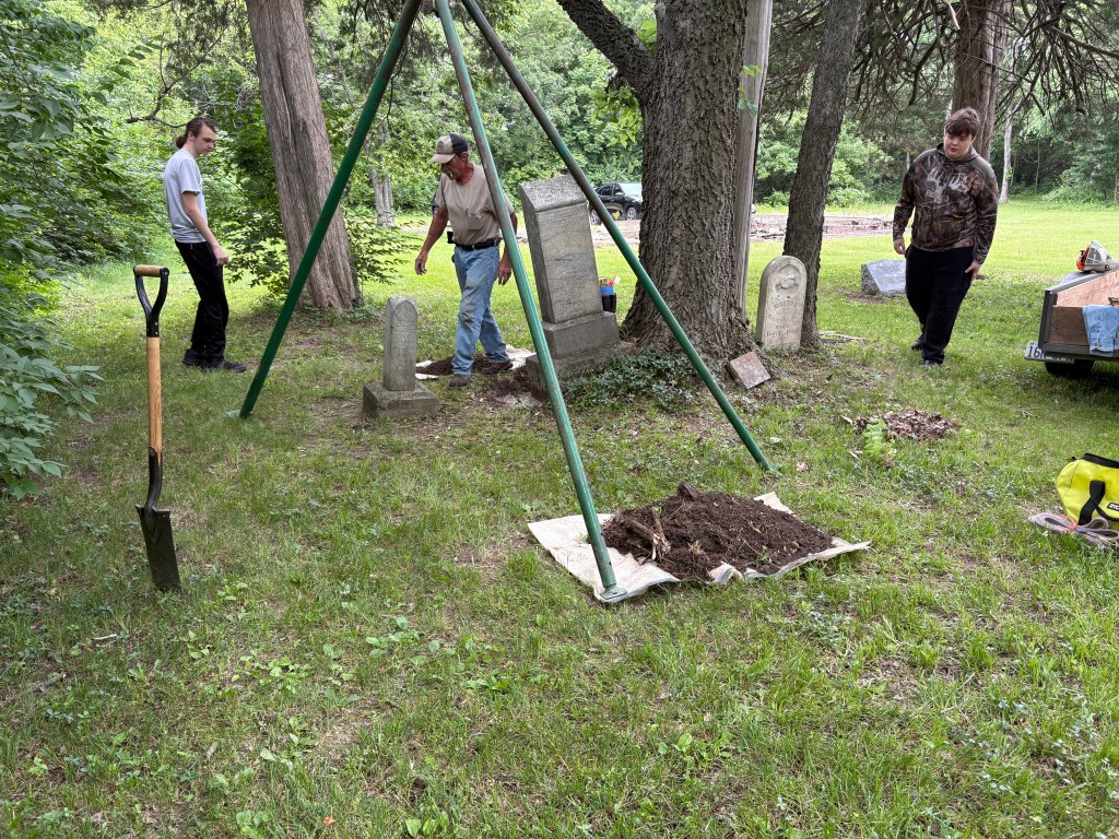
We have compiled a working list of those we believed are buried in Smith Chapel, and the students have also located more. If you know of anyone or have loved ones buried at Smith Chapel we would love to hear from you by using the contact form found at the bottom of this blog.
- SURNAME – FIRST – MAIDEN – BIRTH – DEATH
- Abbington Benjamin B. 1862 1938
- Abbington Katy Smith 8/9/1895 11/29/23
- Abington Chauncey B. 1892 1954
- Abington Katy M. Smith 1894 11/29/23
- Abington Nathaniel 1830 1899
- Ball Asulia A 1867 1882
- Ball Baby 1930
- Ball Edgar Clinton 1904 1992
- Ball Emmer Lee 1868 1893
- Ball Gertrude M 1876 1893
- Ball John H. 1863 1893
- Ball Julia S. 1871 1892
- Ball Lucy P. Jackson 1908 1981
- Ball Minerva Pringle 1847 1899
- Ball Minney C. 1873 1889
- Ball Smith 1833 1912
- Ball William Everett 1861 1886
- Bird Cornilea 1841 1887
- Boyd Lawrence 1899 1958
- Boyd Martin 1826 3-Dec-12
- Brown Georgie Anna 1877 1932
- Brown L. B. 1916
- Carter Cuffy 1873
- Carter P. D. 1890 1918
- Clark Eva T. Smith 1892 1930
- France Vera M. Sanders 1923 1959
- Francis Mary
- Gibson Edward 1879 1927
- Gibson Edward 1-Jun-14 15-Mar-63
- Gibson Eva M 6-May-11 26-Dec-14
- Gibson Infant Boy
- Gibson Mary E 1915 1915
- Gibson Ruth Atkins 1926 1926
- Grady Carrie 1876 1936
- Hall E. J.
- Hedrick Helen
- Hill George H 1894 1967
- Hubbard Harat 1857 1874
- Hubbard Wesley 1844 1918
- Hunter Leora H. 1888 1971
- Jackson James 1910 1927
- Jackson James Henry 1873 1939
- Jackson Mattie L. Carter 1873 1945
- Jackson Wesley S. 1898 1947
- Keithley Qweenie Brown 1869 1932
- Keithley Warren 1844 1932
- Kenner Ellie 1855 1889
- Lanier John W. 1852 1882
- Lanier Louisa 1882
- Lockett Dora Oglesby 1849 1946
- Luckett August Griffin 1897 1955
- Luckett Berta Hubbard 1847 1936
- Luckett Cecil M. 1913 1971
- Luckett Eddie 1882 1884
- Luckett George 1860 1934
- Luckett Kathleen Barbara 1943 1962
- Luckett Lauretta A. Salllee 1920 2013
- Luckett Leon Wesley 1920 1953
- Luckett Maggie 1888
- Luckett Margaret 1867 1927
- Luckett Mary Lee 1903 1962
- Luckett Phyllis A Abington 1865 1954
- Luckett Robert 1899 1920
- Luckett T.W. 1852 1881
- Martin Collette May 1919 1991
- Mathews Maymie May Luckett 1890 1946
- Mathews Nancy 1826 1904
- Matthews Charles 1888 1973
- Matthews Robert C 1952 1967
- Moore Jennie Collins/Carter 1860 1923
- Oglesby Addie Carrie Sanders 1906 1990
- Oglesby Albert 1860 1911
- Oglesby Allie 1874 1913
- Oglesby Arzelia S. 1886 1887
- Oglesby Benjamin 1825 1901
- Oglesby Charles 1868 1942
- Oglesby Charles 1926 1974
- Oglesby Charles H. Jr. 1926 1974
- Oglesby Cora Belle Edwards 1874 1911
- Oglesby Cornelia M. Abington 1866 1890
- Oglesby Edmund “Mount” 1877 1950
- Oglesby Infant Son 1889 1889
- Oglesby Lenard S 1887 1929
- Oglesby Lula 1890 1902
- Oglesby Martha Byrd 1835 1888
- Oglesby Naomi Cora 1910 1911
- Oglesby Samuel 1854 1876
- Oglesby Walter 1871 1947
- Pratt Reuben 1808 1877
- Pratt Susan 1818 1884
- Sanders Alfred 1910 1964
- Sanders Charlotte 1921 1984
- Sanders David Garfield 1881 1951
- Sanders John 1874 1929
- Sanders Lena Ora Simms 1881 1955
- Smith F. E. 1910 1910
- Smith H 1895 1918
- Smith Helen Mozetta Hill 1929 1964
- Smith Joel G. 1913 1913
- Smith M. G. 1904 1906
- Smith Mary Frances 1848 1880
- Smith Rachael D. 1825 1911
- Smith Robert S. 1844 1911
- Smith Sarah Abington 1855 1935
- Smith W. R. 1907 1908
- Sullivan Ella May 1904 1937
- Trout George A. 1880 1883
- Washington, George
- Washington Jullia 1845 1932
- Welch Lavinia (Larrian?) Peyton 1865 1885
- Welch Susan L. 1861 1885
- Whitehead Enis (Elis?) 1811 1873
- Whitehead Hattie 1895 1913
- Wyatt Anna Stacy 1911 1932
- Wyatt Katherine 1864 1883
If you know of someone who is buried in this cemetery, we would like to hear from you. Please use the form below.
FOR MORE ABOUT THE HISTORIC SMITH CHAPEL CEMETERY SEE https://smithchapelcemetery.com/
TO SUBSCRIBE TO STCHARLESCOUNTYHISTORY.ORG AND RECEIVE A DAILY DOSE OF HISTORY
-

St. Charles County saw many enslaved men, seek their freedom during the Civil War by joining the U.S. Colored Troops. Over 8,300 enslaved men from Missouri served in the U.S. Colored Troops during the Civil War. There were 114,931 enslaved people in the state in 1860. But it would not be until Lincoln’s Emancipation Proclamation took effect in January of 1863, that they could even enlist. And since Missouri was a border state, the Emancipation Proclamation did not apply. Many owners were sympathetic to the Union, and would allow their men to enlist, but they also could claim the $300 bounty that the Government was paying. If an enslaved man’s enslaver was of Confederate sympathies, of course he would not allow them to leave. In that case, if an enslaved man took matters into his own hands, and took the risks of escape, he could earn that same Bounty for himself! Three St. Charles men, Benjamin Ogelsby, Martin Boyd, and Smith Ball would make that dangerous journey, and join the Union troops. In 1864, over 10% of the Union Troops would be made up the U.S. Colored Troops. But many of them would die of disease before returning home.
The Civil War ended in 1865, and by 1871, many of those former soldiers dreamed of a new life for their families now living in freedom. Nine men came together, and with their funds purchased one acre of land from a white landowner, who was a German and had also fought in the Union Army, named William Potes. There they would established one more stop for the Methodist ministers, in the African Methodist Episcopal Church, that traveled across St. Charles County. Joining the St. Charles Conference that had been established at St. Charles following the war, Sage Chapel at O’Fallon, Grant Chapel in Wentzville, they named their new church Smith Chapel at Snow Hill. Today this is the City of Foristell.
On September 23, 1871, Benjamin Oglesby’s son-in-law Jackson Luckett, along with Nathaniel Abington, Austin “Oss” Pringle, his son-in-law Smith Ball, David Bird, Thomas McClean, Mark Robinson, Claiborne Richards, and Martin Boyd became Trustees for the newly established Smith Chapel African Methodist Episcopal Church and Cemetery at Snow Hill. All are thought to have been born enslaved, and at least five of the nine trustees had been freedom seekers. Nathaniel Abington, Smith Ball, David Bird, Thomas McClean, and Martin Boyd had all served in the U.S. Colored Troops.
One acre of land was purchased by the Trustees from the adjoining 105-acre farm of William W. Potes farm . The deed filed in the St. Charles County Recorder of Deeds Book 12, Page 38, is dated 23 September 1871 stated:
One acre of land on the S side of the N ½ of the SW ¼ of the NE ¼ of Section No 19 Twp 47 R 1 E beginning at a certain Rock in the Public Road Eight chains E of the SW corner of the farm now owned by W.W. Potes, then E 4.50 chains thence N 2 chains and 11 2/9 links; thence w 4.50 chains, thence S 2 chains and 22 2/9 links, to place of beginning. The said parcel of land to be divided in three equal lots, the E lot to be used for the cemetery, the center lot to be used for church purposes, and the W lot to be used for school purposes the said parcel of land to be held and controlled by the present trustees and their successors in Office of the M.E. Church at Snow Hill, MO, organized for colored people
The original church burnt down during the late 1800s, according to an interview with George Abington (1928-2019) whose grandmother Sarah Abington Smith attended the church lived one mile away, and as a child attended the school in the 1930s. Abington’s great-grandfather Nathaniel Abington is one of the original trustees and a founder of the church, and one of the earliest burials in the cemetery. A second church was built over the foundation of the original church but was lost in the 1960s when Douglass School closed. Research has not revealed the actual cause or date yet. The footprint of the church can still be seen today. George Abington shared many fond memories of how all of the AME Churches along the circuit would come together at Camp Meetings every summer, and how it provided an opportunity to visit with other family members that lived in those communities as well. [i]
Smith Chapel A.M.E. has weathered many storms, and has witnessed many funerals in its’ cemetery. The loved ones lie close by in the cemetery on that one acre of land, still cared for by descendants of the original founders. They still recall the Church Rallies that brought together all of the families, and choirs from the other churches, and the gatherings that would last all day! Carry in dinners, while each pastor took a turn at a sermon, and blessed the meals, the children raced through the grounds with carefree abandon. These were good times, and happy times, that still echo on this hallowed land.
For more see smithchapelcemetery.com
[i] This unrecorded interview was done by the author in 2012 when conducting genealogical research for Mr. George Abington, whose grandmother was Sarah Abington Smith, and whose great Grandfather was Nathaniel Abington.
There are many families that still live in the area that have ties to Smith Chapel Cemetery. If you can contribute photos that may be copied, or would like to share any other information, I would love to hear from you.
SUBSCRIBE TO ST. CHARLES COUNTY HISTORY AND GET A DAILY DOSE OF HISTORY
-
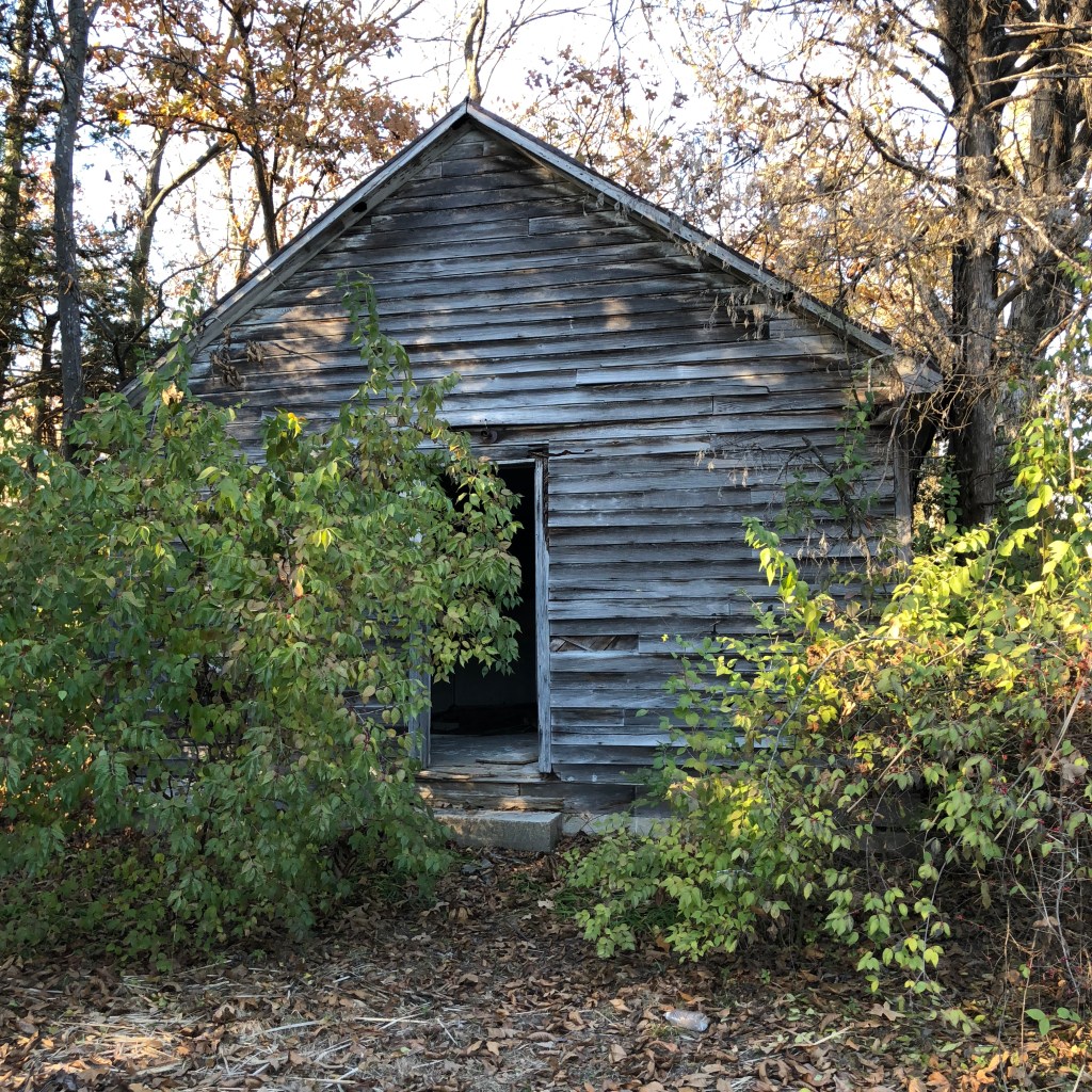
In 1871, one of the proudest moments for the Trustee’s of the Smith Chapel A.M.E. Church was to build a schoolhouse for their children, grandchildren and all future generations. This was a generation that it had been against the law written in 1847, for them to even learn how to read or write. They proudly named it Douglass after the great American Orator named Frederick Douglass.
Douglass school replaced an earlier log school for the area’s African American families in the early 1900s. Teachers included Mrs. Marie Washington, Mrs. Woods, Mary Troutt, Mr. Wolfolk, and Vernell Miller, who was the last teacher before desegregation in the 1950s. At its’ height in the 1930s, enrollment totaled thirty to thirty-eight students in the combined grades of one thru eight. There were never enough desks and always a shortage of materials, students frequently sat two to a desk. The materials, books, and erasers, were handed down from the Foristell white school. The school day began promptly at 9:00 with prayer, pledge, and a song, and ended at 4:00 pm. Many of the students who attended walked. Most lived a mile or more from the school and would not arrive home until after dark during the winter months. Electricity or plumbing was never installed in the building and heat was provided by a centrally located coal stove. For several years they drew their water from a well located a few yards from the school.*
Formal commencement combined graduates from Douglass School and Lincoln School, the African American School across from Grant Chapel Cemetery in Wentzville. After eighth grade the students attended Franklin School in St. Charles which was over twenty miles away. Douglass School is an important African American cultural resource in St. Charles County and is one of only three remaining African American school houses known today.
Douglass Schoolhouse was moved to Oglesby Park and materials used to recreate what the schoolhouse must have looked like. It is located near the back of the park near the lake.

-
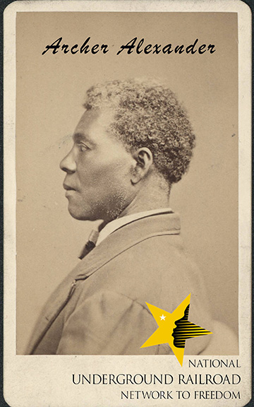
A Memorial Service for Archer Alexander, and for his Day of Freedom will be held on Sunday, September 21st, 2025, at 1:00 pm in the St. Peter’s United Church of Christ Cemetery at 2101 Lucas and Hunt, in Normandy (St. Louis) Missouri.
This event will include a one-act play called “Louisa” performed by actress Peggy Neely Harris which recognizes Archer Alexander’s life and accomplishments. Other speakers will include Ibn Ali, the great great-great-grandson of Archer Alexander and nephew of Muhammad Ali, and historian Dorris Keeven-Franke. A presentation by sculptor Abraham Mohler will share the new memorial and monument being planned at St. Peters U.C.C. Cemetery. Archer Alexander is recognized as a site on the National Underground Railroad Network to Freedom, one of more than 800 sites in this country. He is the icon for Emancipation as he is the enslaved man rising with Lincoln on the Emancipation Memorial in Washington, D.C.’s Lincoln Park. Everyone is welcome, and the public is encouraged to bring lawn chairs. September is National Underground Railroad Month.
Archer Alexander was the last fugitive slave captured in Missouri, and received his freedom on September 24, 1863, for his important services to the United States Military (Union) after informing them of a plot to destroy a local railroad bridge. He saved hundreds of lives, and a vital link conveying troops, funds and supplies for the Union Army in 1863. After risking his life he took sixteen men from Dardenne Prairie and crossed the river at Howell’s Ferry on a dark February night, using the Underground Railroad. His story is one of over 800 sites that honors, preserves and promotes the history of resistance to enslavement through escape and flight, which continues to inspire people worldwide, run by the National Park Service.

-
On Sunday, February 28, 1864, thirty-one-year-old Smith Ball had made his way from one end of St. Charles County to the other, a distance of about 25 miles, to reach freedom. His enslaver was John Ball who had passed away in 1850, leaving fifteen enslaved people living in three small cabins on his widow, Ann Hitch Ball’s large tobacco plantation.[ii] The Ball Plantation was located at Flint Hill,near the Boyd plantation, also in Cuivre Township, a community just over seven miles east of Snow Hill.
Smith Ball had been born May 26, 1833[iii], in Virginia, and had been brought to Missouri during the 1830s. According to his enlistment papers, he was a light-colored black [man], 5 foot 10 inches tall, with brown eyes and black hair. He left behind a wife Minerva Pringle, and four children, William, Lucy, John H., and Ada. When mustered in at Benton Barracks, he was examined by John Bruere, MD. of Benton Barracks in St. Louis like hundreds of other troops. He served in Company B of the 68th US. Colored Troops. [iv] The remarks on the Descriptive list stated “Recruit presented himself” meaning that he had fled his enslaver, Ann Hitch Ball(1804-1870), the widow of John P. Ball (1805-1858)[v].
The 68th U.S. Colored Troops were Infantry, and Ball would advance to Sergeant before mustering out. He had fought at Fort Blakely in Alabama, The Battle of Blakeley was the final major battle of the Civil War, with surrender just hours after Grant had accepted the surrender of Lee at Appomatox in the afternoon of April 9, 1865. Mobile, Alabama, was the last major Confederate port to be captured by Union forces, on April 12, 1865.
He and Minerva would raise a large family, William, Lou, John, Lina, Ada, Julia, Minnie, Birdie, and Mary. By 1900, she had passed away and was buried at Smith Chapel but her father Austin Pringle, who had been born in 1811 in Kentucky was still living with his son in law and grandchildren. When he died in 1912, at age 78, he was living alone at Foristell. He was buried at Smith Chapel Cemetery, where he had served as one of the nine original Trustees in 1871
Notes
[ii] 1850 U.S. Federal Census – Slave Schedules Record, United States of America, Bureau of the Census. Seventh Census of the United States, 1850/i. Washington, D.C.: National Archives and Records Administration, 1850. M432
[iii] MO Secretary of State, Bureau of Vital Statistics, Death Certificate of Smith Ball, Sept. 13, 1912.
[iv]Compiled Military Service Records of Volunteer Union Soldiers Who Served the United States Colored Troops: 56th-138th USCT Infantry, 1864-1866; NARA; 300398; Carded Records Showing Military Service of Soldiers Who Fought in Volunteer Organizations During the American Civil War, compiled 1890 – 1912, documenting the period 1861 – 1866
[v] The 1860 U.S. Federal Slave Schedule for Ann Ball, Cuivre Township, St. Charles County.
Subscribe to this blog:
-

On October 31, 1864, freedom seeker Martin Boyd, born in 1826, left the 300-acre plantation of Alexander Boyd and tried to make his way to George Senden’s store on Main Street in St. Charles, only to make it as far as Peruque Creek Fort at the Missouri Railroad Bridge. There Capt. L.D. Jay would enlist the 5’9” black man into the U.S. Colored Troops. Later, Alexander Boyd tried to show proof that he had inherited Martin from his mother Ruth Carr Boyd, widow of William Boyd, and that Martin Boyd was his property, and was seeking compensation for Martin’s Services and that as such he was entitled to a $300 bounty. Alexander did not receive it. Freedom seeker Martin Boyd would serve in Company B of the 49th United States Colored Troops, until March 22, 1866. That December 31st, 1866, he would marry Mandy (this is Amanda) Logan, as Black Marriages were now legal. Over 8,000 African-American men would serve in the U.S. Colored Troops during the Civil War.
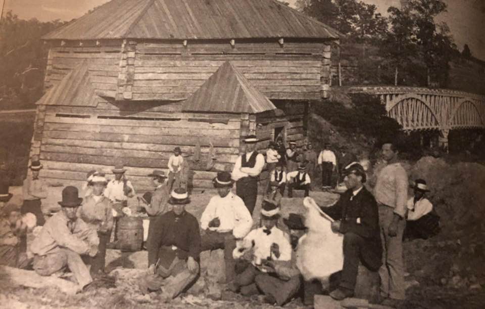
Fort Peruque was manned by Union Troops, that were Missouri’s Home Guards, assigned to guard the North Missouri Railroad Bridge (in the background), where it crossed the Peruque Creek (located at 1052 Peruque Creek Crossing today). The fort was constructed in 1862 and manned until the war ended. In 1827, Missouri was a new state filled with opportunity, at least for some people. Those living in Maryland, Kentucky, and Tennessee saw the opportunity and seized upon it. The land was selling for $1.25 an acre or if it already had “improvements” a man could get at least $2 per acre. And Dardenne and Cuivre Townships of St. Charles County were huge prairies where the crops of tobacco and hemp could make a man richer than his wildest dreams. William Boyd from Shelby County Kentucky had such a dream when he investigated it, but would die in 1830, before he could fulfill it, leaving behind his wife of 32 years, Ruth Carr, mother of his 11 children. Then, when Ruth’s father died in 1832, she brought her children and joined her brother James and his wife Susanna, who had already settled in Flint Hill. With Ruth was her 10-year-old son Alexander Thomas Boyd and at least eleven enslaved individuals.
Photo from St. Charles County Parks website – Towne Park is loacated 100 Town Park Dr. (off of Hwy 61) in Foristell. In 1840, Mrs. Boyd, now living in Cuivre Township, had 14 enslaved individuals living here and working on her plantation. By 1850, the number of these enslaved individuals had grown even larger to 17 African Americans living on the Boyd plantation. The youngest is now an 11-month-old boy, and the oldest is now a 44-year-old woman, among the 8 females and 9 males on the tobacco farm. Unfortunately, the 1850 Census taker did not take the number of buildings there were to house these individuals, and their names were never given. The accounting of this is all based on an honor system, for tax purposes only.
By 1860, Ruth Boyd 78-year-old mother of Alexander Boyd, is living with her son, next to her son Thomas, on the Boyd family plantation. Ruth is the enslaver of 7 people living in two cabins, Alexander has 8 people living in one cabin, and Thomas has 7 people as well living in two cabins. In all, this Flint Hill tobacco plantation has 22 enslaved people living in 4 cabins, which range from a pair of 5-month-old twin girls to a couple of women who are estimated to be 30 years old. No, the 1860 Federal Census, never gives us names of all of these people. But according to records, St. Charles County Park historian Ben Gall shares the names of 14 of these 22 people. They are Martin, Amanda, Henry, Lucy, Thomas, Emeline, Ella, David, Maria, her daughter Maria, Rose, Joshua, George and Ruth. The Boyd Plantation is now Towne Park, part of the St. Charles County Park System.
In 1870, the United States Census revealed so much. Forty-eight-year-old Alexander T. Boyd, and his wife Ann Medora (McRoberts), are still living on the Boyd plantation, with their three children, Fannie aged 13, William aged 12, and 2-year-old Fenton. With them live white 26-year-old Henry Minor and his 30-year-old wife Mary, who works as a farmhand for Alexander. Martin lives on the plantation with his wife Mandy, and their 1-year-old son Samuel. In 1912, 86-year-old Martin Boyd passed away and was buried in the Smith Chapel Cemetery. (For more see https://smithchapelcemetery.com/)
For more stories about St. Charles County History…
-

Around 1822, a schoolteacher named Anthony C. Parmer sold his two story brick building at 301 South Main Street to a prominent physician from Vermont named Dr. Seth Millington. Seth, and his brother Jeremiah were prominent residents in the early village of St. Charles, but Seth would pass away from the Cholera epidemic on August 4, 1834. At the time of his death Seth Millington’s estate would include nine enslaved African Americans. The instructions left in his will was for them to be taken to Liberia.
Seth and Jeremiah had a sister Sarah also called “Sally” who had married Thomas French but she had become widowed in 1835 and she had gone to stay at Seth’s former home in 1837. Sally and Thomas French’s daughter Celia had married the former St. Louis editor Elijah P. Lovejoy, who was a well-known abolitionist and newspaper editor, in addition to being a Presbyterian minister. On October 3, 1837, Elijah Lovejoy had just finished giving a talk at the Second Street Presbyterian Church and was visiting the home of his mother-in-law with his wife and baby. The church was just up the street (where today’s SSM St. Joseph Hospital is today) and only a block away from Sally French’s apartment.
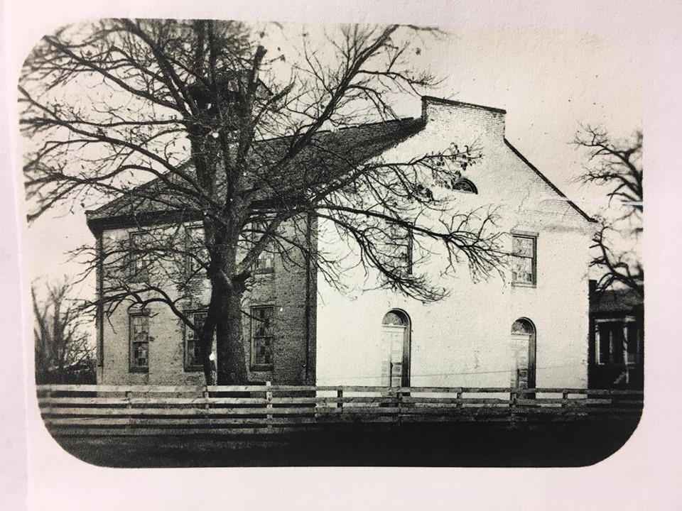
St. Charles Presbyterian Church on Second Street When Lovejoy had left the church a few minutes before, he had been passed a note of warning written by his close friend William M. Campbell, warning him that he was in danger. Campbell said that a large group of men were about to visit his mother-in-laws upstairs home (at 301 South Main Street, today’s Goellner Printing) and suggested that Lovejoy and his family leave St. Charles immediately. Campbell, whose home and office was just down the street (201-207 South Main Street), was a fellow member of the Presbyterian Church. Campbell was also an attorney, and executor of the estate that included Archer Alexander (1806-1880), his wife Louisa, and their children. A few minutes later, a large group of angry men arrived at Sally French’s door to her upstairs apartment in the former Millington house, and the mob was just about to attack Lovejoy, when his wife fainted and the men fortunately chose to retreat.
Lovejoy’s close friend George Sibley (1762-1863), whose wife, the former Mary Easton (1800-1878), had founded the girls school called Linden Wood, which was just a short distance away, would lend Lovejoy a horse. That night Lovejoy would quickly leave St. Charles, and make his way back across the Mississippi River to his home in Alton, Illinois.
After the burning of Francis McIntosh on April 28, 1836 in St. Louis, Lovejoy had championed the end of lynchings of Black Americans and the abolition of slavery, in his newspaper the Alton Observer saying,
“As long as I am an American citizen, and as long as American blood runs in these veins, I shall hold myself at liberty to speak, to write and to publisher whatever I please, being amenable to the laws of my country for the same.”
Sadly, it would only be a few weeks later though when Lovejoy was revisited by another angry mob on November 7, 1837, in Gilman’s Warehouse in Alton. There Elijah Lovejoy was shot and murdered while trying to save his press, which had been thrown into the river. Lovejoy has often been referred to as a martyr and the founder of the “free press” in America, a right guaranteed to all citizens under the First Amendment of the U.S. Constitution.
The formerly enslaved John Richard Anderson is said to have witnessed the whole event, as he was working as a typesetter for Lovejoy at the time. Anderson was a former slave of the Bates family, who after being emancipated, would learn how to read and write and later become a Baptist minister, like his close friend John Berry Meachum. (Both of them are buried at Bellefontaine Cemetery and Arboretum in the Baptist Minister’s Lot, purchased by the Baptist minister John Mason Peck.)
Subscribe to this blog for more stories…
-
“The Underground Railroad is one of the most remarkable stories in American history. This is a story of ordinary men and women coming together in harmony, united to pursue the extraordinary mission of helping those in their journey to freedom. This movement, which thrived from the late 18th century through the Civil War, was a testament to the power of unity, courage, and a shared commitment to liberty.”
http://www.nps.gov/subjects/undergroundrailroad/index.htm Stories of the Underground Railroad in St. Charles County have been shared for years. I know of several sites that have oral history associating them with being “stops” or “stations” on the Underground Railroad. The National Park Services’ National Underground Railroad Network to Freedom is the only Nationally recognized program that not only recognizes but documents and shares true stories that would never be known otherwise. There are over 800 sites, stories and programs listed across our country, and there are two sites and one program in St. Charles County Missouri. Th National Park Service began the Network to Freedom in 1998, and while similar to the National Register of Historic Places, requires even more extensive and documentation in order to be listed.
As their website informs readers:
The Underground Railroad—the resistance to enslavement through escape and flight, through the end of the Civil War—refers to the efforts of enslaved African Americans to gain their freedom by escaping bondage. Wherever slavery existed, there were efforts to escape. At first to maroon communities in remote or rugged terrain on the edge of settled areas and eventually across state and international borders. These acts of self-emancipation labeled slaves as “fugitives,” “escapees,” or “runaways,” but in retrospect “freedom seeker” is a more accurate description. Many freedom seekers began their journey unaided and many completed their self-emancipation without assistance, but each subsequent decade in which slavery was legal in the United States, there was an increase in active efforts to assist escape.
The decision to assist a freedom seeker may have been spontaneous. However, in some places, especially after the Fugitive Slave Act of 1850, the Underground Railroad was deliberate and organized. Despite the illegality of their actions, people of all races, class and genders participated in this widespread form of civil disobedience. Freedom seekers went in many directions – Canada, Mexico, Spanish Florida, Indian territory, the West, Caribbean islands and Europe.
In Foristell, Missouri, as you go north from the Interstate 70 exit, you will pass a small entrance to the Historic Smith Chapel Cemetery, where three freedom seekers lie. Established in 1871 the cemetery is final resting place for Smith Ball (1833-1912), Benjamin Oglesby (1825-1901), and Martin Boyd (1826-1912) who each took steps toward freedom and joined the United States Colored Troops, despite the risks involved for themselves and their families. The small one acre of ground was purchased by nine trustees of the Smith Chapel A.M.E. Church where they built a chapel, and laid out a burying ground for their loved ones. They also built a small one room school, that they named Douglass for the great orator, and by 1880 were educating their children, grandchildren and other area black children. All that remains today is the cemetery, but this has earned it a designation as a site on the National Underground Railroad Network to Freedom. For more about the Smith Chapel Cemetery see https://smithchapelcemetery.com/
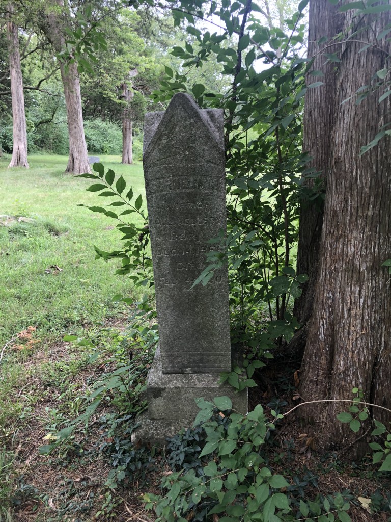
That schoolhouse which had been replaced in the early 1900s, had fallen into disrepair after desegregation in the 1960s when black children began attending area public schools. It was also during that same time period that families would begin joining the nearby Wesley A.M.E. Church in Wright City or the Grant Chapel A.M.E. in nearby Wentzville. In 2023, the schoolhouse was donated to the St. Charles County Parks and was dismantled and used in creating a replica in the Oglesby Park on Meyer Road in Wentzville. Today it sits at the rear of the park, on the same land that was once owned and farmed by freedom seeker Benjamin Oglesby, which has earned the recognition of the Oglesby Park as a site on the National Underground Railroad Network to Freedom.
Also listed on the National Underground Railroad Network to Freedom as a PROGRAM is Archer Alexander and the Underground Railroad, a freedom seeker who during the Civil War risked his life to warn the Union Army how the Confederates were about to destroy the Peruque Creek Bridge. Soon after he had to flee, but was joined by sixteen other men that he led across the Howell’s Ferry Crossing on the Missouri River. Archer would be rewarded with his freedom on September 24, 1863 for his services to the military, and he would become the icon for emancipation by becoming the enslaved man on the Emancipation Memorial in Washington, D.C.

For more information about National Underground Railroad Network to Freedom see https://www.nps.gov/subjects/undergroundrailroad/index.htm
TO SUBSCRIBE TO THIS FREE BLOG – STCHARLESCOUNTYHISTORY.ORG
-
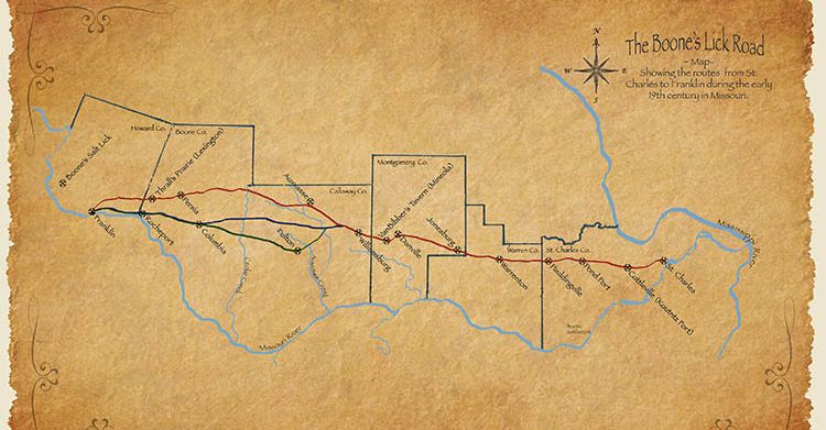
[Pond Fort DAR MARKER 8780 Highway N, Lake St Louis, MO 63367, USA – not the original location]
The original trail used by the Boone family in 1804 to reach their salt lick in Howard County, had already been used by the buffalo and the Native Americans for years before that. The expansion of Americans into the area had disrupted the original residents, and forced Native Americans tribes in the east to crowd into the Missississippi and Missouri River area in the early 1800s. This had caused the settlers to fear and be caught up in the depradations and raids on the settlements by 1812. Many of the early residents along “the Osage Trace” soon would be forced to Fort Up, or fortify their homes, in order to give them and thier neighbors safety. These early forts were not “Forts” in the traditional sense, as the military would erect for hundereds of soldiers, but homes where the windows were boarded up, and provisions stored in case of an attack.
Pond Fort was started by Robert Baldridge, a native of Ireland, who moved to Kentucky and then Missouri. The fort was said to be built in the form of a hollow square on land from a Spanish land grant. A single family there originally and the fort was given the name for a large pond two hundred yards away. This fort, as well as several others, were constructed on the lower Missouri in 1800. It was also a stopover for William Clark on his expedition along the Missouri River.The marker is located on the south side of Highway N, about two miles west of Highway 40-61.
On April 12, 1809, the Missouri Gazette, a newspaper published in St., Louis, Missouri stated “Lewis ordered all volunteer companies of cavalry, riflemen, and infantry in Upper Louisiana to hold themselves in readiness to march at a moment’s warning, and appointed a committee—Colonel Timothy Kibby, Major Daniel Morgan Boone, and James Morrison – to superintend the building of blockhouses from the Mississippi to the Missouri.”
Robert Baldridge (1737-1822) was one of the thousands of Scotch Irish Presbyterians who would emigrate from Ireland, and settle in Kentucky, which had been formed out of Virginia in 1792. One of the first settlers of what was to become St. Charles County, he’d married Hannah Beverly Fruit in Kentucky, and together they had James, Elizabeth, John, Daniel, Catherine, Malachi, Alexander, Grace, Nancy and Robert Junior. Their children would intermarry with several other of the earliest families; the Hoffmann, Zumwalt, Howell, Price, Scott, and Ryebolt families, among others.
Robert’s son Malachi and two of his companions, Price and Lewis, were killed while hunting on Loutre Prairie (today’s Montgomery County). Shortly after this event, Robert’s son Daniel, who wanted to avenge his brother’s death, tracked the party of Native Americans to their camp at night and attempted to shoot their Chief as he sat by the campfire. Daniel then concealed himself in the tall grass and watched while they searched for him; however, they failed to find him. Robert’s sons Robert Junior and John both served as rangers in Callaway’s company, during the War of 1812. The Baldridge family had established what was called Pond Fort, one in a series of private forts that formed a line of defense against the Native Americans by the settlers. The fort was built in the form of a hollow square and named for a pond, two hundred yards away.
In 1868 Historian Lyman Draper was talking with Major John Gibson who described the Ranger activities as follows:
In 1811 Nathan Boone raised a Company of Rangers for 12 months we went into Building forts in Different places over the country to keep the Indians from murdering our helpless women and children. We built Fort Howard, 17 miles from St. Charles; then we Built Capogri; then we built Buffalo, then Fort Mason; then we built fort Madison 24 miles above the mouth of Desmoines [sic] river; then we built prarai Deshain [sic] and Built forts over the country. We built Stouts Fort; we built one at Troy, then crossed over on the Missouri River to Bellefountain Below St. Charles; then fortified at St. Charles; then came to Pinkney; then we built a fort at Charette Village; then came to Louter Island and built Fort Clemson: then up to Cote San Dessein, built a fort there; then thence to Boon’s Lick, and Built Coopers fort; then to the Council Bluffs; then we Returned back to St. Charles commenced building forts out in the country from the Missouri River we built Pond fort; then we built Kennedy’s fort on Peruke [sic] Creek; we finished all those garrisons in the year 1812 and had our women and children out of danger of the wild Savages.
Sapp’s Mapping the Boone’s Lick Road cites historian Kate Gregg with:
It is at Pond Fort that the Stephen Long expedition joins the road on their way west. Having crossed the Missouri River from St. Louis on May 4, 1820, Capt. Bell reported that they “rode on 8 miles to Pond fort, situated on a prairie, this work of defence was erected during the late war by the scattered inhabitants of the country . . . it is constructed of logs and a square, whose sides are about 200 feet, having block houses at each of the angles, in the interior, and joining to the sides are erected cabins for the accomodation of families . . . . It stands on a quarter section of land belonging to Mr. Baily, he resides here and keeps excellent entertainment for travellers . . . .
Further up the Boone’s Lick Road (Today’s Hwy N in St. Charles County) sits the site of Rodman Kenner’s Tavern
[2480 West Hwy N, Foristell, MO 63348, USA is where Pauldingville now stands. The marker was dedicated on 21 October 1913.]
As we reach the edge of today’s St. Charles County, we have to remember that it was organized as one of the five original counties organized in 1812. By 1818, its territory was what comprises Montgomery, Warren and St. Charles, half of the six counties it crosses today. When Warren County was organized in 1833, St. Charles took today’s shape. However, when early settlers like Rodham (also known as Rodman) Frederick Kenner arrived this didn’t really matter. He’d been born in Virginia December 3, 1791, to Rodham and Jennie (Burke) Kenner who had served in the Revolutionary War. Rodham served in the War of 1812 in Virginia and earned a Land Bounty in Missouri. He married Elizabeth Johnson, in Virginia, prior to 1812, and they would come to Missouri in 1834, bringing four sons, George, William, Rodham and a twin brother Winder. They also brought an enslaved family with them, who had a son named Rodman Kenner as well. Elizabeth’s brother Charles M. Johnson came to Missouri in 1835 and would purchase the old Boone home and 680 acres from Nathan Boone on 24 January 1837. Boone then left St. Charles County and resettled in Ash Grove in Greene County.
Kenner was a first-class landlord, and his hotel became a noted resort and stage stop. He also played the fiddle so well he could almost make the “trees dance.” When he heard the stagecoach approaching or the dogs with their bark of welcome, would take his seat outside the door, his fiddle in hand and play Money Musk, Arkansas Traveler or some other lively tune. Kenner said the blessing at mealtime, ending with, “And for all these blessings we thank Thee, O Lord. Amen. Kick that blamed dog out from under the table.” Col. Thomas Hart Benton, one of Missouri’s first Senators, after stopping in the area visiting friends, commented on the good food and good beds. Many travelers would ride extra hard to make Kenner’s Tavern for the night. Kenner’s Tavern was also the location for sale auctions for the area’s enslaved individuals prior to the Civil War. Kenner made a fortune and died in 1876 at eighty-six years of age in what was by then called Pauldingville. He is buried in the small cemetery nearby which may be attributed to the early Pauldingville Baptist Church at that location. So ends our journey across St. Charles County along the Boone’s Lick Road.
For more about the entire Boone’s Lick Road visit https://booneslickroad.org/

Suggested Reading for further study…
[1] Lynn Morrow, Boone’s Lick Heritage Collector’s Edition Boonslick Historical Society Periodical
Vol. 13 Nos. 3 & 4 — Fall–Winter 2014
[1] Lynn Morrow, Boone’s Lick Heritage Collector’s Edition Boonslick Historical Society Periodical
Vol. 13 Nos. 3 & 4 — Fall–Winter 2014
[1] Dorris Keeven-Franke, Historic Main Street Tour ArcGis Map URL: https://arcg.is/1qqHzn0
[1] Dorris Keeven-Franke, Historic Main Street Tour ArcGis Map URL: https://arcg.is/1qqHzn0
[1] Dorris Keeven-Franke, Historic Main Street Tour ArcGis Map URL: https://arcg.is/1qqHzn0
[1] Dorris Keeven-Franke, Historic Main Street Tour ArcGis Map URL: https://arcg.is/1qqHzn0
[1] Dan A. Rothwell, Along the Boone’s Lick Road, 1999, Reprint 2022, Page 22
[1] Dorris Keeven-Franke, Historic Main Street Tour ArcGis Map URL: https://arcg.is/1qqHzn0
[1] Sheryl Guffy, Cottleville Legacy https://cottleville.org/
[1] U.S. Circuit Court, Territory of Missouri, County of St. Charles, Book A, Box 15, File 38, April 1816
[1] Dorris Keeven-Franke, Cottleville Legacy https://cottleville.org/
[1] Dorris Keeven-Franke, The True Story of Archer Alexander, https://archeralexander.blog/
[1] Melish, John. The Traveller’s Directory Through the United States: . . . John Melish: Philadelphia, 1822. 3 Peters, “Path of Land-Rush Traffic Across Boone and Callaway Counties,” Genealogical Society of Central Missouri Reporter Quarterly, vol. 13, no. 2 (Summer, 1994): 39. 4
SUBSCRIBE TO ST CHARLES COUNTY HISTORY BLOG BY DORRIS KEEVEN-FRANKE (FREE)
-
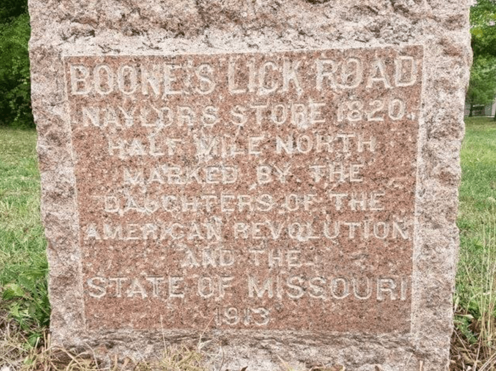
By 1821, Missouri had become a State, and St. Charles County had established “Dardenne” as a Township. As settlers established themselves along the Boone’s Lick Road, there were no “official” towns, but your Post Office was your address. Mail was sent there, and you visited the Postmaster to pay for and retrieve your mail. If not picked up, then your name was listed in the local newspaper letting you know that you need to make a trip to “town” which was usually the mill or General Store as well. Many towns were first established by what the name of the Post Office – quite often his name – or the Railroad Station. Railroads did not begin until 1850s, and the Station Master was automatically the designated Postmaster as well. The word Dardenne is said to be French in origin and given to both the prairie and the creek, but there is no translation for its meaning. Some say a man by that name first lived there, but that too is lost in history. When Census takers would visit, up until 1980 they simply listed the Township as there was not an actual town incorporated by that name until 1983 or a City until 2001. Today it is one of the fastest growing areas in our county, having a population of 13,803 in 2023.

Further west along the Boone’s Lick Road, past Alexander’s or Captain Campbell’s house, we would have found the mill of John Gill, who came from Kentucky to Missouri in 1811. He originally worked as a carpenter, in St. Louis, before returning to Kentucky and marrying there. He returned to Missouri and established a home, tavern and a large Grist Mill on the Boone’s Lick Road by 1822. Soon had established two large farms, which he managed with his sons and enslaved. At the outbreak of the Civil War, he gave each of his sons an enslaved man. As the only mill in the area, he was quite prosperous, and popular. *[1]
Gill House and the Mill’s Millstones were located on the south side of Highway N, 0.6 miles west of Highway K. The mill stones were first purchased from the Dickherber family for marking the Boone’s Lick Road in 1913. At some point the stones were removed and stored at the Howell school. Then Mr. and Mrs. N.H. Loeffler purchased them, and on Septemer 24, 1959, and they were placed on the property and dedicated. Then in about 2012, during the Highway 364 road construction they were once again removed. They were the only mill stones used by the DAR along the entire route. The DAR marker for the Gill Mill is no longer found on the Boone’s Lick Road.

Naylor Store. [7767 Highway N, O’Fallon, MO 63368, USA no longer standing]
Just past Gill’s mill was the house of John Naylor, where the Dardenne Presbyterian Church first met in 1819. It soon became a Stagecoach and Postal stop, in his Mercantile. Today it is the location of the City of Dardenne Prairie. The road originally curved off to the north to the store, before returning to Hwy N, up until the 1860s. The Dardenne Presbyterian Church’s first church building was first located on the south side of Dardenne Creek (in what is today’s Weldon Spring Government Reserve) but was burned during the Civil War. The beautiful new stone Church that was built after the Civil War can still be seen today as Hwy N, mixes with and crosses Interstate 364.
Naylor’s Store, on the Dardenne Prairie, was a stage stop in the 1820’s. John Naylor was an influential citizen in the area who helped to found the town of Dardenne. He and his wife helped start the Dardenne Presbyterian Church in 1818. The marker is located on the north side of Highway N, 3.2 miles west of Highways K and N intersection.
In David P. Sapp’s Mapping the Boone’s Lick Road he explains the route of the road was documented in early gazetteers, explaining how two contemporary gazetteers and a journal are of major importance in identifying this route.
“John Melish published the route and distances from St. Charles to Franklin in his The Traveller’s Directory Through the United States[i]: . . . in 1822. In this publication, Melish listed hundreds of routes between various cities and towns in the United States, including the road from St. Charles to Franklin. While this work was published in 1822, analysis shows that the effective date was probably 1820. Melish describes the route from St. Charles to Franklin thus: Beginning at St. Charles; 12 miles to Dardenne; 8 miles to Pond Fort; … His total mileage from St. Charles to Franklin is 151. Another great contemporary description of the alpha route comes from Lewis Beck’s 1823 Gazetteer which listed the stage route from St. Louis to Fort Osage. Peters concludes that the effective date of this route is 1821 or 1822, just a year or two later than the Melish data. With Beck, we begin at St. Charles; then 9 miles to Coonts; 12 miles to Pond Fort;”
Postal records shows that the route included Naylor’s Store from 1827-1840 and 1841-1868. This is the same location of Campbell’s 1873 Atlas of New Missouri for Dalhoff Post Office, on land purchased by John Naylor in Section 2, of Township 46, Range Two East.
NOTES
[i] Melish, John. The Traveller’s Directory Through the United States: . . . John Melish: Philadelphia, 1822. 3 Peters, “Path of Land-Rush Traffic Across Boone and Callaway Counties,” Genealogical Society of Central Missouri Reporter Quarterly, vol. 13, no. 2 (Summer, 1994): 39. 4
Subscribe to the St. Charles County History Blog by Dorris Keeven-Franke -its free.
For more about the Boone’s Lick Road – see https://booneslickroad.org/
-
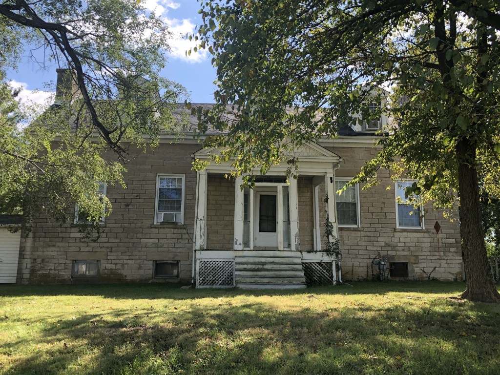
In October of 1829, four families from Rockbridge County Virginia, would come to settle on Dardenne Prairie with over two dozen enslaved people. They had left in August, and would be led by a young attorney named William Campbell (1805-1849) whose journal stated
My own object in going to that remote section of the Union was to seek a place where I might obtain an honest livelihood by the practice of law.
In his journal, he tells the story
The first family is that of Dr. McCluer, his wife (my sister) and five children from six months to thirteen years old and fourteen negro servants. Two young men, McNutt and Cummings, and myself form a part of the traveling family of Dr. McCluer. Dr. McCluer leaves a lucrative practice and proposes settling himself in St. Charles County Missouri on a fine farm which he has purchased about 36 miles from St. Louis. The second family is that of James H. Alexander, who married a sister of Dr. McCluer, with five children and seven negro slaves. Intends farming in Missouri. Third family, James Wilson, a young man who is to be married this night to a pretty young girl and start off in four days to live one thousand miles from her parents. He has four or five negroes. Fourth family, Jacob Icenhoward, an honest, poor, industrious Dutchman with several children and a very aged father in law whom he is taking at great trouble to Missouri, to keep him from becoming a county charge. He has labored his life time here and made nothing more than a subsistence and has determined to go to a country where the substantial comforts of life are more abundant.
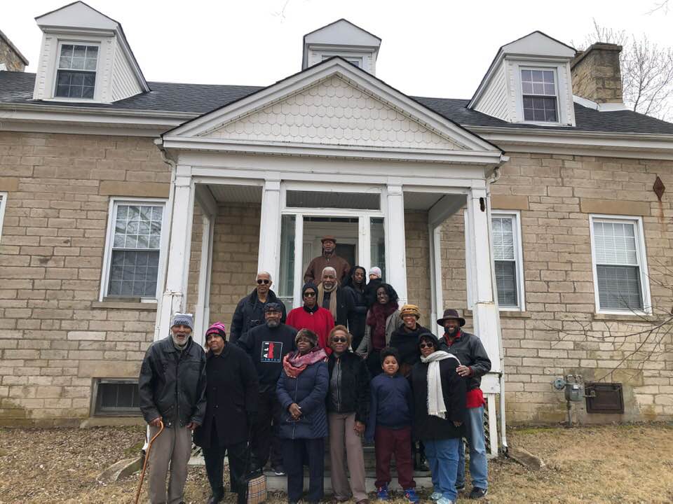
Archer Alexander’s descendants through Wesley Alexander – Photo by Dorris Keeven-Franke William Campbell’s cousin, James H. Alexander (1789-1835), purchases land in St. Charles County, near today’s intersection of Hwy K and Hwy N – which is the Boone’s Lick Road. He chose this location on purpose because of the road, and it being a major thouroughfare. His enslaved are put to work following the instructions of professional stone masons that have come from Ireland. When the house is complete, James Alexander applies to be postmaster and establishes his house as a stagecoach stop on the Boone’s Lick Road!
Missouri Intelligencer and Boone’s Lick Advertiser, July 18, 1835 However, as fate would have it, Cholera is sweeping the countryside, and on the 4th of September, 1835 James Alexander dies leaving four children, ages 13, 11, 9 and seven years old behind. They are sent back to Virginia to live with relatives who will be their Guardians. Alexander’s will states that his plantation and his enslaved are not to be sold, and to be leased out and all the profits used for the benefits of his children.
His enslaved include Archer Alexander (1806-1880) Louisa his wife (1810-1865) , her sister, her mother, and their children. In the Probate files Louisa’s seven children and their values are listed as 1) Eliza $325, 2) Mary Ann $300, 3) Archer $225, 4) James $200, 5) Alexander $175, 6) Lucinda $150, and 7) John $125. The estate would continue to be administered by William Campbell until his death, and the children reached maturity. At that point, the enslaved were sold, with Archer Alexander going to David Hickman Pitman, and Louisa and what was left of her children becoming the property of James Naylor, further west on the Boone’s Lick Road.
In 1863, Archer Alexander was visiting his wife Louisa at Naylor’s Store where he heard a regularly held meeting of the area Confederates plotting to take down the North Missouri Railroad Bridge over Peruque Creek. They had stored guns and ammunition in the ice house on the old Alexander place, which was now owned by Captain Campbell. Knowing what this meant, Archer would make his way to the Peruque Creek Fort manned by the Union Army’s Home Guards, to warn them. When suspicion fell on Archer as the informant, he had to flee via the Underground Railroad, to St. Louis. He and 16 other men from the Dardenne Prairie, including some who were owned by the McCluer and Bates family, fled south and crossed the Missouri River at Howell’s Ferry.
Union Fort at Peruque Creek with Home Guards The Howell’s Ferry Crossing was where the town of Howell was before the 1941 demolition for the TNT plant. Near there was also the town of Hamburg that had been founded in 1834 by German immigrants. Today this is the Hwy 40/64 Bridge. The crossing, which had been used by freedom seekers for years, led to a river landing originally called Bonhomme. This was the ending of the twenty mile long Olive Street Road, which was the shortest route between the Missouri River and the Mississippi River. For more about Archer Alexander see the archeralexander.blog or his facebook page. Archer Alexander is the emancipated man seen rising on the Emancipation Memorial to Lincoln by the formerly enslaved in Washington, D.C. and the great great great grandfather of Muhammad Ali.
Sources: The Campbell Journal from the Rockbridge Historical Society, and the Washington and Lee University in Lexington, Virginia.
Probate files from the Missouri State Archives
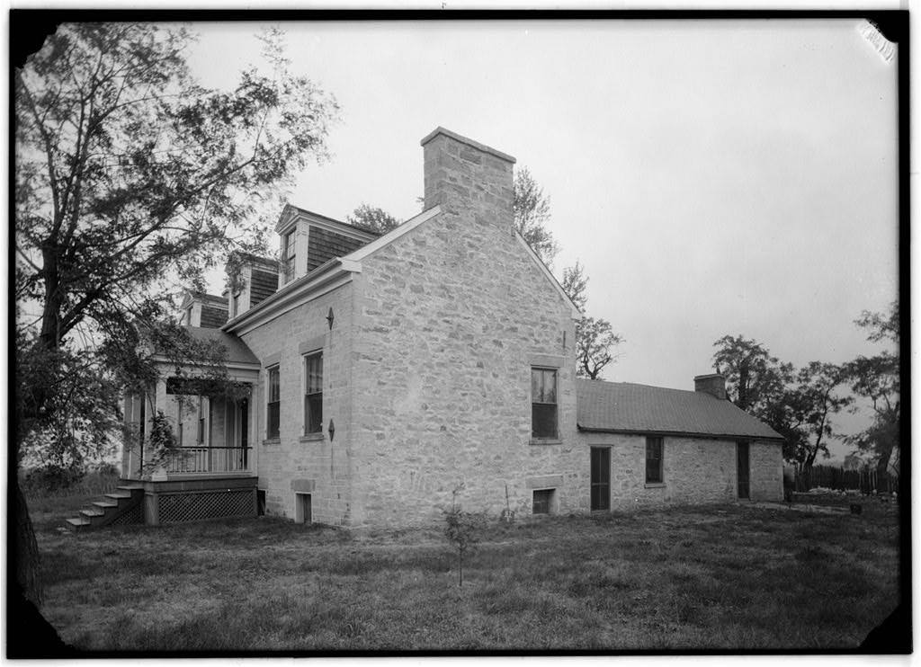
HABS Photo from the LOC 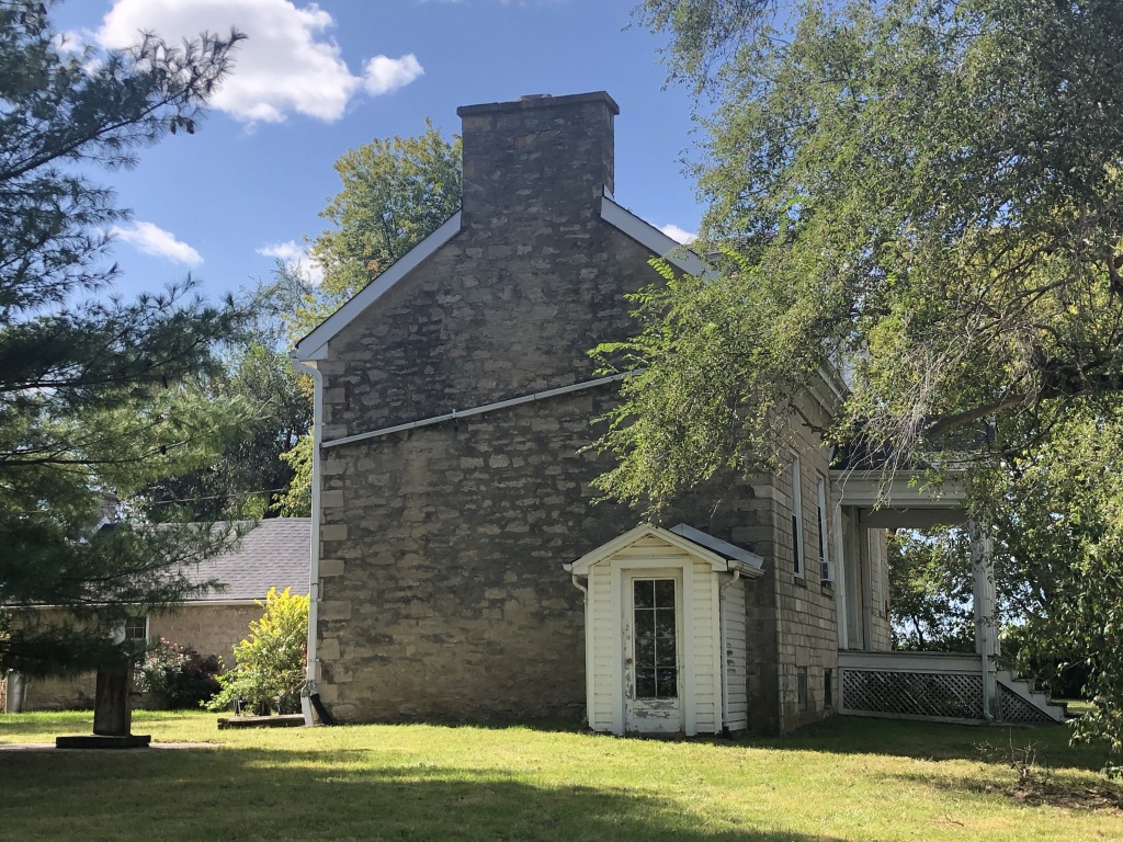
Photo by Dorris Keeven-Franke 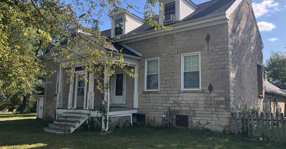
Photo by Dorris Keeven-Franke SUBSCRIBE TO THE FREE BLOG STCHARLESCOUNTYHISTORY.ORG BY DORRIS KEEVEN-FRANKE AND RECEIVE A DAILY DOSE OF HISTORY
-

On Cottleville’s Chestnut Street sits a large two-and-one-half story frame building that once served its’ Methodist Episcopal South congregation. By 1810, John Pitman, a veteran of the Revolutionary War had come to Missouri from Kentucky, settling just to the south of the Cottle family. Portions of his huge estate would provide two additions to the town of Cottleville. John Pitman was owner of a large amount of enslaved property. He had been born in what was Bedford County Virginia in 1757. In 1776, Kentucky would become a County of Virginia, and eventually a state in 1792. By 1800, we find Pitman paying taxes on that property in Kentucky. However, many early Missouri settlers were like Pitman, and had received payment for their service in the Continental Congress during the Revolutionary War in the form of a Land Warrant, in the newly acquired Louisiana Territory. In February of 1805, John married Magdelene Irvine, and their son David Kyle Pitman was born that December.
John Pitman (1753-1839) was the son of Thomas Pitman, who had come to the Missouri Territory by 1816, with several of his relatives. Some would settle as far west as what became Montgomery County (later Warren County) and some south of him along the Missouri River, near Howell’s Island. He purchased the earlier land grant of Hoffman, and began building what would become the largest plantations in St. Charles County and on the Boone’s Lick Road.
The hostilities with the Native Americans had ended with the Peace and Friendship Treaties at nearby Portage des Sioux in September of 1815. And by 1816, John Pitman and his neighbors would ask the Missouri Territorial Government to establish a road to the Boone’s Lick settlement where the Bryan and Morrison saltworks was, near Franklin in Howard County.
Territory of Missouri )
County of St. Charles )
Circuit Court )
) 1816
April Term)
John Pitman – filed a petition signed by twelve householders & upwards – of the County of St. Charles, praying that a road maybe laid from from (sic) the Town of St. Charles, In the direction to Boones lick Settlement, until it strikes the line of Howard County.
Where upon the Court appont John Gibson, Hugh McDermid, James Kennedy, Samuel Lewis & Joseph Yeardley, House holders of said County as commissioners to view & mark out said Road – The nearest & most practicable route – and to the Greatest ease & convenience to the inhabitants and as little as may be to the prejudice of individuals and make return there of – to the Court at the next Term. According to the State in Such case made and provided.
County of St. Charles vis Circuit Court July Term 1816. John Gibson, Hugh McDermid, James Kennedy, Samuel Lewis & Joseph Yeardly, being appointed commissioners, at the last Term of this court to view and mark out a road from the Town of Saint Charles with direction to Boones lick Settlements until it strike the line of Howard Countyand that return should be made to thy Term of the Court, It appearing to the Court that notice has been served on said commissioners – They ordered that the said Commisioners view and mark out a road is aforesaid and make return there of – to the next Term of they Court, And that Notice be given then respectively, by the Sheriff of thy Order.
A True Copy, attest.
Wm. Christy Clk.Ct., Cit of St. Charles[i]
Pitmans Addition to Cottleville
The Methodist religion had come to Missouri with the preachings of John Clark in 1816. According to the Methodist Archives at Central Methodist University in Fayette “In 1844 when the Methodist Episcopal Church separated into the MEC and the MEC, South, Missouri officially went South. Both churches operated in Missouri, many times side-by-side in the same town“. By 1854, John Pitman’s son David, and his son Richard would join with others to build a frame church building at the cost of $1,600. Other founding members were William C. Ellis, S. R. Watts, and James T. Sanford.They would start out with 20 members.[ii]
Southern Methodist Church with Public School in back When John Pitman passed away, his youngest son David Kyle Pitman (1805-1891) and his grandson Richard Hickman Pitman (1830-1893) would inherit his home and much of his enslaved property. The Pitman home was built by the enslaved on the west side of Cottleville along the Boone’s Lick Road, with the family cemetery on the opposite side of the home. On July 3rd, 1856, David Kyle Pitman would record his plat of an addition to the town of Cottleville.
David Kyle Pitman Pitman Home on Hwy N (no longer standing) from HABS – Library of Congress 
Photo of the the grave of John Pitman in the Pitman Cemetery on Hwy N – the Boone’s Lick Road David Kyle Pitman’s property stretched from Cottleville, up to James Alexander’s further west on the Boone’s Lick Road. David Pitman was one of St. Charles County’s largest enslavers in 1860 with over 35 people living in homes behind his home on the Boone’s Lick Road. By that time, David’s son Richard had married and also lived on the Pitman farm, and had ten more enslaved people of his own. John Pitman’s son David Pitman had gifted Archer Alexander (1806-1880) to his son Richard Hickman Pitman in 1859During the Civil War in 1863, his son Richard Pitman was a Confederate sympathizer and involved in treasonous activity, and because of this his enslaved man named Archer Alexander would be given his freedom.[iii]
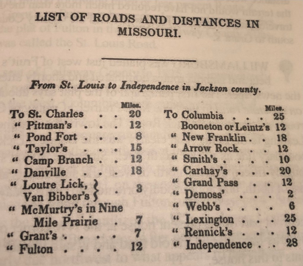
IT WAS 12 MILES FROM ST. CHARLES TO PITTMANS (COTTLEVILLE) BY STAGECOACH IN THE LATE 1830s AND A FULL DAY’S JOURNEY. Today you can leave Berthold Park on Main Street and go south to the Boone’s Lick Road where you make a right turn and proceed west for one mile. At First Capitol (Hwy 94) you proceed west (left) on Hwy 94 to the Mid Rivers Exit, go west to Hwy N, where you make a left turn. You stay on Hwy N – which is the Boone’s Lick Road, as you pass Cottleville, to Pitman’s. This takes less than one hour in 2025.
[i] U.S. Circuit Court, Territory of Missouri, County of St. Charles, Book A, Box 15, File 38, April 1816
[ii] Dorris Keeven-Franke, Cottleville Legacy https://cottleville.org/
[iii] Dorris Keeven-Franke, The True Story of Archer Alexander, https://archeralexander.blog/

1905 Atlas of Cottleville 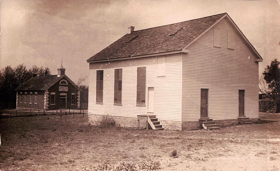
Southern Methodist Church with Public School in back 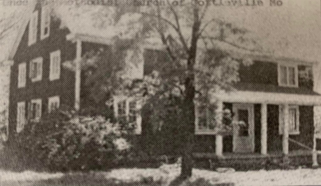
FOR MORE ABOUT THE BOONE’S LICK ROAD SEE https://booneslickroad.org/
SUBSCRIBE TO STCHARLESCOUNTYHISTORY.ORG (FREE) AND RECEIVE DAILY EMAILS BY DORRIS KEEVEN-FRANKE
-
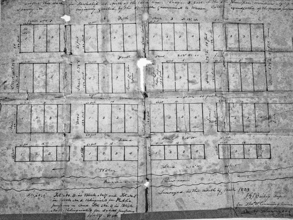
Heading westward from St. Charles on the Boone’s Lick Road, one left the village heading west and would pass Old Man Schaffer’s Tavern [on Parkside, today it is a private home and still standing, but there is no marker] who served the needs for those driving their stock to market. Friedrich Schaeffer was a German immigrant who hadmost likely read the Report on a Journey to the Western States of America, published in Germany by Gottfried Duden in 1829 which extolled the virtues of the young state of Missouri. Like thousands who came during the 1830s, the German immigrants would not only change the state’s demographics but its’ history as well. Schaeffer’s Inn was a favorite for those needing a watering hole for their cattle, outside of the town’s limits on what was formerly the Commons. City ordinances did not allow cattle and hogs to roam the streets.
[Proceeding further on Boone’s Lick, turn left/south on Missouri’s State Highway 94/First Capitol and proceed to Mid-Rivers Exit. Turn right/west on Mid-Rivers and proceed until the intersection with County Highway N. Turn left on Highway N ]
COONTZ’ FORT
BOONE’S LICK ROAD MARKER – BY THE DAUGHTERS OF THE AMERICAN REVOLUTION AND THE STATE OF MISSOURI IN 1913 KOUNTZ’ FORT at 4965 Highway N on your right hand side.
Two Coontz brothers had been born in Germany and had perhaps served in the Hessian Militia for the British Army during the Revolutionary War, but defected and joined the colonists. One brother had been captured by the Native Americans and had been presumed dead. The other would come further west and settle in St. Charles purchasing Blanchette’s property from his estate. The first brother had learned of the others whereabouts and joined him in what was then Louisiana Territory. Nicholas Coontz would acquire Survey #58 on 29 Aug 1799. His log home was large enough and well-built and would be fortified to serve as a Fort, for the protection of many of the area families during the War of 1812. He kept a tavern, and in the Memoirs of John Mason Peck, D.D., 1789-1857 he was described as “a rough, wicked and yet hospitable old German”.

Site of the 6 mile house where travelers could stop for water was earlier site of Koonz Fort PROCEED SOUTH ON HWY N TO COTTLEVILLE, IT IS IMPORTANT TO STAY ON HWY N AS IT MAKES SEVERAL TURNS THROUGH COTTLEVILLE.
COTTLEVILLE
Cottleville’s history as a settlement begins with the occupation of Warren Cottle, Sr. on a plot near Dardenne River (Creek), obtained through Spanish land grants in 1798. Together, with his sons, Warren and Ira, Cottle began a grist mill on the Dardenne River (Creek) in 1799. Cottle’s Mill used waterpower to sift and grind wheat, oats, and other products. The water method proved to be superior to the other horse powered mills found within the area and many people began to bring their harvested crops to Cottle’s Mill. Over the next decade, the large number of customers encouraged the establishment of small shops and lodges to accommodate those waiting, sometimes overnight, for their turn at the mill. The mill was one story high. The power for the mill came from an overshot wheel on the left side of the drop and it had wooden gears. The driving gear had all wooden cog wheels and the frame mill was one story high.[i] In 1837, Cottle would file a plat of his town with the St. Charles County Recorder of Deeds, making it official.

An unidentified Cottleville house 
Southern Methodist Church by Public School 
Ora Cottle home (no longer standing) 
Original Plat of Cottleville (St. Charles County Recorder of Deeds 
Southern Methodist Church as a home Southern Methodist Church with Public School in back 1905 Atlas of Cottleville 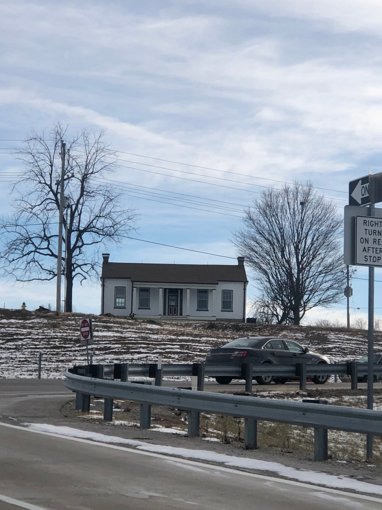
Hoffmann house at Hwy 94 and Mid-Rivers Dr. 
HABS photo of Cottleville Public School SOURCES
[i] Sheryl Guffy, Cottleville Legacy https://cottleville.org/
FOR MORE ABOUT THE BOONE’S LICK ROAD SEE https://booneslickroad.org/
SUBSCRIBE TO STCHARLESCOUNTYHISTORY.ORG (FREE) AND RECEIVE DAILY EMAILS BY DORRIS KEEVEN-FRANKE
-

An early undated map in the St. Charles County Historical Society shows that In Lynn Morrow’s Boone’s Lick in Western Expansion: James Mackay, the Boones, and the Morrisons[i] today’s St. Charles County is part of the St. Charles District or county, “the only American political subdivision on the north side of the Missouri River until 1816”.
Unfolding events brought Morgan and Nathan Boone into a commercial salt industry with Philadelphia’s Bryan and Morrison trading company, the most influential American firm in Missouri’s trans-Mississippi West. Of the six Morrison brothers who came West, William, the eldest, administered the family business from Kaskaskia, assigning James, Jesse, nephews, and others to implement their strategic economic reach. Boone’s Lick salt became crucial in the Osage Indian trade, Missouri River commerce, and for support of federal and Missouri militia troops in the War of 1812.[ii] It would be James Morrison who would open the Trading Post on Main Street in 1804 that would sell the product of his salt lick in what is later called “the Boonslick” in Howard County. In 1806 he would supply and outfit Gen. Zebulon Pike (Pike’s Peak) expedition from this storefront.
An early undated map of St. Charles I discovered in 2011in the St.Charles County Historical Society archives gives us a view of the village’s Rue de Grande or Main Street in what is believed to be 1817. When the map was restored and processed by Lisa Fox at the State Archives in 2013, this was confirmed in their examination of the paper and ink used, and by Lynn Morrow, with the Missouri State Archives who had examined the map before retiring that year. It places the Bryan and Morrison trading company between Clay and Madison; Main and Second, with other records indicating that the property had been purchased by Morrison by 1804.
Operators of frontier salines usually owned enslaved and/or leased enslaved to shoulder a lot of the hard, physical work, especially wood chopping, but there are few documents about slaves at Boone’s Lick. In 1814, a Draper informant told about Moses, who in the face of an Indian alarm, rode one of the Morrison horses back to St. Charles. Flanders Callaway’s slave Moses had worked for years up and down the Missouri River, serving the Callaway family in agriculture and market hunting. Moses cut a lot of wood at Boone’s Lick, too.
Across from the Bryan and Morrison Trading Company at 200 South Main Street is Missouri’s First State Capitol.

Circa 1819 – Built by Charles and Ruloff Peck in 1819, this building housed Missouri’s first State Capitol from 1821 until 1826. Missouri’s first legislators – some of them frontiersmen and others of the gentry – met in this building to undertake the task of reorganizing Missouri’s early territorial government into a progressive state system. Before Missouri was granted statehood on Aug. 10, 1821, the territorial government met at various locations in St. Louis. As statehood became a certainty, the search began for a site to become the permanent seat of government. An undeveloped tract of land located in the center of the state overlooking the Missouri River was chosen to be the site of “The City of Jefferson,” Missouri’s permanent capital. However, until the new Capitol could be constructed, the state’s first legislators needed a place to meet. Nine cities competed for the honor of hosting the state’s temporary seat of government. One of these cities was St. Charles, a growing center of trade located on the Missouri River with easy access to the most rapidly growing areas in the state via the river or the Boonslick Road. The citizens of St. Charles pledged that if their city was chosen as the temporary capital, they would furnish free meeting space for the legislators. On Nov. 25, 1820, Gov. Alexander McNair signed a bill making St. Charles the first capital of Missouri. The state’s first legislators met in St. Charles for the first time on June 4, 1821. Heated debates over state’s rights and slavery filled the rooms of the new temporary Capitol. The meeting place provided by the citizens of St. Charles was on the second floor of two newly constructed adjoining Federal-style brick buildings. The Peck brothers, Charles and Ruluff, owned one of the buildings and they operated a general store on the first floor. Chauncy Shepard owned the adjoining building with a carpenter shop on the first floor. The second floor of the building was divided and used as Senate and House chambers, an office for the governor, and a small committee room. Four Missouri governors ran the state’s affairs from the Capitol in St. Charles until the new Capitol in Jefferson City was ready in 1826.[iii]
As one continues south on the City of St. Charles Main Street they will pass:

515 S Main St, Saint Charles, Missouri, 63301
Circa 1821 – Historians confer that this is the site of William Eckert’s St. Charles Hotel in 1821. He and his partners had offered his establishment to the State when they were seeking a site for the Capitol , as a larger and more commodious building. At that time, in 1821, a large stone building was known to have sat to the rear of this building, so perhaps that was the one being offered for the State’s use. Some historians suggest that this building was damaged in the 1876 tornado to such an extent that it was altered to be the building you see today. Eckert’s Tavern was also reported to be where Benjamin Reeves, George C. Sibley and Thomas Mathers, who were appointed as Commissioners in 1825 by President John Quincy Adams, laid out the Sante Fe Trail. This work to establish a route for trade with the southwest and New Mexico, went over budget and took seven years for the three commissioners to receive their pay for this feat. [iv]
Further south on St. Charles’ Main Street, one encounters other vestiges of Bryan and Morrison’s route to their salt lick. Farmer’s Home is an example of the many inns and mercantiles that line the street…
700 S Main St, Saint Charles, Missouri, 63301
Circa 1805 – In 1817 when Alexander McNair owned this property, he would add on to the earliest portion of the building, keeping the French influence. McNair’s wife was Margarite Regal, the daughter of a French Marquis. In 1820, he defeated William Clark, to become our State’s first Governor. Although he lived in St. Louis with his wife and children, he would stay here when he needed to conduct State business. The building was a tavern, where J.J Dozier the Innkeeper would invite the Legislature and other visitors to the town to stay at the establishment when St. Charles was Missouri’s first State Capitol 1821-1826. At that time the cost of lodging was “2 bits a night (or 25 cents) and you could get Chicken Fixings for 3 bits or 37 and one-half cents”. McNair died on March 18, 1824 while still in office. The building would continue to serve as an Inn, and was always a hub of activity, since visitors would arrive on the nearby ferry and have to pass the Inn on their way to the State Capitol, ensuring its success. At one time the inn was known as the “Bear Sign” and owned by a German named Valentine Schmidt. In 1853 the name according to the St. Charles newspaper named the Reville, was changed to Farmer’s Home and managed by the German innkeeper named Frances Bierbaum. On the 26th of February 1876, the Inn was struck by the great tornado. Stories tell of a man in his bed on the second floor who was picked up and thrown into the street without even being hurt. [v]
When you proceed further south, one will reach the location of Blanchette’s first settlement…

906 S Main St, Saint Charles, Missouri, 63301 (private home)
Circa 1793 – The site of the home of the City of Saint Charles’ founder Louis Blanchette who settled here with his wife and children in 1769. Soon after he was appointed Commandant by the Spanish he built three buildings along the small stream nearby. After his death in 1793, the property was owned by Peter Coontz [Koonz/Kountz], a German, who either added onto Blanchette’s building or built this one with a small primitive mill along Blanchette’s creek. When Louis Tayon had been appointed Commandant for the District and he felt that all of Blanchette’s’ property should by rights be owned by the City and by rights become his under the Spanish Crown. This would later be argued all of the way to Missouri’s Supreme Court, with the Court still finding in favor of the Coontz family. Excavations done by the Archeology Department for Lindenwood University do confirm that there was a building situated here at this location during the time period of Blanchette’s arrival.[vi]
Author Dan Rothwell’s book shares how the original pathway of the Boone’s Lick Road merged with Main Street at this point, which was probably because of early connection with Blanchette as Commandant. Early deeds refer to the southern stretch of Main Street as Upper San Carlos as it was where the seat of Government was prior to the Louisiana Purchase.[vii] But by 1851, one had to continue further south on Main Street before it turned west. There one sees further evidence of what the Boone’s Lick Road meant to travelers at The Western House…

preservationjournal.org 1001 S Main St, Saint Charles, Missouri, 63301
Circa 1820 – Gregorie Kiercereau, born Bebi, was the owner of this property in 1817, and the property across the street to the north indicating that he most likely owned this property prior to that date. Kiercereau was the nephew of the second Commandant Carlos Tayon by marriage. The original structure of the building faces Main Street was built in 1820 with several additions made over the years, with some as late as 1856. During the 1850s, the route of the Boone’s Lick Road, which had begun by the 1820s and had originally left Main Street going west up McDonough, was moved alongside this building. This accounts for the direction of the additions at the rear. The road had been part of the Plank Road system, which was a short-lived paving system which used cut logs forming what was also called a ‘courderoy’. Travelers would often use the logs as firewood though. The city macadamized the road in the 1850s, which is an early gravel and oil method. By that time, Fanny Smith Eckert maintained an inn named Western House here, which was very popular with travelers. An inn was always maintained on the lower floor with sleeping rooms on the upper levels. During the days of the covered wagon treks, a large stable and wagon yard was located in the rear and to the south of the existing building. Later the establishment was conducted by a Mr. Bliss and was considered too rowdy for women and children. The inn provided excellent care to oxen, horses and cattle when Mr. Bliss eventually added a blacksmith shop to provide for care and repair of equipment.


[i] Lynn Morrow, Boone’s Lick Heritage Collector’s Edition Boonslick Historical Society Periodical
Vol. 13 Nos. 3 & 4 — Fall–Winter 2014
[ii] Lynn Morrow, Boone’s Lick Heritage Collector’s Edition Boonslick Historical Society Periodical
Vol. 13 Nos. 3 & 4 — Fall–Winter 2014
[iii] Dorris Keeven-Franke, Historic Main Street Tour ArcGis Map URL: https://arcg.is/1qqHzn0
[iv] Dorris Keeven-Franke, Historic Main Street Tour ArcGis Map URL: https://arcg.is/1qqHzn0
[v] Dorris Keeven-Franke, Historic Main Street Tour ArcGis Map URL: https://arcg.is/1qqHzn0
[vi] Dorris Keeven-Franke, Historic Main Street Tour ArcGis Map URL: https://arcg.is/1qqHzn0
[vii] Dan A. Rothwell, Along the Boone’s Lick Road, 1999, Reprint 2022, Page 22
[viii] Dorris Keeven-Franke, Historic Main Street Tour ArcGis Map URL: https://arcg.is/1qqHzn0orses and cattle when Mr. Bliss eventually added a blacksmith shop to provide for care and repair of equipment.
Subscribe to stcharlescountyhistory.org for a free story by email every day…
-
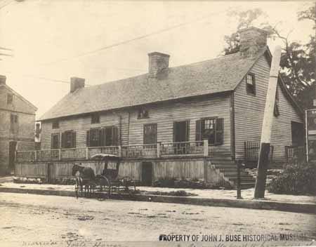
When Americans declared themselves independent of Great Britain in 1776, there were three settlements west of the Mississippi, Ste. Genevieve, Saint Louis, and San Carlos. In 1763, Saint Louis had been established on the south side of the great Missouri River, creating what would later become the “Gateway to the West”. Shortly afterwards, in 1769, a French-Canadian fur trader named Louis Blanchette, would establish himself in what was then called “Les Petite Cotes” or the little hills. These hills were the mounds created by the indigenous people that had been living here, for centuries. Travel between St. Louis and San Carlos, followed one of either two pathways, by river or overland. When traveling westward overland, pathways became established, that were ones of the least resistance, which the buffalo and other animals had already discovered. The earliest people, such as the Osage, would follow these same pathways, and establish would be called a “trace”.
As the population increased, so did the use of these early pathways. The first residents were fur traders, who knew that they were leaving the protection of United States but chose to live among the indigenous nations of Osage, Pottawatomie, Sioux and Fox. The land itself though had remained under the flags of the French and the Spanish, being traded first in 1769, and then again in 1799. That year, the well-known trailblazer Daniel Boone, would settle along the Missouri River, south of San Carlos, otherwise known as Saint Charles. Many of those who followed him, were from Kentucky, a State carved from Virginia in the 1770s. These large families brought with them, an enslaved population, that lived under rules known as the Code Noir, or Black Code. All the while, the indigenous population was growing as well, as many were being pushed westward, because of settlement in the Ohio valley. The land was being eyed. So that when the territory was purchased in 1804, there was already a large population.
In 1804, as President Thomas Jefferson commissioned a Corps under the command of Captains Meriwether Lewis and William Clark, the Morrison family would establish themselves on the Rue de Grande, later known as Main Street, in St. Charles. The family had been on the leading edge coming from Philadelphia and had already established outposts for trade in Cincinnati and Kaskaskia. William Morrison, and his younger brother Jesse, were cousins to the Boone family, through Daniel’s wife, the former Rebecca Bryan, and would establish a trading post called Bryan and Morrison (Today’s Berthold Park 217 S. Main Street St Charles 63301) at the northern landing on the Missouri River. A pathway had already been established from Saint Louis to Saint Charles, which was referred to as the St. Charles Road. However, it was salt lick referred owned by the Morrisons in partnership with Daniel Boone’s sons Nathan and Daniel Morgan, that gave its name to the region further west, the Boonslick.
Salt was one of the most valuable commodities necessary in 1804. Needed not only for curing and preserving their meat but used in tanning furs as well. The beaver, bear and buffalo furs were rendered not only into the fashions of the time but worn by all. Salt was manufactured by boiling water originating from a saltwater spring, a tedious, difficult and often dangerous process. The Bryan and Morrison salt lick had been discovered by the Boone family earlier and was the largest in its’ day. Made even more successful by the generous funds of the Morrison family and the large workforce, many of which were enslaved, that ran the factory 24 hours a day and seven days a week. The salt was packed in bags and crates; and carried downriver on the Missouri River to the landing and the huge stone storehouse to be sold at the Morrison’s mercantile. Supplies and manpower were then carted overland back up to the salt lick, using what became known as the Boone’s Lick trail. No longer just a trace used by the native populations, it was an established trail used by everyone to go westward.
Documentation of the Boone’s Lick Road comes from many sources. Maps, plats and Surveys, showing early Spanish Land Grants (on an angle) establish when the property was purchased, with deeds going more in depth. Early deeds will quite often establish where the Boone’s Lick Road intersects with a property, or lines its’ border. Early journals are often simple notes, describing the road’s conditions or available lodging. A gazetteer is similar as it just simply gives the local’s name for a place and what is found at that location. Newspapers share postal routes and stagecoach stations, and the distances are helpful to a degree, as property owners and postmasters could often change. Early historians like Kate Gregg bring so much depth and history by adding details about the residents and their activities.]
A factory for trade had been established with the Osage, named Fort Osage, just west of the salt lick by 1808. The settlement of San Carlos with 100 families, as Lewis and Clark described it in 1804, was incorporated as the Village of St. Charles in 1809. Within a few years, its Territorial Governor Benjamin Howard, would raise two Corps of soldiers, led by both the Boone sons, to control the uprisings that were occurring between the settlers and the earliest residents. What was called the War of 1812 in the east, was simply referred to as the Indian Wars in the U.S.’ Louisiana Territory. The dispute over the control of what had been the native Americans, presided over the residents’ lives for several years, with several homes turned into fortresses, along the Boone’s Lick trail. This in turn established what had once been only a trace, into an actual road, by the end of the hostilities in 1815.

State Historical Society of Missouri – Columbia – John J. Buse collection Interested in St. Charles County History? Subscribe to a free daily story about its history here:
-

Everyone loves old maps. Maps can do a lot more than give directions. Historic maps can share what a place looked like at a certain point in time and transport us back. There are some maps can do more than all of this, they can share a story as well. This is the story of a map that takes people back in time, to the City of St. Charles historic past, all the way back to its’ beginning.
It took me back to the City’s beginning. In 2010, when I began working as archivist for the St. Charles County Historical Society, I discovered a crinkled and faded old map. The secretary at that time, Cleta Flynn, was introducing me to some of the more reclusive collections tucked away in corners of the archives and had said “if you like old maps, this large map case has a lot of interesting old ones.” Buried in amongst several other interesting items, was one that was taped, creased, folded and flattened (something us archivists hate) and that appeared to have not seen daylight in a hundred years – which was good for the map – but also rather sad.
Keeping the old map handy for the next few years, it would be used for study from time to time by myself, and several of the volunteers. Trying to unlock its secrets, the map did not appear to have any date on it, nor did it have a signature to recognize who had drawn this treasure trove of information. Realizing it was a map of St. Charles, and that it was old (which could also be recognized by its ink and paper) we became determined to learn more. It was old, but just how old? And who had drawn it? And why? What was its’ purpose and who was the information for? This wasn’t a map for directions.
The map clearly laid out St. Charles as a grid of streets and cross streets, giving just their names. The street names were old and historic themselves, such as Barbour, Chauncey, Pike and Clay, names that meant something in the early 19th century when St. Charles was just a village. Over the years we would pull the map out whenever a researcher needed information about very early St. Charles. The names of the owners in each of these blocks became very important, as that seemed to be the purpose of the map. It became obvious that if we were to know just when the map was made, perhaps knowing more about when these were the owners, we could possibly discern a date. And so every time we were able, we used the map, taking great care.
Then one day a local researcher came in working on these families, who had done some very careful research on these early families. Finally we were able to pin the map down to the era of circa 1817-1822, with his help. This is when it became apparent that this was a vital component to our City’s history. Discussing this with our Local Records Field Archivist Bill Glankler and Lisa Fox, at the State Archives was my next step. Evaluating the authenticity, the condition of the map and its importance, was their next step. It was then decided that this should be something submitted to them for conservation and preservation. Lisa Fox, Head Conservator at the Missouri State Archives, Mike Everman, in St. Louis, and Bill Glankler coordinated everything. Fox’s wonderful team worked their magic, carefully removing the old tape, creases, and even the dirt to reveal a more magical piece of history. The map, approximately fourteen by seventy-two inches was then digitized in order to enable everyone to delve into its history. The State Archives also retained a digital scan of the map thereby enabling everyone access to this historic treasure.
Because of this great work, the map is carefully preserved, yet made available to everyone. Since then, I wanted to know more of the maps other great mysteries. Who was its’ creator and why? What stories does this map share? That has been quite a journey as well, leading to all kinds of wonderful new discoveries of St. Charles and its history. Sometimes, when trying to discover the stories found in old documents and maps, you have to travel to the time in which the people lived. This map does help one to do that.
For clues to its’ history one has to look at what information is shared and the purpose. This map provides a) the layout of streets, their names, and measurements; b) names inside some of the blocks formed by that grid; c) the dimensions of the blocks in the old French Foot measurement; and a survey number of that block of land. The names of the streets running north and south and parallel to the Missouri River are Main, Second, High and Fourth. The cross streets (these run east-west) run from Barbour, which is the original southern city limits to Tecumseh Street on the north. The Missouri River is not shown, neither is the Boone’s Lick Road, nor any buildings, landmarks or terrain. This map was probably made by Benjamin Emmons (the first) to start and establish who was where in St. Charles.
1817 Survey Map of the Village of St. Charles. St. Charles County Historical Society Archives, 101 S. Main Street, St. Charles Missouri. Enter your email for a free subscription to a daily email with St. Charles COUNTY history! Share with your friends… they will thank you for it!
-
“as long as I am an American citizen, and as long as American blood runs in these veins, I shall hold myself at liberty to speak, to write, and to publish, whatever I please on any subject, being amenable to the laws of my country for the same.” Elijah Parish Lovejoy
“I plant myself down on my unquestionable rights, and the question to be decided is, whether I am to be protected in the exercise and enjoyment of those rights,–that is the question, sir,– whether my property shall be protected; whether I shall be suffered to go home to my family at night without being assailed and threatened with tar and feathers, and assassination; whether my afflicted wife, whose life has been in jeopardy from
 continued alarm and excitement, shall, night after night, be driven from a sickbed into the garret to escape the brickbats and violence of the mobs,–that, sir, is the question.[Here the speaker burst into tears.] Forgive me, sir, that I have thus betrayed my weakness. It was allusion to my family that overcame my feelings; not, sir, I assure you, from any fears on my part. I have no personal fears. Not that I feel able to contest the matter with the whole community: I know perfectly well I am not. I know, sir, you can tar and feather me, hang me, or put me in the Mississippi, without the least difficulty. But what then? Where shall I go? I have been made to feel that if I am not safe in Alton I shall not be safe anywhere. I recently visited St. Charles [301 South Main Street, St. Charles, MO] to bring home my family. I was torn from their frantic embrace by a mob. I have been beset day and night in Alton. And now, if I leave here and go elsewhere, violence may overtake me in my retreat, and I have no more claim upon the protection of any other community than I have upon this; and I have concluded, after consultation with my friends and earnestly seeking counsel of God, to remain at Alton, and here insist on protection in the exercise of my rights. If the civil authorities refuse to protect me, I must look to God; and if I die, I am determined to make my grave in Alton.”
Five days later, Nov. 7, 1837, a citizen mob took him at his word, beset him at his printing-office, and murdered him.
From the pages of William Greenleaf Eliot’s book “The Story of Archer Alexander“, where he writes “I am indebted for nearly all the details to several recent articles in the “Globe Democrat” of St. Louis, and in the “St. Louis Republican,” the latter of which are from the pen of Mr. Thomas Dimmock, one of the ablest editors of that well-known and influential journal.” who wrote “Mr. Lovejoy first came to St. Louis in 1827, being at the time twenty-five years of age. “Having a decided taste and talent for journalism, he naturally drifted into it, and in 1828 became editor of the long since forgotten ‘Times,’ then advocating the claims of Henry Clay. His editorial work made him quite popular with the Whig party, and might have opened the way to political advancement; but in the winter of 1831-32, during a religious revival, his views of life underwent a radical change, and he united with the Second Presbyterian Church, then in charge of Rev. W. S. Potts. Believing he had a call to the sacred office, he entered the Princeton Theological School in the spring of 1832, where he remained until April, 1833, when he received his ministerial credentials. In the autumn of the same year he returned to St. Louis, then a city of seven thousand inhabitants, and, yielding to the solicitations of many friends, established a weekly religious newspaper, called the ‘Observer,’ the friends furnishing the necessary funds, and the entire management being intrusted to him. The first number appeared Nov. 29, 1833. In the spring of 1834 he publicly announced his anti-slavery principles, and thus began the bitter warfare, which finally cost hirn his life. He was not, however, what was then popularly known as an abolitionist. He favored gradual emancipation, with the consent, compensation, and assistance of the slave-owners; and this should be considered in our estimate of the character and conduct of the man, and of those who hounded him to death.”
First Post by Dorris Keeven-Franke November 16, 2018
-
AN ORDINANCE ABOLISHING SLAVERY IN MISSOURI Be it ordained by People of the State of Missouri, in Convention assembled That hereafter, in this State, there shall be neither slavery nor involuntary servitude, except in punishment of crime, whereof the party shall have been duly convicted; and all persons held to service or labor as slaves are hereby declared free.
Over 150 years ago, Missouri freed their enslaved. The State’s constitution allowed slavery with the Missouri Compromise, as it gained statehood on August 10, 1821. Many would later reflect as this was the beginning of the “War between the States” otherwise known today as the Civil War.
By the 10th of January, a new Ordinance had been written and laid upon the table to be read before the proceedings the next day. On January 11, the Convention dispensed with the rule that the new Ordinance had to be read and voted on three separate days, and allowed for all three to happen at the same instant. The first reading was held, and the vote was 60-4. With three members not present. There was some discussion, and a few words were substituted but the essence of the motion remained the same. The second reading was held, and a highly respected Unitarian minister, William Greenleaf Eliot offered a prayer for the proceedings. Drake asked that the 44th Rule be suspended and that the Constitutional Amendment be adopted. And for the third and final reading, William G. Owens from Franklin County, called for the vote, and the issue was so adopted. From that moment forward, all of those who had been born enslaved, brought to Missouri to continue their enslavement, and any in the future, would be forever free!
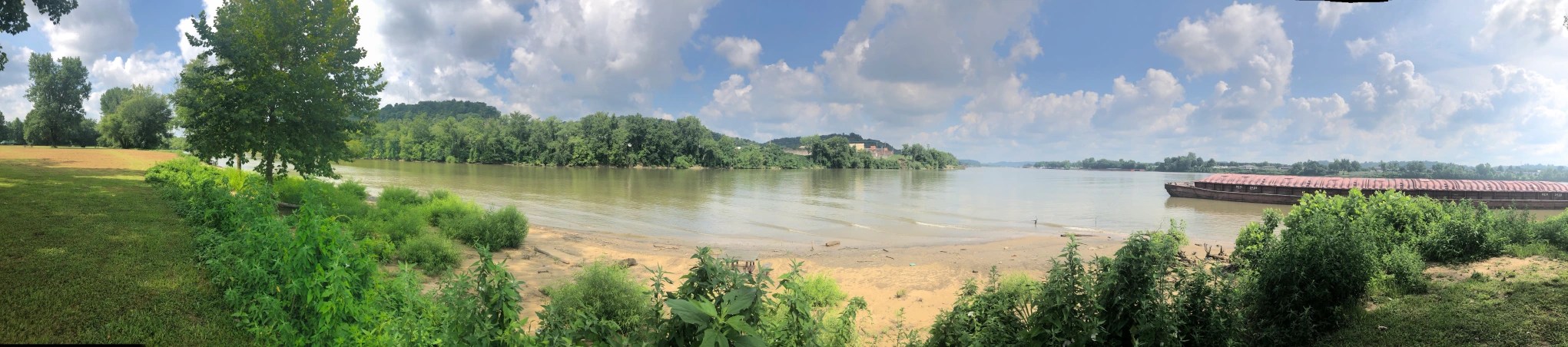
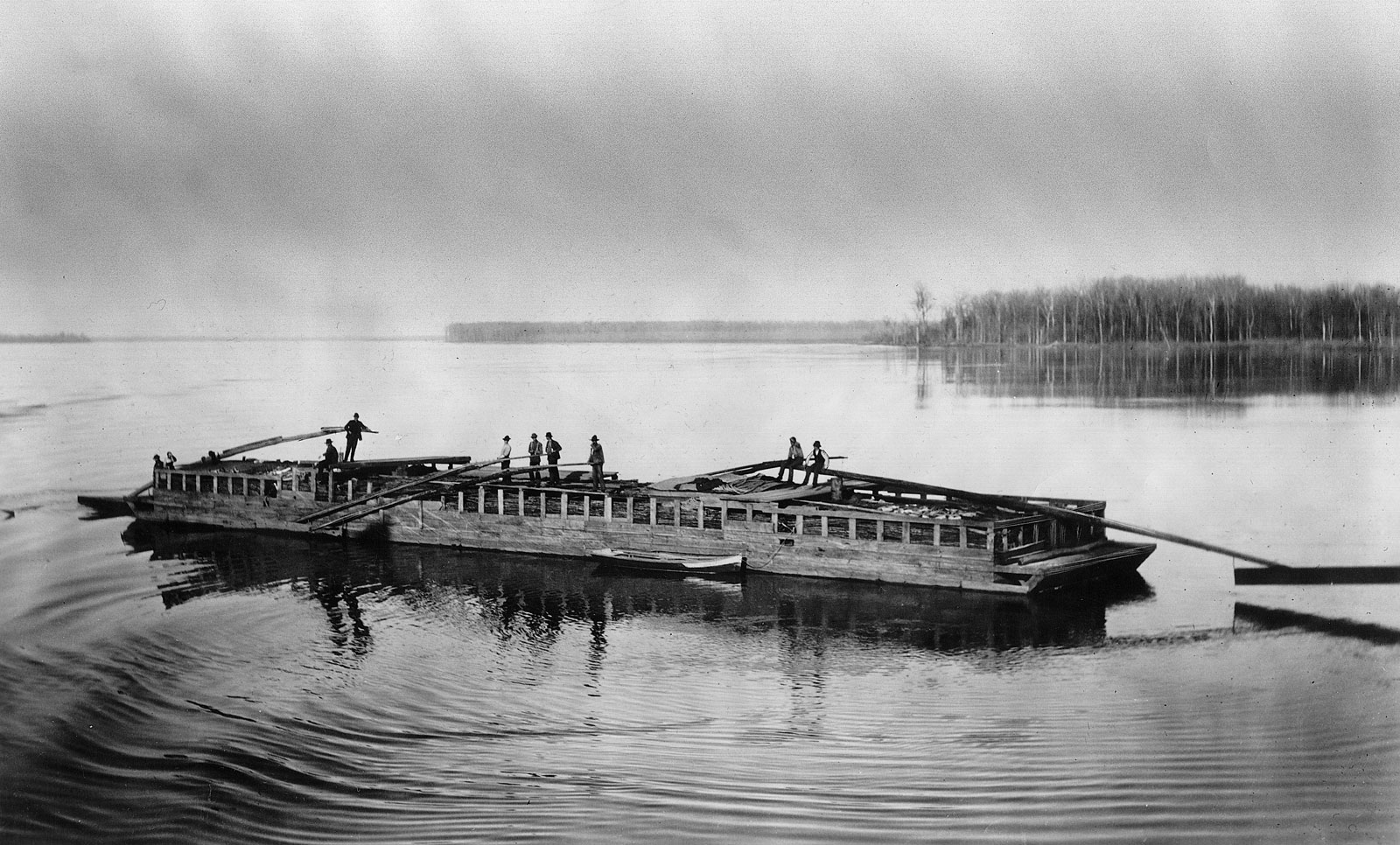


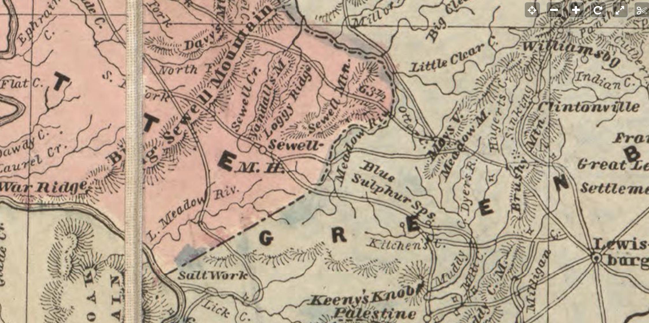

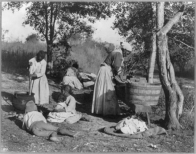


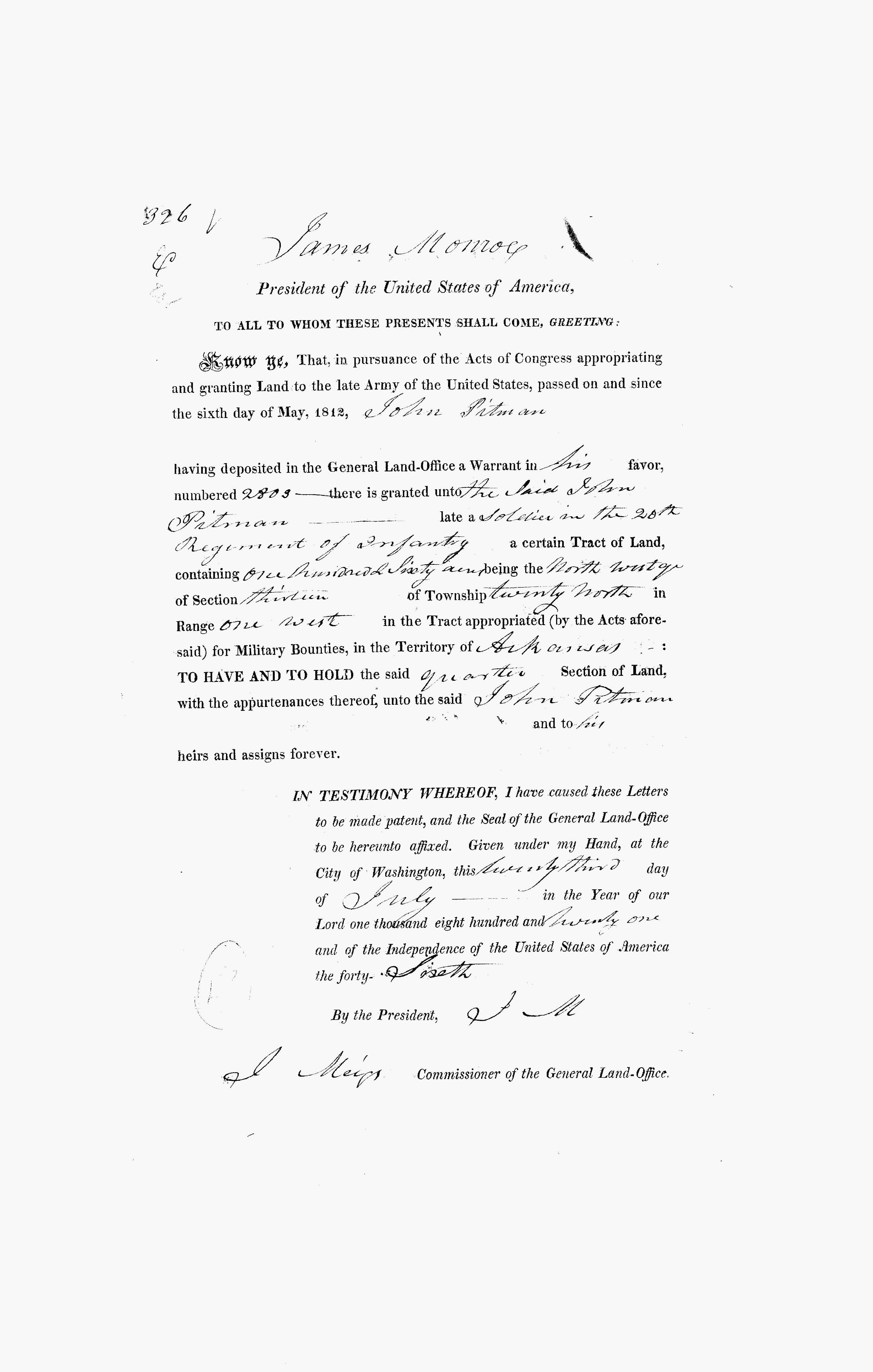
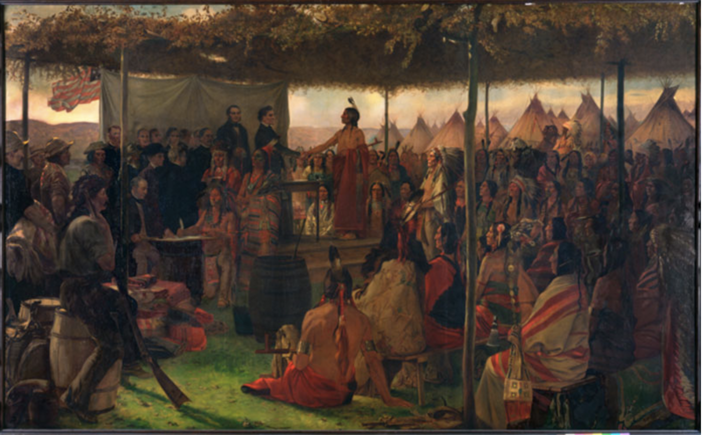
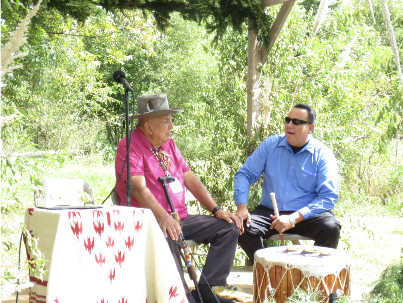
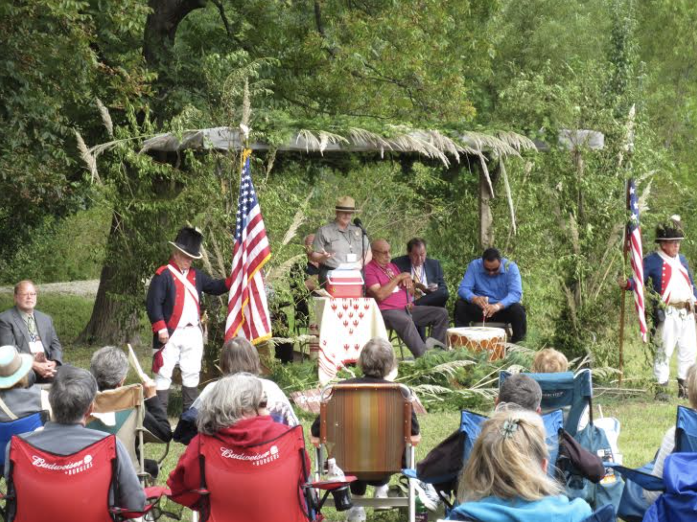

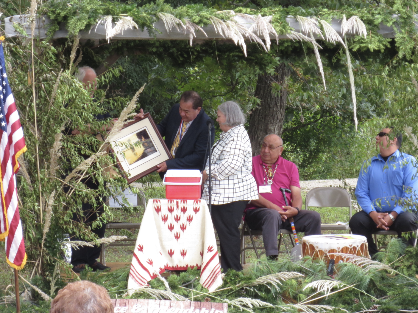
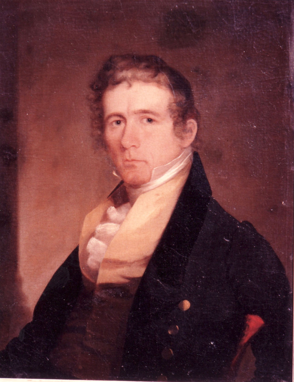


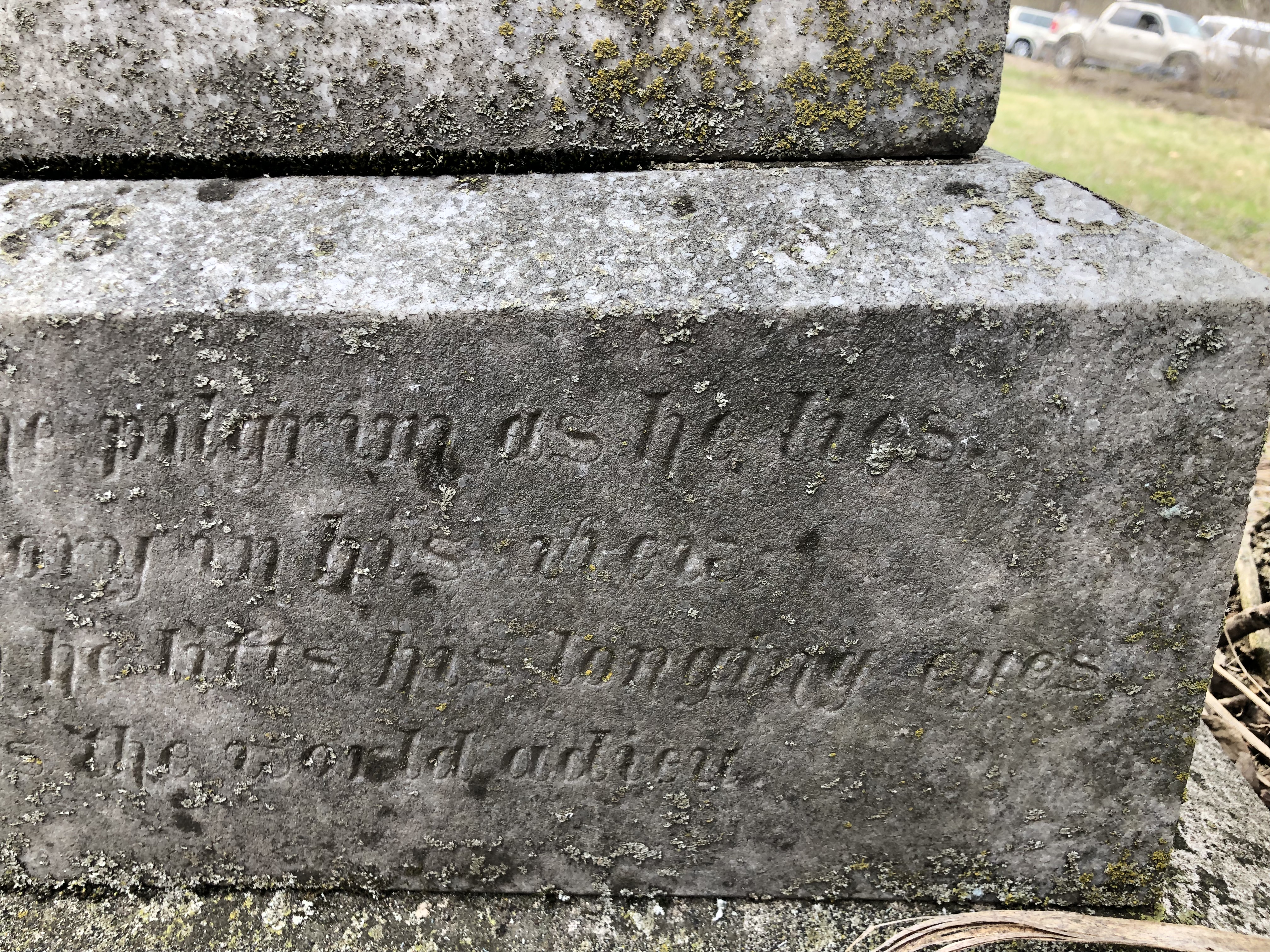


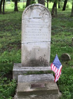


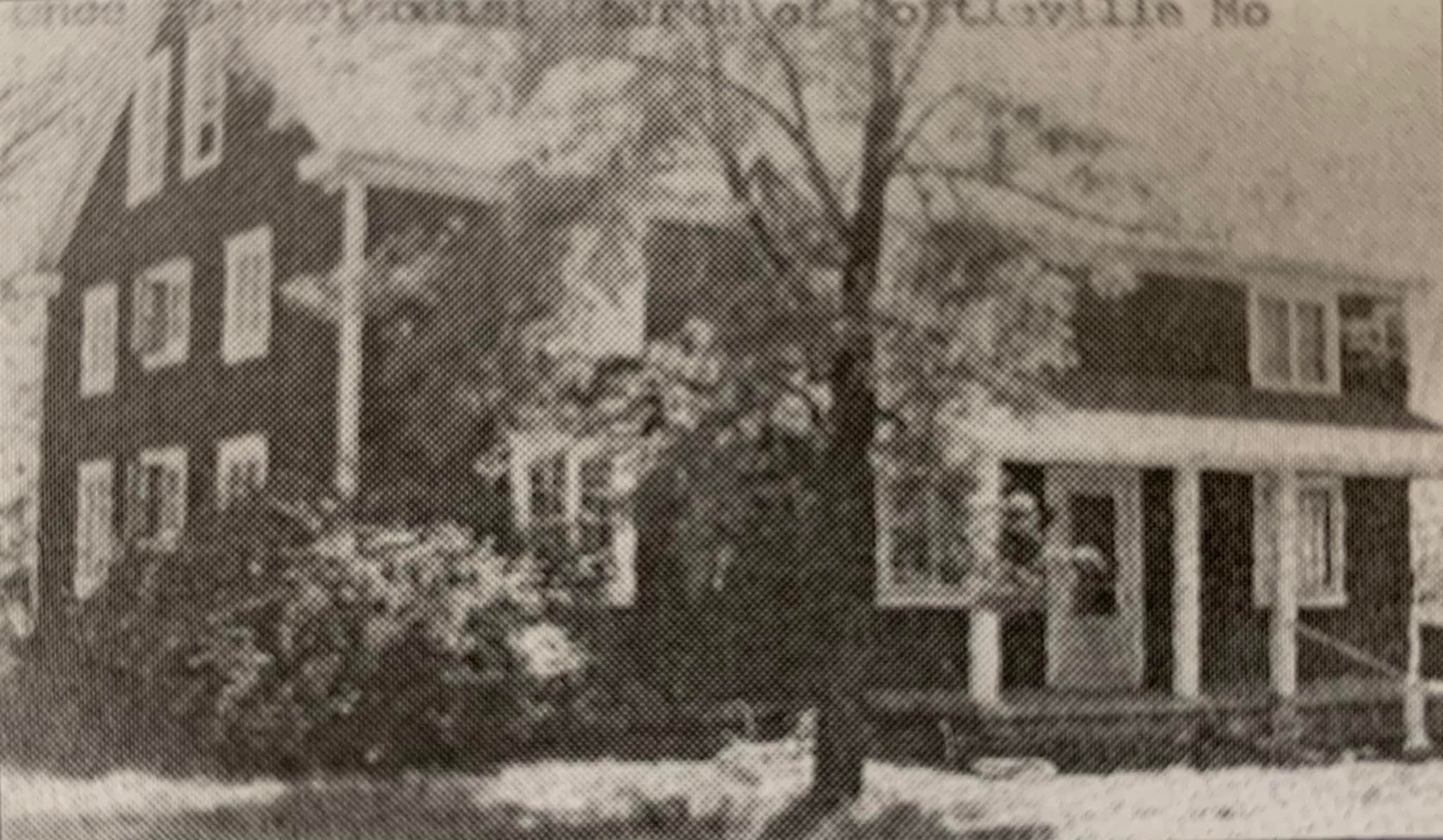


You must be logged in to post a comment.