When Americans declared themselves independent of Great Britain in 1776, there were three settlements west of the Mississippi, Ste. Genevieve, Saint Louis, and San Carlos. In 1763, Saint Louis had been established on the south side of the great Missouri River, creating what would later become the “Gateway to the West”. Shortly afterwards, in 1769, a French-Canadian fur trader named Louis Blanchette, would establish himself in what was then called “Les Petite Cotes” or the little hills. These hills were the mounds created by the indigenous people that had been living here, for centuries. Travel between St. Louis and San Carlos, followed one of either two pathways, by river or overland. When traveling westward overland, pathways became established, that were ones of the least resistance, which the buffalo and other animals had already discovered. The earliest people, such as the Osage, would follow these same pathways, and establish would be called a “trace”.
As the population increased, so did the use of these early pathways. The first residents were fur traders, who knew that they were leaving the protection of United States but chose to live among the indigenous nations of Osage, Pottawatomie, Sioux and Fox. The land itself though had remained under the flags of the French and the Spanish, being traded first in 1769, and then again in 1799. That year, the well-known trailblazer Daniel Boone, would settle along the Missouri River, south of San Carlos, otherwise known as Saint Charles. Many of those who followed him, were from Kentucky, a State carved from Virginia in the 1770s. These large families brought with them, an enslaved population, that lived under rules known as the Code Noir, or Black Code. All the while, the indigenous population was growing as well, as many were being pushed westward, because of settlement in the Ohio valley. The land was being eyed. So that when the territory was purchased in 1804, there was already a large population.
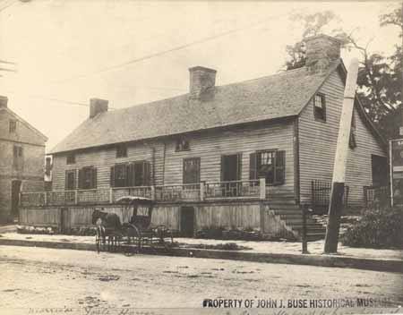
In 1804, as President Thomas Jefferson commissioned a Corps under the command of Captains Meriwether Lewis and William Clark, the Morrison family would establish themselves on the Rue de Grande, later known as Main Street, in St. Charles. The family had been on the leading edge coming from Philadelphia and had already established outposts for trade in Cincinnati and Kaskaskia. William Morrison, and his younger brother Jesse, were cousins to the Boone family, through Daniel’s wife, the former Rebecca Bryan, and would establish a trading post called Bryan and Morrison (Today’s Berthold Park 217 S. Main Street St Charles 63301) at the northern landing on the Missouri River. A pathway had already been established from Saint Louis to Saint Charles, which was referred to as the St. Charles Road. However, it was salt lick referred owned by the Morrisons in partnership with Daniel Boone’s sons Nathan and Daniel Morgan, that gave its name to the region further west, the Boonslick.
Salt was one of the most valuable commodities necessary in 1804. Needed not only for curing and preserving their meat but used in tanning furs as well. The beaver, bear and buffalo furs were rendered not only into the fashions of the time but worn by all. Salt was manufactured by boiling water originating from a saltwater spring, a tedious, difficult and often dangerous process. The Bryan and Morrison salt lick had been discovered by the Boone family earlier and was the largest in its’ day. Made even more successful by the generous funds of the Morrison family and the large workforce, many of which were enslaved, that ran the factory 24 hours a day and seven days a week. The salt was packed in bags and crates; and carried downriver on the Missouri River to the landing and the huge stone storehouse to be sold at the Morrison’s mercantile. Supplies and manpower were then carted overland back up to the salt lick, using what became known as the Boone’s Lick trail. No longer just a trace used by the native populations, it was an established trail used by everyone to go westward.
Documentation of the Boone’s Lick Road comes from many sources. Maps, plats and Surveys, showing early Spanish Land Grants (on an angle) establish when the property was purchased, with deeds going more in depth. Early deeds will quite often establish where the Boone’s Lick Road intersects with a property, or lines its’ border. Early journals are often simple notes, describing the road’s conditions or available lodging. A gazetteer is similar as it just simply gives the local’s name for a place and what is found at that location. Newspapers share postal routes and stagecoach stations, and the distances are helpful to a degree, as property owners and postmasters could often change. Early historians like Kate Gregg bring so much depth and history by adding details about the residents and their activities.]
A factory for trade had been established with the Osage, named Fort Osage, just west of the salt lick by 1808. The settlement of San Carlos with 100 families, as Lewis and Clark described it in 1804, was incorporated as the Village of St. Charles in 1809. Within a few years, its Territorial Governor Benjamin Howard, would raise two Corps of soldiers, led by both the Boone sons, to control the uprisings that were occurring between the settlers and the earliest residents. What was called the War of 1812 in the east, was simply referred to as the Indian Wars in the U.S.’ Louisiana Territory. The dispute over the control of what had been the native Americans, presided over the residents’ lives for several years, with several homes turned into fortresses, along the Boone’s Lick trail. This in turn established what had once been only a trace, into an actual road, by the end of the hostilities in 1815.

Interested in St. Charles County History? Subscribe to a free daily story about its history here:

3 responses to “How a trail became a road”
I love the stories about the old trails, and also of the freedmen villages that existed even during my lifetime. I’d love to read more about the Salt River Road trail. I grew up in a cabin built circa 1812 on Hwy P not far from the Adam Zumwalt property.
LikeLike
I love these posts, but was someone drinking when they created this one???
1. St. Louis was founded on the west side of the Mississippi, not the south side of the Missouri. Of course it was south of the Missouri. It was also south of several other rivers….
2. The little hills wee not native created mounds. There were mounds aplenty in the St. Louis area but not the little hills referred to.
LikeLike
Yes, St. Louis is both on the west side of the Mississippi and the south side of the Missouri. St. Charles is on the north side of the Missouri. Many historians have written that they are native American mounds.
LikeLike